 |
|
|
|
|
|
|
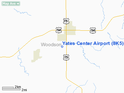
Location &
QuickFacts
|
FAA
Information Effective: |
2008-09-25 |
|
Airport
Identifier: |
8K5 |
|
Airport
Status: |
Operational |
|
Longitude/Latitude: |
095-44-50.2800W/37-51-10.8000N
-95.747300/37.853000 (Estimated) |
|
Elevation: |
1140 ft / 347.47 m (Estimated) |
|
Land: |
19 acres |
|
From
nearest city: |
2 nautical miles S of Yates Center, KS |
|
Location: |
Woodson County, KS |
|
Magnetic Variation: |
06E (1985) |
Owner & Manager
|
Ownership: |
Publicly owned |
|
Owner: |
Yates Center City |
|
Address: |
117 E Rutledge
Yates Center, KS 66783 |
|
Phone
number: |
620-625-2118 |
|
Manager: |
Janie Massoth |
|
Address: |
117 E Rutledge
Yates Center, KS 66783 |
|
Phone number: |
620-625-2118 |
Airport Operations and Facilities
|
Airport
Use: |
Open to public |
|
Wind
indicator: |
No |
|
Segmented Circle: |
No |
|
Control
Tower: |
No |
|
Lighting
Schedule: |
RDO-CTL
ACTVT LIRL RY 17/35 - CTAF. |
|
Landing
fee charge: |
No |
|
Sectional chart: |
Kansas City |
|
Region: |
ACE - Central |
|
Boundary
ARTCC: |
ZKC - Kansas City |
|
Tie-in
FSS: |
ICT - Wichita |
|
FSS on
Airport: |
No |
|
FSS Toll
Free: |
1-800-WX-BRIEF |
|
NOTAMs
Facility: |
ICT (NOTAM-d service avaliable) |
Airport Communications
|
Runway Information
Runway 17/35
|
Dimension: |
2765 x 160 ft / 842.8 x 48.8 m |
|
Surface: |
TURF, Fair Condition
SLIGHTY ROUGH VARIOUS PORTIONS OF RY. |
|
Edge Lights: |
Low
LIRLS; NON-BREAKABLE COUPLINGS & VARIES IN ELEVATION; OVER 14 INCHES. |
|
|
Runway 17
|
Runway 35
|
|
Traffic
Pattern: |
Left |
Left |
|
Obstruction: |
4 ft fence, 55.0 ft from runway, 13:1 slope to clear |
8 ft road, 295.0 ft from runway, 36:1 slope to clear |
|
Radio Navigation Aids
|
ID |
Type |
Name |
Ch |
Freq |
Var |
Dist |
|
MSB |
NDB |
Monarch |
|
410.00 |
04E |
16.2 nm |
|
UKL |
NDB |
Boyd |
|
245.00 |
05E |
26.9 nm |
|
PPF |
NDB |
Parsons |
|
258.00 |
06E |
33.0 nm |
|
CFV |
NDB |
Coffeyville |
|
212.00 |
05E |
46.4 nm |
|
FSK |
NDB |
Fort Scott |
|
379.00 |
05E |
46.7 nm |
|
CNU |
VOR/DME |
Chanute |
029X |
109.20 |
05E |
15.5 nm |
|
EMP |
VORTAC |
Emporia |
075X |
112.80 |
08E |
32.2 nm |
|
OSW |
VORTAC |
Oswego |
123X |
117.60 |
08E |
49.2 nm |
Remarks
-
RY 35 +2 PIPE
FENCE 16' RY END LEFT & RIGHT.
-
E111 PRVDD THE
APCH TO EACH RWY IS MAINTD FOR A MIN 20:1 GLIDE SLOPE AND THE ARPT
TRANSITIONAL SFC MAINTD FOR A 7:1 SLOPE.
Operational Statistics
Time Period: 2006-09-14 - 2007-09-13
|
Aircraft
Operations: |
25/Week |
|
General
Aviation Local: |
76.9% |
|
General
Aviation Itinerant: |
23.1% |
Yates Center Airport
Address:
Woodson County, KS
Tel:
620-625-2118
Images
and information placed above are from
http://www.airport-data.com/airport/8K5/
We
thank them for the data!
|
General Info |
| Country |
United
States |
| State |
KANSAS
|
| FAA ID |
8K5
|
| Latitude |
37-51-50.131N |
|
Longitude |
095-45-50.943W |
|
Elevation |
1140
feet |
| Near
City |
YATES
CENTER |
We don't guarantee the information is fresh and accurate. The data may
be wrong or outdated.
For more up-to-date information please refer to other sources.
|
|


