 |
|
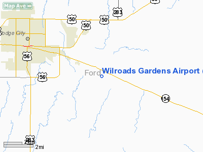
| Wilroads Gardens Airport |
| IATA: none â ICAO: none â FAA LID: 9K1 |
| Summary |
| Airport type |
Public |
| Owner |
Wayne Neese |
| Serves |
Dodge City, Kansas |
| Elevation AMSL |
2,440 ft / 744 m |
| Coordinates |
37°43â²24â³N 099°55â²36â³W / 37.72333°N 99.92667°W / 37.72333; -99.92667 |
| Runways |
| Direction |
Length |
Surface |
| ft |
m |
| 14/32 |
2,630 |
802 |
Turf |
| Statistics (2009) |
| Aircraft operations |
200 |
| Source: FAA, Kansas DOT |
Wilroads Gardens Airport or Wilroads Garden Airport (FAA LID: 9K1) is a public use airport located one nautical mile (1.85 km) southeast of the central business district of Dodge City, in Ford County, Kansas, United States.
Facilities and aircraft
Wilroads Gardens Airport covers an area of 15 acres (6 ha) at an elevation of 2,440 feet (744 m) above mean sea level. It has one runway designated 14/32 with a turf surface measuring 2,630 by 60 feet (802 x 18 m). For the 12-month period ending March 16, 2009, the airport had 200 general aviation aircraft operations, an average of 16 per month.
The above content comes from Wikipedia and is published under free licenses – click here to read more.
|
Location &
QuickFacts
|
FAA
Information Effective: |
2008-09-25 |
|
Airport
Identifier: |
9K1 |
|
Airport
Status: |
Operational |
|
Longitude/Latitude: |
099-55-35.5000W/37-43-23.7000N
-99.926528/37.723250 (Estimated) |
|
Elevation: |
2440 ft / 743.71 m (Estimated) |
|
Land: |
15 acres |
|
From
nearest city: |
1 nautical miles SE of Dodge City, KS |
|
Location: |
Ford County, KS |
|
Magnetic Variation: |
08E (1985) |
Owner & Manager
|
Ownership: |
Privately owned |
|
Owner: |
Wayne Neese |
|
Address: |
11616 Main Road
Dodge City, KS 67801 |
|
Phone
number: |
620-225-3368 |
|
Manager: |
Wayne Neese |
|
Address: |
2404 5th Ave
Dodge City, KS 67801 |
|
Phone number: |
620-225-3368 |
Airport Operations and Facilities
|
Airport
Use: |
Open to public |
|
Wind
indicator: |
Yes
WINDSOCK OUT OF SERVICE INDEFINITELY. |
|
Segmented Circle: |
No |
|
Control
Tower: |
No |
|
Landing
fee charge: |
No |
|
Sectional chart: |
Wichita |
|
Region: |
ACE - Central |
|
Boundary
ARTCC: |
ZKC - Kansas City |
|
Tie-in
FSS: |
ICT - Wichita |
|
FSS on
Airport: |
No |
|
FSS Toll
Free: |
1-800-WX-BRIEF |
|
NOTAMs
Facility: |
ICT (NOTAM-d service avaliable) |
Airport Communications
Airport Services
|
Airframe
Repair: |
NONE |
|
Power
Plant Repair: |
NONE |
|
Bottled
Oxygen: |
NONE |
|
Bulk
Oxygen: |
NONE |
|
Runway Information
Runway 14/32
|
Dimension: |
2630 x 60 ft / 801.6 x 18.3 m |
|
Surface: |
TURF, Poor Condition
RUNWAY IS IN POOR CONDITION DUE TO NO RUNWAY MAINTENANCE ACTION; TURF RUNWAY
HAS NOT BEEN MOWED IN SOME TIME RESULTING IN THE GRASS BEING OVER GROWN.
APPROX. 8 INCHES TO TWO FEET TALL. |
|
|
Runway 14
|
Runway 32
|
|
Longitude: |
099-55-46.2200W |
099-55-24.7300W |
|
Latitude: |
37-43-33.4900N |
37-43-13.8800N |
|
Traffic
Pattern: |
Left |
Left |
|
Obstruction: |
3 ft fence |
8 ft ridge, 0.0 ft from runway, 50 ft left of centerline |
|
Radio Navigation Aids
|
ID |
Type |
Name |
Ch |
Freq |
Var |
Dist |
|
MEJ |
NDB |
Meade |
|
389.00 |
09E |
33.5 nm |
|
GC |
NDB |
Pieve |
|
347.00 |
09E |
38.4 nm |
|
LQR |
NDB |
Larned |
|
296.00 |
08E |
49.2 nm |
|
DDC |
VORTAC |
Dodge City |
019X |
108.20 |
08E |
8.5 nm |
|
GCK |
VORTAC |
Garden City |
080X |
113.30 |
11E |
39.7 nm |
Remarks
-
RY 14 HAS +50'
TREES 1050' FROM THR.
-
ULTRALIGHT ACTVTY
ON & INVOF ARPT.
-
IN AN EFFORT TO
DENY ACCESS TO A LEVEE ACROSS THE TXY BY ALL TERRAIN VEHICLES, A FENCE & EARTH
BERM WAS ERECTED ACROSS THE TXY. THESE MEASURES HAVE CREATED AN OBSTN HAZARD
ACROSS THE TXY ELIMINATING ACCESS BWTN THE HANGERS & RY & PREVENTING NECESSARY
RWY MAINTENANCE.
TURF 8" TO 2'
-
EXISTED PRIOR TO 1959.
Based Aircraft
|
Aircraft based
on field: |
5 |
|
Single Engine
Airplanes: |
1 |
|
Ultralights: |
4 |
Operational Statistics
Time Period: 2004-07-16 - 2005-07-15
|
Aircraft
Operations: |
17/Month |
|
General
Aviation Local: |
100.0% |
Wilroads Gardens Airport
Address:
Ford County, KS
Tel:
620-225-3368
Images
and information placed above are from
http://www.airport-data.com/airport/9K1/
We
thank them for the data!
|
General Info |
| Country |
United
States |
| State |
KANSAS
|
| FAA ID |
9K1
|
| Latitude |
37-43-22.072N |
|
Longitude |
099-55-34.474W |
|
Elevation |
2440
feet |
| Near
City |
DODGE
CITY |
We don't guarantee the information is fresh and accurate. The data may
be wrong or outdated.
For more up-to-date information please refer to other sources.
|
|


