 |
|
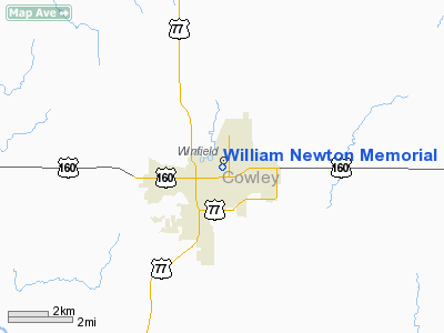
William Newton Memorial Hospital Heliport |
|
Location &
QuickFacts
|
FAA
Information Effective: |
2008-09-25 |
|
Airport
Identifier: |
SN31 |
|
Airport
Status: |
Operational |
|
Longitude/Latitude: |
096-58-55.1297W/37-14-42.6057N
-96.981980/37.245168 (Estimated) |
|
Elevation: |
1156 ft / 352.35 m (Estimated) |
|
Land: |
0 acres |
|
From
nearest city: |
0 nautical miles N of Winfield, KS |
|
Location: |
Cowley County, KS |
|
Magnetic Variation: |
07E (1985) |
Owner & Manager
|
Ownership: |
Privately owned |
|
Owner: |
William Newton Memorial Hosp |
|
Address: |
1300 East 5th
Winfield, KS 67156 |
|
Phone number: |
316-221-2300 |
|
Manager: |
Danny Huckvale |
|
Address: |
1300 East 5th
Winfield, KS 67156 |
|
Phone number: |
316-221-2300 |
Airport
Operations and Facilities
|
Airport
Use: |
Private
MEDICAL |
|
Segmented Circle: |
No |
|
Control
Tower: |
No |
|
Sectional chart: |
Wichita |
|
Region: |
ACE - Central |
|
Boundary
ARTCC: |
ZKC - Kansas City |
|
Tie-in
FSS: |
ICT - Wichita |
|
FSS on
Airport: |
No |
|
FSS Toll
Free: |
1-800-WX-BRIEF |
|
Runway Information
Helipad H1
|
Dimension: |
40 x 40 ft / 12.2 x 12.2 m |
|
Surface: |
CONC, |
|
|
Runway H1
|
Runway
|
|
Traffic
Pattern: |
Left |
Left |
|
Radio Navigation Aids
|
ID |
Type |
Name |
Ch |
Freq |
Var |
Dist |
|
EGT |
NDB |
Wellington |
|
414.00 |
07E |
20.1 nm |
|
PN |
NDB |
Ponca |
|
515.00 |
05E |
25.9 nm |
|
IC |
NDB |
Piche |
|
332.00 |
07E |
30.2 nm |
|
EQA |
NDB |
El Dorado |
|
383.00 |
05E |
33.1 nm |
|
IAB |
TACAN |
Mc Connell |
112X |
|
07E |
26.4 nm |
|
PER |
VORTAC |
Pioneer |
079X |
113.20 |
06E |
31.2 nm |
|
ICT |
VORTAC |
Wichita |
085X |
113.80 |
07E |
41.6 nm |
|
ICT |
VOT |
Wichita |
|
114.00 |
|
31.9 nm |
Remarks
-
PRVDD CLEAR APCH/DEP
PATHS TO LANDING AREA FOR A MINIMUM 8:1 GLIDE SLOPE AND A CLEAR TRANSITIONAL
SURFACE FOR A MINIMUM 2:1 SLOPE.
William Newton Memorial Hospital
Heliport
Address:
Cowley County, KS
Tel:
316-221-2300
Images
and information placed above are from
http://www.airport-data.com/airport/SN31/
We
thank them for the data!
|
General Info |
| Country |
United
States |
| State |
KANSAS
|
| FAA ID |
SN31
|
| Latitude |
37-07-05.104N |
|
Longitude |
096-52-06.119W |
|
Elevation |
1156
feet |
| Near
City |
WINFIELD
|
We don't guarantee the information is fresh and accurate. The data may
be wrong or outdated.
For more up-to-date information please refer to other sources.
|
|


