 |
|
|
|
|
|
|
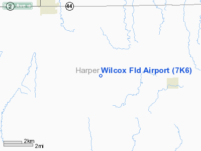
Location &
QuickFacts
|
FAA
Information Effective: |
2008-09-25 |
|
Airport
Identifier: |
7K6 |
|
Airport
Status: |
Operational |
|
Longitude/Latitude: |
097-57-51.2150W/37-05-00.0840N
-97.964226/37.083357 (Estimated) |
|
Elevation: |
1263 ft / 384.96 m (Surveyed) |
|
Land: |
11 acres |
|
From
nearest city: |
5 nautical miles SE of Anthony, KS |
|
Location: |
Harper County, KS |
|
Magnetic Variation: |
07E (1985) |
Owner & Manager
|
Ownership: |
Privately owned |
|
Owner: |
Herbert L. Wilcox |
|
Address: |
462 Se 40th Ave
Anthony, KS 67003 |
|
Phone
number: |
620-842-3261 |
|
Manager: |
Herbert L. Wilcox |
|
Address: |
462 Se 40th Ave
Anthony, KS 67003 |
|
Phone number: |
620-842-3367 |
Airport Operations and Facilities
|
Airport
Use: |
Open to public |
|
Wind
indicator: |
Yes |
|
Segmented Circle: |
No |
|
Control
Tower: |
No |
|
Landing
fee charge: |
No |
|
Sectional chart: |
Wichita |
|
Region: |
ACE - Central |
|
Boundary
ARTCC: |
ZKC - Kansas City |
|
Tie-in
FSS: |
ICT - Wichita |
|
FSS on
Airport: |
No |
|
FSS Toll
Free: |
1-800-WX-BRIEF |
|
NOTAMs
Facility: |
ICT (NOTAM-d service avaliable) |
Airport Communications
Airport Services
|
Airframe
Repair: |
MAJOR |
|
Power
Plant Repair: |
NONE |
|
Bottled
Oxygen: |
NONE |
|
Bulk
Oxygen: |
NONE |
|
Runway Information
Runway 18/36
|
Dimension: |
2100 x 80 ft / 640.1 x 24.4 m |
|
Surface: |
TURF, Fair Condition
SURFACE ROUGH.
ROUGH CULTIVATED FIELD. |
|
|
Runway 18
|
Runway 36
|
|
Traffic
Pattern: |
Left |
Left |
|
Obstruction: |
18 ft tree, 500.0 ft from runway, 27:1 slope to clear |
34 ft trees, 90.0 ft from runway, 20 ft left of
centerline, 2:1 slope to clear |
|
Balloonport B1
|
Dimension: |
1400 x 1600 ft / 426.7 x 487.7 m |
|
Surface: |
TURF, Poor Condition
SURFACE ROUGH.
ROUGH CULTIVATED FIELD. |
|
|
Runway B1
|
Runway
|
|
Traffic
Pattern: |
Left |
Left |
|
Radio Navigation Aids
|
ID |
Type |
Name |
Ch |
Freq |
Var |
Dist |
|
EGT |
NDB |
Wellington |
|
414.00 |
07E |
31.0 nm |
|
IC |
NDB |
Piche |
|
332.00 |
07E |
38.4 nm |
|
AVK |
NDB |
Alva |
|
203.00 |
08E |
38.6 nm |
|
PN |
NDB |
Ponca |
|
515.00 |
05E |
44.3 nm |
|
IAB |
TACAN |
Mc Connell |
112X |
|
07E |
46.4 nm |
|
ODG |
VOR/DME |
Woodring |
027X |
109.00 |
08E |
43.5 nm |
|
ANY |
VORTAC |
Anthony |
076X |
112.90 |
07E |
10.9 nm |
|
PER |
VORTAC |
Pioneer |
079X |
113.20 |
06E |
43.6 nm |
|
ICT |
VORTAC |
Wichita |
085X |
113.80 |
07E |
43.7 nm |
|
END |
VORTAC |
Vance |
101X |
115.40 |
09E |
44.4 nm |
|
ICT |
VOT |
Wichita |
|
114.00 |
|
41.8 nm |
Remarks
-
6 BALLOONS BASED ON ARPT.
-
FARM ANIMALS
OCNLY GRAZE ON RY 18/36 & ON B1.
-
RY B1 TREES EAST
& SOUTH; POWERLINE WEST.
-
PROPANE & HELIUM
GAS AVBL; CALL AMGR (620) 842-3367.
Based Aircraft
|
Aircraft based
on field: |
2 |
|
Single Engine
Airplanes: |
2 |
Operational Statistics
Time Period: 2006-01-19 - 2007-01-18
|
Aircraft
Operations: |
7/Month |
|
General
Aviation Local: |
87.5% |
|
General
Aviation Itinerant: |
12.5% |
Wilcox Field Airport
Address:
Harper County, KS
Tel:
620-842-3261,
620-842-3367
Images
and information placed above are from
http://www.airport-data.com/airport/7K6/
We
thank them for the data!
|
General Info |
| Country |
United
States |
| State |
KANSAS
|
| FAA ID |
7K6
|
| Latitude |
37-05-00.084N |
|
Longitude |
097-57-51.215W |
|
Elevation |
1263
feet |
| Near
City |
ANTHONY
|
We don't guarantee the information is fresh and accurate. The data may
be wrong or outdated.
For more up-to-date information please refer to other sources.
|
|


