 |
|
|
|
|
|
|
Location &
QuickFacts
|
FAA
Information Effective: |
2008-09-25 |
|
Airport
Identifier: |
71K |
|
Airport
Status: |
Operational |
|
Longitude/Latitude: |
097-23-01.3000W/37-38-51.7000N
-97.383694/37.647694 (Estimated) |
|
Elevation: |
1290 ft / 393.19 m (Estimated) |
|
Land: |
32 acres |
|
From
nearest city: |
3 nautical miles SW of Wichita, KS |
|
Location: |
Sedgwick County, KS |
|
Magnetic Variation: |
07E (1985) |
Owner & Manager
|
Ownership: |
Privately owned |
|
Owner: |
Earl V. Long |
|
Address: |
2558 S Kessler
Wichita, KS 67217 |
|
Phone number: |
316-943-5510 |
|
Manager: |
Earl V. Long |
|
Address: |
2558 S Kessler
Wichita, KS 67217 |
|
Phone number: |
316-943-5510 |
Airport
Operations and Facilities
|
Airport
Use: |
Open to public |
|
Wind
indicator: |
Yes |
|
Segmented Circle: |
No |
|
Control
Tower: |
No |
|
Landing
fee charge: |
No |
|
Sectional chart: |
Wichita |
|
Region: |
ACE - Central |
|
Boundary
ARTCC: |
ZKC - Kansas City |
|
Tie-in
FSS: |
ICT - Wichita |
|
FSS on
Airport: |
No |
|
FSS Toll
Free: |
1-800-WX-BRIEF |
|
NOTAMs
Facility: |
ICT (NOTAM-d service avaliable) |
Airport Communications
Airport Services
|
Fuel
available: |
100LL |
|
Airframe
Repair: |
MAJOR |
|
Power
Plant Repair: |
MAJOR |
|
Bottled
Oxygen: |
NONE |
|
Bulk
Oxygen: |
NONE |
|
Runway Information
Runway 17/35
|
Dimension: |
2520 x 30 ft / 768.1 x 9.1 m |
|
Surface: |
ASPH, Good Condition
RWY 17/35 HAS GRASS ENCROACHING ON RWY SIDES NUMEROUS SURFACE CRACKS |
|
Weight Limit: |
Single wheel: 3000 lbs. |
|
|
Runway 17
|
Runway 35
|
|
Longitude: |
097-23-01.5500W |
097-23-01.0100W |
|
Latitude: |
37-39-04.1700N |
37-38-39.2500N |
|
Traffic
Pattern: |
Left |
Right |
|
Markings: |
Basic, Good Condition |
Basic, Good Condition |
|
Displaced
threshold: |
400.00 ft |
0.00 ft |
|
Runway End
Identifier: |
No |
No |
|
Centerline
Lights: |
No |
No |
|
Touchdown
Lights: |
No |
No |
|
Obstruction: |
22 ft bldgs, 230.0 ft from runway, 1:1 slope to clear
APCH RATIO 28:1 TO DSPLCD THR.
+24 FT TELEPHONE CABLE 80 FT FM RY END BOTH SIDES. |
40 ft pline, 1260.0 ft from runway, 26:1 slope to clear
+8 FT FENCE 50 FT FROM THR; BOTH SIDES OF CNTRLN. |
|
Radio Navigation Aids
|
ID |
Type |
Name |
Ch |
Freq |
Var |
Dist |
|
IC |
NDB |
Piche |
|
332.00 |
07E |
5.4 nm |
|
EGT |
NDB |
Wellington |
|
414.00 |
07E |
19.5 nm |
|
EWK |
NDB |
Newton |
|
281.00 |
06E |
25.6 nm |
|
EQA |
NDB |
El Dorado |
|
383.00 |
05E |
28.1 nm |
|
MPR |
NDB |
Mc Pherson |
|
227.00 |
06E |
44.5 nm |
|
IAB |
TACAN |
Mc Connell |
112X |
|
07E |
5.7 nm |
|
HUT |
VOR/DME |
Hutchinson |
115X |
116.80 |
09E |
33.5 nm |
|
ICT |
VORTAC |
Wichita |
085X |
113.80 |
07E |
11.2 nm |
|
ANY |
VORTAC |
Anthony |
076X |
112.90 |
07E |
47.7 nm |
|
ICT |
VOT |
Wichita |
|
114.00 |
|
2.5 nm |
Remarks
-
DEPS CTC WICHITA
ATCT ON THE GROUND ON FREQ 125.7 FOR DEP INSTRUCTIONS. IF UNABLE - CONTACT
ATCT ON FREQ 118.2 UPON DEP & REMAIN EAST OF THE FIELD UNTIL COMMUNICATIONS
ARE ESTABLISHED.
-
PRVDD RT TFC PAT
IS ESTABD FOR RWY & APCHS OF 20:1 & TRSNL SFC OF 7:1 ARE MAINT.
Based Aircraft
|
Aircraft based
on field: |
14 |
|
Single Engine
Airplanes: |
12 |
|
Multi Engine
Airplanes: |
2 |
Operational Statistics
Time Period: 2007-05-01 - 2008-04-29
|
Aircraft
Operations: |
17/Week |
|
General
Aviation Local: |
93.0% |
|
General
Aviation Itinerant: |
7.0% |
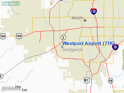
Westport Airport
Address:
Sedgwick County, KS
Tel:
316-943-5510
Images
and information placed above are from
http://www.airport-data.com/airport/71K/
We
thank them for the data!
|
General Info |
| Country |
United
States |
| State |
KANSAS
|
| FAA ID |
71K
|
| Latitude |
37-38-51.053N |
|
Longitude |
097-23-04.163W |
|
Elevation |
1290
feet |
| Near
City |
WICHITA
|
We don't guarantee the information is fresh and accurate. The data may
be wrong or outdated.
For more up-to-date information please refer to other sources.
|
|


