 |
|
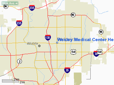
Wesley Medical Center Heliport |
|
Location &
QuickFacts
|
FAA
Information Effective: |
2008-09-25 |
|
Airport
Identifier: |
8KS6 |
|
Airport
Status: |
Operational |
|
Longitude/Latitude: |
097-17-54.1590W/37-41-44.0500N
-97.298378/37.695569 (Estimated) |
|
Elevation: |
1440 ft / 438.91 m (Estimated) |
|
Land: |
0 acres |
|
From
nearest city: |
0 nautical miles N of Wichita, KS |
|
Location: |
Sedgwick County, KS |
|
Magnetic Variation: |
07E (1985) |
Owner & Manager
|
Ownership: |
Privately owned |
|
Owner: |
Wesley Medical Center |
|
Address: |
550 N Hillside
Wichita, KS 67214 |
|
Phone number: |
316-962-2040 |
|
Manager: |
Jim Carney |
|
Address: |
550 N Hillside
Wichita, KS 67214 |
|
Phone number: |
316-962-3331 |
Airport Operations and Facilities
|
Airport Use: |
Private
MEDICAL. |
|
Wind indicator: |
Yes |
|
Segmented Circle: |
No |
|
Control Tower: |
No |
|
Lighting Schedule: |
DUSK-DAWN |
|
Landing fee charge: |
No |
|
Sectional chart: |
Wichita |
|
Region: |
ACE - Central |
|
Boundary ARTCC: |
ZKC - Kansas City |
|
Tie-in FSS: |
ICT - Wichita |
|
FSS on Airport: |
No |
|
FSS Toll Free: |
1-800-WX-BRIEF |
Airport
Communications
|
Runway Information
Helipad H1
|
Dimension: |
80 x 80 ft / 24.4 x 24.4 m |
|
Surface: |
CONC,
ROOFTOP. |
|
|
Runway H1
|
Runway
|
|
Traffic
Pattern: |
Left |
Left |
|
Radio Navigation Aids
|
ID |
Type |
Name |
Ch |
Freq |
Var |
Dist |
|
IC |
NDB |
Piche |
|
332.00 |
07E |
10.3 nm |
|
EWK |
NDB |
Newton |
|
281.00 |
06E |
22.2 nm |
|
EGT |
NDB |
Wellington |
|
414.00 |
07E |
22.8 nm |
|
EQA |
NDB |
El Dorado |
|
383.00 |
05E |
23.5 nm |
|
MPR |
NDB |
Mc Pherson |
|
227.00 |
06E |
43.3 nm |
|
IAB |
TACAN |
Mc Connell |
112X |
|
07E |
4.7 nm |
|
HUT |
VOR/DME |
Hutchinson |
115X |
116.80 |
09E |
35.2 nm |
|
ICT |
VORTAC |
Wichita |
085X |
113.80 |
07E |
13.9 nm |
|
ICT |
VOT |
Wichita |
|
114.00 |
|
7.3 nm |
Remarks
-
MEDICAL EMERGENCY USE ONLY
-
PRVDD THAT APCH/DEPT
PATHS TO THE LNDG AREA ARE MAINTAINED FOR A MIN 8:1 GS AND THAT THE
TRANSITIONAL SURFACE BE MAINTAINED FOR A MIN 2:1 SLOPE.
Based Aircraft
|
Aircraft based
on field: |
2 |
|
Helicopters: |
2 |
Wesley Medical Center Heliport
Address:
Sedgwick County, KS
Tel:
316-962-2040, 316-962-3331
Images
and information placed above are from
http://www.airport-data.com/airport/8KS6/
We
thank them for the data!
|
General Info |
| Country |
United
States |
| State |
KANSAS
|
| FAA ID |
8KS6
|
| Latitude |
37-41-44.050N |
|
Longitude |
097-17-54.159W |
|
Elevation |
1440
feet |
| Near
City |
WICHITA
|
We don't guarantee the information is fresh and accurate. The data may
be wrong or outdated.
For more up-to-date information please refer to other sources.
|
|


