 |
|
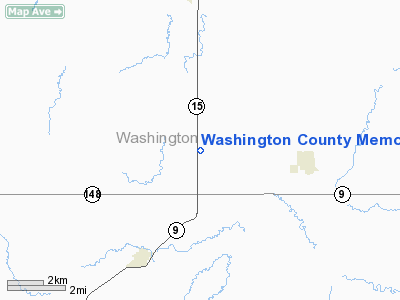
Washington County Memorial Airport |
|
|
|
Location &
QuickFacts
|
FAA
Information Effective: |
2008-09-25 |
|
Airport
Identifier: |
K38 |
|
Airport
Status: |
Operational |
|
Longitude/Latitude: |
097-02-51.5900W/39-44-00.6110N
-97.047664/39.733503 (Estimated) |
|
Elevation: |
1435 ft / 437.39 m (Surveyed) |
|
Land: |
23 acres |
|
From
nearest city: |
5 nautical miles S of Washington, KS |
|
Location: |
Washington County, KS |
|
Magnetic Variation: |
06E (1990) |
Owner & Manager
|
Ownership: |
Publicly owned |
|
Owner: |
Washington County |
|
Address: |
Co Cmsnrs, Wash Co Courthouse
Washington, KS 66968 |
|
Phone number: |
785-325-2974 |
|
Manager: |
Sharon Pierce |
|
Address: |
Po Box 277
Washington, KS 66968 |
|
Phone number: |
785-325-2318 |
Airport
Operations and Facilities
|
Airport
Use: |
Open to public |
|
Wind
indicator: |
Yes |
|
Segmented Circle: |
No |
|
Control
Tower: |
No |
|
Lighting
Schedule: |
DUSK-DAWN
ACTVT MIRL RY 17/35 - CTAF. |
|
Beacon
Color: |
Clear-Green (lighted land airport) |
|
Landing
fee charge: |
No |
|
Sectional chart: |
Wichita |
|
Region: |
ACE - Central |
|
Boundary
ARTCC: |
ZKC - Kansas City |
|
Tie-in
FSS: |
ICT - Wichita |
|
FSS on
Airport: |
No |
|
FSS Toll
Free: |
1-800-WX-BRIEF |
|
NOTAMs
Facility: |
ICT (NOTAM-d service avaliable) |
Airport Communications
Airport Services
|
Fuel
available: |
100LL
SELF-HELP CREDIT CARD FUELING AVAILABLE. |
|
Runway Information
Runway 17/35
|
Dimension: |
3400 x 60 ft / 1036.3 x 18.3 m |
|
Surface: |
CONC, Good Condition |
|
Edge Lights: |
Medium |
|
|
Runway 17
|
Runway 35
|
|
Traffic
Pattern: |
Left |
Left |
|
Markings: |
Non-precision instrument, Good Condition |
Non-precision instrument, Good Condition |
|
Displaced
threshold: |
220.00 ft |
0.00 ft |
|
Obstruction: |
15 ft road, 300.0 ft from runway, 6:1 slope to clear
RWY 17 APPROACH SLOPE 34:1 TO THE DISP THLD. |
68 ft pline, 1562.0 ft from runway, 20:1 slope to clear |
|
Radio Navigation Aids
|
ID |
Type |
Name |
Ch |
Freq |
Var |
Dist |
|
DBX |
NDB |
Morrison |
|
212.00 |
06E |
1.7 nm |
|
MYZ |
NDB |
Marysville |
|
341.00 |
06E |
20.4 nm |
|
CYW |
NDB |
Clay Center |
|
362.00 |
07E |
21.8 nm |
|
FBY |
NDB |
Fairbury |
|
293.00 |
06E |
27.2 nm |
|
RPB |
NDB |
Republican |
|
414.00 |
07E |
28.6 nm |
|
CNK |
NDB |
Concordia |
|
335.00 |
06E |
30.0 nm |
|
HWB |
NDB |
Shaw |
|
263.00 |
06E |
34.6 nm |
|
HJH |
NDB |
Hebron |
|
323.00 |
06E |
35.3 nm |
|
BJU |
NDB |
Big Blue |
|
248.00 |
06E |
39.4 nm |
|
MQD |
NDB |
Mc Dowell Creek |
|
391.00 |
06E |
41.8 nm |
|
CVY |
NDB |
Cavalry |
|
314.00 |
06E |
44.1 nm |
|
BIE |
VOR |
Beatrice |
|
110.60 |
07E |
36.7 nm |
|
FRI |
VOR |
Fort Riley |
|
109.40 |
06E |
46.7 nm |
|
MHK |
VOR/DME |
Manhattan |
039X |
110.20 |
06E |
39.5 nm |
|
PWE |
VORTAC |
Pawnee City |
071X |
112.40 |
05E |
47.9 nm |
Remarks
-
24 HR PHONE AVBL
FOR PUBLIC USE WITH PHONE CARD.
-
E111 PRVDD THE
APCH TO EACH RWY IS MAINTD FOR A MIN 20:1 GLIDE SLOPE AND THE TRANSITIONAL SFC
BE MAINTD FOR A 7:1 SLOPE.
Based Aircraft
|
Aircraft based
on field: |
3 |
|
Single Engine
Airplanes: |
3 |
Operational Statistics
Time Period: 2007-06-22 - 2008-06-20
|
Aircraft
Operations: |
33/Week |
|
General
Aviation Local: |
52.9% |
|
General
Aviation Itinerant: |
47.1% |
Washington County Memorial Airport
Address:
Washington County, KS
Tel:
785-325-2974, 785-325-2318
Images
and information placed above are from
http://www.airport-data.com/airport/K38/
We
thank them for the data!
|
General Info |
| Country |
United
States |
| State |
KANSAS
|
| FAA ID |
K38
|
| Latitude |
39-44-00.611N |
|
Longitude |
097-02-51.590W |
|
Elevation |
1435
feet |
| Near
City |
WASHINGTON |
We don't guarantee the information is fresh and accurate. The data may
be wrong or outdated.
For more up-to-date information please refer to other sources.
|
|


