 |
|
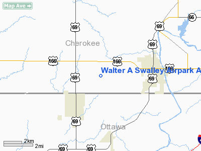
Walter A Swalley Airpark Airport |
|
|
|
Location &
QuickFacts
|
FAA
Information Effective: |
2008-09-25 |
|
Airport
Identifier: |
78KS |
|
Airport
Status: |
Operational |
|
Longitude/Latitude: |
094-48-00.8210W/37-01-00.2370N
-94.800228/37.016732 (Estimated) |
|
Elevation: |
840 ft / 256.03 m (Estimated) |
|
Land: |
80 acres |
|
From
nearest city: |
3 nautical miles W of Baxter Springs, KS |
|
Location: |
Cherokee County, KS |
|
Magnetic Variation: |
05E (1985) |
Owner & Manager
|
Ownership: |
Privately owned |
|
Owner: |
Jo Ann Swalley |
|
Address: |
855 Swalley Ave
Baxter Springs, KS 66713 |
|
Phone
number: |
620-856-4340 |
|
Manager: |
Jo Ann Swalley |
|
Address: |
855 Swalley Ave
Baxter Springs, KS 66713 |
|
Phone number: |
620-856-4340 |
Airport Operations and Facilities
|
Airport Use: |
Private |
|
Segmented Circle: |
No |
|
Control Tower: |
No |
|
Landing fee charge: |
No |
|
Sectional chart: |
Kansas City |
|
Region: |
ACE - Central |
|
Boundary ARTCC: |
ZKC - Kansas City |
|
Tie-in FSS: |
ICT - Wichita |
|
FSS on Airport: |
No |
|
FSS Toll Free: |
1-800-WX-BRIEF |
Airport Services
|
Airframe
Repair: |
NONE |
|
Power
Plant Repair: |
NONE |
|
Bottled
Oxygen: |
NONE |
|
Bulk
Oxygen: |
NONE |
|
Runway Information
Runway 17/35
|
Dimension: |
2860 x 45 ft / 871.7 x 13.7 m |
|
Surface: |
ASPH, Fair Condition
3 INCH BUMP 300 FT FROM NORTH END. |
|
|
Runway 17
|
Runway 35
|
|
Traffic
Pattern: |
Left |
Left |
|
Markings: |
Nonstandard, Fair Condition
17/35 HAS CNTRLN MARKINGS ONLY. |
Nonstandard, Fair Condition |
|
Obstruction: |
30 ft tree, 490.0 ft from runway, 66 ft left of
centerline, 9:1 slope to clear
TREES 66' L CNTRLN AT 10'-55' FM RY END. |
45 ft trees, 1350.0 ft from runway, 40 ft left of
centerline, 25:1 slope to clear
+3' GRASS & BRUSH 125' L TO 125' R AT O-50'; ROAD +15' AT 60' ON CNTRLN;
+5' FENCE AT 90' ON CNTRLN. |
|
Radio Navigation Aids
|
ID |
Type |
Name |
Ch |
Freq |
Var |
Dist |
|
PTS |
NDB |
Pittsburg |
|
365.00 |
05E |
25.8 nm |
|
LLU |
NDB |
Spring River |
|
356.00 |
05E |
36.7 nm |
|
CFV |
NDB |
Coffeyville |
|
212.00 |
05E |
37.3 nm |
|
PPF |
NDB |
Parsons |
|
258.00 |
06E |
39.0 nm |
|
FSK |
NDB |
Fort Scott |
|
379.00 |
05E |
46.9 nm |
|
EOS |
VOR/DME |
Neosho |
120X |
117.30 |
07E |
20.4 nm |
|
OSW |
VORTAC |
Oswego |
123X |
117.60 |
08E |
21.1 nm |
Operational Statistics
Time Period: 1997-03-11 - 1998-03-10
|
Aircraft
Operations: |
16/Week |
|
General
Aviation Local: |
62.5% |
|
General
Aviation Itinerant: |
37.5% |
Walter A Swalley Airpark Airport
Address:
Cherokee County, KS
Tel:
620-856-4340
Images
and information placed above are from
http://www.airport-data.com/airport/78KS/
We
thank them for the data!
|
General Info |
| Country |
United
States |
| State |
KANSAS
|
| FAA ID |
78KS
|
| Latitude |
37-01-00.237N |
|
Longitude |
094-48-00.821W |
|
Elevation |
840 feet
|
| Near
City |
BAXTER
SPRINGS |
We don't guarantee the information is fresh and accurate. The data may
be wrong or outdated.
For more up-to-date information please refer to other sources.
|
|


