 |
|
|
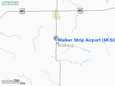
Location &
QuickFacts
|
FAA
Information Effective: |
2008-09-25 |
|
Airport
Identifier: |
6KS3 |
|
Airport
Status: |
Operational |
|
Longitude/Latitude: |
101-44-52.6150W/38-50-44.0360N
-101.747949/38.845566 (Estimated) |
|
Elevation: |
3670 ft / 1118.62 m (Surveyed) |
|
Land: |
0 acres |
|
From
nearest city: |
3 nautical miles S of Sharon Springs, KS |
|
Location: |
Wallace County, KS |
|
Magnetic Variation: |
09E (1985) |
Owner & Manager
|
Ownership: |
Privately owned |
|
Owner: |
Orville Walker |
|
Address: |
Sharon Springs, KS 67758 |
|
Phone number: |
913-852-4834 |
|
Address: |
|
Airport Operations and Facilities
|
Airport Use: |
Private |
|
Wind indicator: |
Yes |
|
Segmented Circle: |
No |
|
Control Tower: |
No |
|
Landing fee charge: |
No |
|
Sectional chart: |
Wichita |
|
Region: |
ACE - Central |
|
Boundary ARTCC: |
ZDV - Denver |
|
Tie-in FSS: |
ICT - Wichita |
|
FSS on Airport: |
No |
|
FSS Toll Free: |
1-800-WX-BRIEF |
Airport Services
|
Airframe
Repair: |
NONE |
|
Power
Plant Repair: |
NONE |
|
Runway
Information
Runway N/S
|
Dimension: |
3800 x 60 ft / 1158.2 x 18.3 m |
|
Surface: |
DIRT, |
|
|
Runway N
|
Runway S
|
|
Traffic
Pattern: |
Left |
Left |
|
Radio Navigation Aids
|
ID |
Type |
Name |
Ch |
Freq |
Var |
Dist |
|
GL |
NDB |
Shugr |
|
414.00 |
09E |
27.8 nm |
|
ITR |
NDB |
Kit Carson |
|
209.00 |
10E |
34.7 nm |
|
TQK |
NDB |
Scott City |
|
256.00 |
08E |
45.9 nm |
|
OEL |
NDB |
Oakley |
|
380.00 |
08E |
46.4 nm |
|
GLD |
VORTAC |
Goodland |
098X |
115.10 |
12E |
32.7 nm |
Remarks
-
<
AT RWY S N DIVIDES ROAD COUNTY W>
-
EXISTED PRIOR TO 1959.
Based Aircraft
|
Aircraft based
on field: |
6 |
|
Single Engine
Airplanes: |
5 |
|
Ultralights: |
1 |
Walker Strip Airport
Address:
Wallace County, KS
Tel:
913-852-4834
Images
and information placed above are from
http://www.airport-data.com/airport/6KS3/
We
thank them for the data!
|
General Info |
| Country |
United
States |
| State |
KANSAS
|
| FAA ID |
6KS3
|
| Latitude |
38-50-44.036N |
|
Longitude |
101-44-52.615W |
|
Elevation |
3670
feet |
| Near
City |
SHARON
SPRINGS |
We don't guarantee the information is fresh and accurate. The data may
be wrong or outdated.
For more up-to-date information please refer to other sources.
|
|


