 |
|
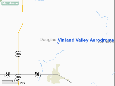
Vinland Valley Aerodrome Airport |
|
|
|
Location &
QuickFacts
|
FAA
Information Effective: |
2008-09-25 |
|
Airport
Identifier: |
K64 |
|
Airport
Status: |
Operational |
|
Longitude/Latitude: |
095-10-55.8960W/38-50-15.0200N
-95.182193/38.837506 (Estimated) |
|
Elevation: |
890 ft / 271.27 m (Estimated) |
|
Land: |
23 acres |
|
From
nearest city: |
3 nautical miles N of Baldwin City, KS |
|
Location: |
Douglas County, KS |
|
Magnetic Variation: |
05E (1985) |
Owner & Manager
|
Ownership: |
Privately owned |
|
Owner: |
Land & Sky L.c. |
|
Address: |
694 E. 1700 Rd.
Baldwin City, KS 66006 |
|
Phone
number: |
785-594-2741 |
|
Manager: |
Cheryl Kurtz |
|
Address: |
696 E. 1700 Rd
Baldwin City, KS 66006 |
|
Phone number: |
785-594-2741 |
Airport Operations and Facilities
|
Airport
Use: |
Open to public |
|
Wind
indicator: |
Yes |
|
Segmented Circle: |
No |
|
Control
Tower: |
No |
|
Lighting
Schedule: |
PHONE REQ
FOR LIRL RY 16/34 CALL 785-594-2741. |
|
Landing
fee charge: |
No |
|
Sectional chart: |
Kansas City |
|
Region: |
ACE - Central |
|
Boundary
ARTCC: |
ZKC - Kansas City |
|
Tie-in
FSS: |
ICT - Wichita |
|
FSS on
Airport: |
No |
|
FSS Toll
Free: |
1-800-WX-BRIEF |
|
NOTAMs
Facility: |
ICT (NOTAM-d service avaliable) |
Airport Communications
Airport Services
|
Runway Information
Runway 16/34
|
Dimension: |
3030 x 80 ft / 923.5 x 24.4 m |
|
Surface: |
TURF-DIRT, Fair Condition |
|
Edge Lights: |
Non-standard lighting system
NSTD LIRL; FIRST 1,028 FT SOUTH END NOT LGTD. |
|
|
Runway 16
|
Runway 34
|
|
Traffic
Pattern: |
Left |
Left |
|
Obstruction: |
18 ft road, 240.0 ft from runway, 13:1 slope to clear |
, 50:1 slope to clear |
|
Radio Navigation Aids
|
ID |
Type |
Name |
Ch |
Freq |
Var |
Dist |
|
GQ |
NDB |
Norge |
|
517.00 |
05E |
28.0 nm |
|
GKB |
NDB |
Norge |
|
517.00 |
05E |
28.0 nm |
|
TO |
NDB |
Biloy |
|
521.00 |
05E |
29.1 nm |
|
DO |
NDB |
Dotte |
|
359.00 |
05E |
30.6 nm |
|
LXT |
NDB |
Lesumit |
|
263.00 |
04E |
38.6 nm |
|
UKL |
NDB |
Boyd |
|
245.00 |
05E |
41.1 nm |
|
FOE |
TACAN |
Forbes |
053X |
|
05E |
23.4 nm |
|
OJC |
VOR/DME |
Johnson County |
077X |
113.00 |
06E |
20.9 nm |
|
RIS |
VOR/DME |
Riverside |
051X |
111.40 |
05E |
32.2 nm |
|
TOP |
VORTAC |
Topeka |
125X |
117.80 |
05E |
24.9 nm |
|
MCI |
VORTAC |
Kansas City |
079Y |
113.25 |
05E |
34.0 nm |
|
BUM |
VORTAC |
Butler |
106X |
115.90 |
07E |
47.1 nm |
|
FOE |
VOT |
Forbes |
|
111.00 |
|
23.7 nm |
|
MKC |
VOT |
Kansas City Downtown |
|
108.60 |
|
32.2 nm |
Remarks
-
TALL TREES L SIDE
AER 16.
-
+27 TREES 350 FT FROM AER 16.
-
+55 TREES 630 FT
FM AER 34, 85 FT L, 11:1 SLOPE.
Based Aircraft
|
Aircraft based
on field: |
23 |
|
Single Engine
Airplanes: |
20 |
|
Gliders: |
1 |
|
Ultralights: |
2 |
Operational Statistics
Time Period: 2004-09-01 - 2005-08-31
|
Aircraft
Operations: |
16/Week |
|
General
Aviation Local: |
87.5% |
|
General
Aviation Itinerant: |
12.5% |
Vinland Valley Aerodrome Airport
Address:
Douglas County, KS
Tel:
785-594-2741
Images
and information placed above are from
http://www.airport-data.com/airport/K64/
We
thank them for the data!
|
General Info |
| Country |
United
States |
| State |
KANSAS
|
| FAA ID |
K64
|
| Latitude |
38-50-15.020N |
|
Longitude |
095-10-55.896W |
|
Elevation |
890 feet
|
| Near
City |
BALDWIN
CITY |
We don't guarantee the information is fresh and accurate. The data may
be wrong or outdated.
For more up-to-date information please refer to other sources.
|
|


