 |
|
|
Location &
QuickFacts
|
FAA
Information Effective: |
2008-09-25 |
|
Airport
Identifier: |
44KS |
|
Airport
Status: |
Operational |
|
Longitude/Latitude: |
097-09-45.1480W/37-36-37.0610N
-97.162541/37.610295 (Estimated) |
|
Elevation: |
1350 ft / 411.48 m (Estimated) |
|
Land: |
30 acres |
|
From
nearest city: |
4 nautical miles SE of Wichita, KS |
|
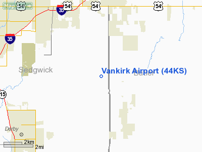
Location: |
Sedgwick County, KS |
|
Magnetic Variation: |
07E (1985) |
Owner & Manager
|
Ownership: |
Privately owned |
|
Owner: |
E L Vankirk |
|
Address: |
Box 236c Rr2
Derby, KS 67037 |
|
Address: |
|
Airport Operations and Facilities
|
Airport
Use: |
Private |
|
Wind
indicator: |
Yes |
|
Segmented Circle: |
No |
|
Control
Tower: |
No |
|
Lighting
Schedule: |
24 HRS |
|
Landing
fee charge: |
No |
|
Sectional chart: |
Wichita |
|
Region: |
ACE - Central |
|
Boundary
ARTCC: |
ZKC - Kansas City |
|
Tie-in
FSS: |
ICT - Wichita |
|
FSS on
Airport: |
No |
|
FSS Toll
Free: |
1-800-WX-BRIEF |
|
Runway Information
Runway 04/22
|
Dimension: |
2000 x 75 ft / 609.6 x 22.9 m |
|
Surface: |
TURF,
; 04/22 & 08/26 ARE ROUGH IN CERTAIN AREAS & ARE BOUNDED BY DITCHES. |
|
|
Runway 04
|
Runway 22
|
|
Traffic
Pattern: |
Left |
Left |
|
Obstruction: |
|
25 ft trees |
|
Runway 08/26
|
Dimension: |
1650 x 75 ft / 502.9 x 22.9 m |
|
Surface: |
TURF,
; 04/22 & 08/26 ARE ROUGH IN CERTAIN AREAS & ARE BOUNDED BY DITCHES. |
|
|
Runway 08
|
Runway 26
|
|
Traffic
Pattern: |
Left |
Left |
|
Obstruction: |
50 ft pline |
4 ft fence |
|
Runway 17/35
|
Dimension: |
2600 x 100 ft / 792.5 x 30.5 m |
|
Surface: |
TURF,
; 04/22 & 08/26 ARE ROUGH IN CERTAIN AREAS & ARE BOUNDED BY DITCHES. |
|
|
Runway 17
|
Runway 35
|
|
Traffic
Pattern: |
Left |
Right |
|
Obstruction: |
50 ft pline, 375.0 ft from runway |
|
|
Radio Navigation Aids
|
ID |
Type |
Name |
Ch |
Freq |
Var |
Dist |
|
IC |
NDB |
Piche |
|
332.00 |
07E |
14.1 nm |
|
EQA |
NDB |
El Dorado |
|
383.00 |
05E |
19.3 nm |
|
EGT |
NDB |
Wellington |
|
414.00 |
07E |
20.4 nm |
|
EWK |
NDB |
Newton |
|
281.00 |
06E |
27.8 nm |
|
PN |
NDB |
Ponca |
|
515.00 |
05E |
47.3 nm |
|
IAB |
TACAN |
Mc Connell |
112X |
|
07E |
5.1 nm |
|
HUT |
VOR/DME |
Hutchinson |
115X |
116.80 |
09E |
43.4 nm |
|
ICT |
VORTAC |
Wichita |
085X |
113.80 |
07E |
21.6 nm |
|
ICT |
VOT |
Wichita |
|
114.00 |
|
13.0 nm |
Remarks
-
OWNER DESIRES
ARPT NOT BE CHARTED.
-
TRACTORS
EQUIPMENT AND AIRCRAFT PARKED ON RWYS.
PEOPLE ON RWYS.
-
PROVIDED
APPROACHES ARE MAINTAINED FOR A 20:1 GLIDE SLOPE AND TRANSITIONAL SURFACES FOR
A 7:1 SLOPE; RIGHT TRAFFIC PATTERNS TO RWY 02 AND 35.
Based Aircraft
|
Aircraft based
on field: |
1 |
|
Single Engine
Airplanes: |
1 |
Vankirk Airport
Address:
Sedgwick County, KS
Tel:
Images
and information placed above are from
http://www.airport-data.com/airport/44KS/
We
thank them for the data!
|
General Info |
| Country |
United
States |
| State |
KANSAS
|
| FAA ID |
44KS
|
| Latitude |
37-36-37.061N |
|
Longitude |
097-09-45.148W |
|
Elevation |
1350
feet |
| Near
City |
WICHITA
|
We don't guarantee the information is fresh and accurate. The data may
be wrong or outdated.
For more up-to-date information please refer to other sources.
|
|


