 |
|
|
Location &
QuickFacts
|
FAA
Information Effective: |
2008-09-25 |
|
Airport
Identifier: |
03KS |
|
Airport
Status: |
Operational |
|
Longitude/Latitude: |
095-15-50.9140W/39-51-52.9940N
-95.264143/39.864721 (Estimated) |
|
Elevation: |
1160 ft / 353.57 m (Estimated) |
|
Land: |
0 acres |
|
From
nearest city: |
1 nautical miles NE of Highland, KS |
|
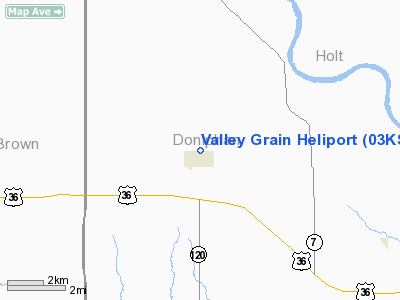
Location: |
Doniphan County, KS |
|
Magnetic Variation: |
05E (1985) |
Owner & Manager
|
Ownership: |
Privately owned |
|
Owner: |
Valley Grain Fert. Co Inc |
|
Address: |
Po Box 326
Highland, KS 66035 |
|
Address: |
|
|
Phone number: |
913-442-3221 |
Airport
Operations and Facilities
|
Airport
Use: |
Private |
|
Wind
indicator: |
No |
|
Segmented Circle: |
No |
|
Control
Tower: |
No |
|
Landing
fee charge: |
No |
|
Sectional chart: |
Kansas City |
|
Region: |
ACE - Central |
|
Boundary
ARTCC: |
ZKC - Kansas City |
|
Tie-in
FSS: |
COU - Columbia |
|
FSS on
Airport: |
No |
|
FSS Toll
Free: |
1-800-WX-BRIEF |
|
Runway Information
Helipad H1
|
Dimension: |
25 x 25 ft / 7.6 x 7.6 m |
|
Surface: |
GRAVEL, |
|
|
Runway H1
|
Runway
|
|
Traffic
Pattern: |
Left |
Left |
|
Radio Navigation Aids
|
ID |
Type |
Name |
Ch |
Freq |
Var |
Dist |
|
AZN |
NDB |
Amazon |
|
233.00 |
06E |
16.5 nm |
|
FNB |
NDB |
Brenner |
|
404.00 |
05E |
19.6 nm |
|
EVU |
NDB |
Emville |
|
317.00 |
05E |
33.2 nm |
|
AYB |
NDB |
Auburn |
|
430.00 |
05E |
42.4 nm |
|
DO |
NDB |
Dotte |
|
359.00 |
05E |
45.5 nm |
|
EZZ |
NDB |
Cameron |
|
394.00 |
03E |
46.5 nm |
|
TO |
NDB |
Biloy |
|
521.00 |
05E |
48.9 nm |
|
RBA |
VOR/DME |
Robinson |
019X |
108.20 |
04E |
7.4 nm |
|
STJ |
VORTAC |
St Joseph |
102X |
115.50 |
08E |
16.7 nm |
|
MCI |
VORTAC |
Kansas City |
079Y |
113.25 |
05E |
42.5 nm |
|
TOP |
VORTAC |
Topeka |
125X |
117.80 |
05E |
45.7 nm |
|
PWE |
VORTAC |
Pawnee City |
071X |
112.40 |
05E |
47.8 nm |
Remarks
-
PRVDD APCH/DEP
PATHS TO THE LNDG AREA ARE MAINTD FOR A MIN 8:1 GLIDE SLOPE & THE TRSNL SFC BE
MAINTD FOR A 2:1 SLOPE.
Based Aircraft
|
Aircraft based
on field: |
1 |
|
Helicopters: |
1 |
Valley Grain Heliport
Address:
Doniphan County, KS
Tel:
913-442-3221
Images
and information placed above are from
http://www.airport-data.com/airport/03KS/
We
thank them for the data!
|
General Info |
| Country |
United
States |
| State |
KANSAS
|
| FAA ID |
03KS
|
| Latitude |
39-51-52.994N |
|
Longitude |
095-15-50.914W |
|
Elevation |
1160
feet |
| Near
City |
HIGHLAND
|
We don't guarantee the information is fresh and accurate. The data may
be wrong or outdated.
For more up-to-date information please refer to other sources.
|
|


