 |
|
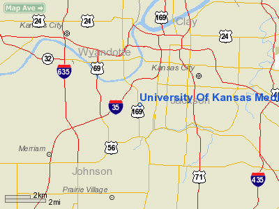
University Of Kansas Medical Center Heliport |
|
|
|
Location &
QuickFacts
|
FAA
Information Effective: |
2008-09-25 |
|
Airport
Identifier: |
10KS |
|
Airport
Status: |
Operational |
|
Longitude/Latitude: |
094-36-38.8440W/39-03-24.0180N
-94.610790/39.056672 (Estimated) |
|
Elevation: |
958 ft / 292.00 m (Estimated) |
|
Land: |
0 acres |
|
From
nearest city: |
0 nautical miles N of Kansas City, KS |
|
Location: |
Wyandotte County, KS |
|
Magnetic Variation: |
05E (1985) |
Owner & Manager
|
Ownership: |
Publicly owned |
|
Owner: |
Univer. Of Ks. Med. Center |
|
Address: |
39th & Rainbow Blvd.
Kansas City, KS 66103 |
|
Phone
number: |
913-588-5267 |
|
Manager: |
Thomas B. Allen |
|
Address: |
39th & Rainbow Blvd.
Kansas City, KS 66103 |
|
Phone number: |
913-588-5267 |
Airport Operations and Facilities
|
Airport
Use: |
Private
MEDICAL. |
|
Wind
indicator: |
Yes |
|
Segmented Circle: |
No |
|
Control
Tower: |
No |
|
Lighting
Schedule: |
PHONE REQ
FOR PERIMETER LGTS CALL 913-588-6500. |
|
Landing
fee charge: |
No |
|
Sectional chart: |
Kansas City |
|
Region: |
ACE - Central |
|
Boundary
ARTCC: |
ZKC - Kansas City |
|
Tie-in
FSS: |
COU - Columbia |
|
FSS on
Airport: |
No |
|
FSS Toll
Free: |
1-800-WX-BRIEF |
|
Runway Information
Helipad H1
|
Dimension: |
64 x 64 ft / 19.5 x 19.5 m |
|
Surface: |
ASPH-CONC, |
|
|
Runway H1
|
Runway
|
|
Traffic
Pattern: |
Left |
Left |
|
Radio Navigation Aids
|
ID |
Type |
Name |
Ch |
Freq |
Var |
Dist |
|
GKB |
NDB |
Norge |
|
517.00 |
05E |
2.1 nm |
|
GQ |
NDB |
Norge |
|
517.00 |
05E |
2.1 nm |
|
DO |
NDB |
Dotte |
|
359.00 |
05E |
11.8 nm |
|
LXT |
NDB |
Lesumit |
|
263.00 |
04E |
12.6 nm |
|
GPH |
NDB |
Mosby |
|
284.00 |
03E |
22.4 nm |
|
EZZ |
NDB |
Cameron |
|
394.00 |
03E |
43.4 nm |
|
FOE |
TACAN |
Forbes |
053X |
|
05E |
49.5 nm |
|
RIS |
VOR/DME |
Riverside |
051X |
111.40 |
05E |
3.9 nm |
|
OJC |
VOR/DME |
Johnson County |
077X |
113.00 |
06E |
14.3 nm |
|
BQS |
VOR/DME |
Braymer |
049X |
111.20 |
03E |
48.6 nm |
|
MCI |
VORTAC |
Kansas City |
079Y |
113.25 |
05E |
14.9 nm |
|
ANX |
VORTAC |
Napoleon |
087X |
114.00 |
07E |
22.6 nm |
|
TOP |
VORTAC |
Topeka |
125X |
117.80 |
05E |
44.0 nm |
|
BUM |
VORTAC |
Butler |
106X |
115.90 |
07E |
47.5 nm |
|
MKC |
VOT |
Kansas City Downtown |
|
108.60 |
|
4.0 nm |
|
FOE |
VOT |
Forbes |
|
111.00 |
|
49.7 nm |
Remarks
-
PROVIDED THAT
APPROACH/DEPARTURE PATHS TO THE LANDING AREA ARE MAINTAINED FOR A MINIMUM 8:1
GLIDE SLOPE AND THAT THE TRANSITIONAL AREA BE MAINTAINED FOR A 2:1 SLOPE.
University Of Kansas Medical Center
Heliport
Address:
Wyandotte County, KS
Tel:
913-588-5267
Images
and information placed above are from
http://www.airport-data.com/airport/10KS/
We
thank them for the data!
|
General Info |
| Country |
United
States |
| State |
KANSAS
|
| FAA ID |
10KS
|
| Latitude |
39-03-24.018N |
|
Longitude |
094-36-38.844W |
|
Elevation |
958 feet
|
| Near
City |
KANSAS
CITY |
We don't guarantee the information is fresh and accurate. The data may
be wrong or outdated.
For more up-to-date information please refer to other sources.
|
|


