 |
|
|
Location &
QuickFacts
|
FAA
Information Effective: |
2008-09-25 |
|
Airport
Identifier: |
30KS |
|
Airport
Status: |
Operational |
|
Longitude/Latitude: |
097-04-24.1380W/37-07-56.0990N
-97.073372/37.132250 (Estimated) |
|
Elevation: |
1200 ft / 365.76 m (Estimated) |
|
Land: |
5 acres |
|
From
nearest city: |
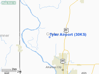
3 nautical miles NW of Arkansas City, KS |
|
Location: |
Cowley County, KS |
|
Magnetic Variation: |
07E (1985) |
Owner & Manager
|
Ownership: |
Privately owned |
|
Owner: |
Thomas Tyler |
|
Address: |
5230 242 Rd
Arkansas City, KS 67005 |
|
Phone number: |
620-442-6525 |
|
Manager: |
Thomas Tyler |
|
Address: |
5230 242 Rd.
Arkansas City, KS 67005 |
|
Phone number: |
620-442-2624 |
Airport
Operations and Facilities
|
Airport
Use: |
Private |
|
Wind
indicator: |
No |
|
Segmented Circle: |
No |
|
Control
Tower: |
No |
|
Landing
fee charge: |
No |
|
Sectional chart: |
Wichita |
|
Region: |
ACE - Central |
|
Boundary
ARTCC: |
ZKC - Kansas City |
|
Tie-in
FSS: |
ICT - Wichita |
|
FSS on
Airport: |
No |
|
FSS Toll
Free: |
1-800-WX-BRIEF |
|
Runway Information
Runway 17/35
|
Dimension: |
2600 x 60 ft / 792.5 x 18.3 m |
|
Surface: |
TURF, |
|
|
Runway 17
|
Runway 35
|
|
Traffic
Pattern: |
Right |
Left |
|
Displaced
threshold: |
0.00 ft |
300.00 ft |
|
Obstruction: |
|
15 ft trees |
|
Radio Navigation Aids
|
ID |
Type |
Name |
Ch |
Freq |
Var |
Dist |
|
PN |
NDB |
Ponca |
|
515.00 |
05E |
18.5 nm |
|
EGT |
NDB |
Wellington |
|
414.00 |
07E |
19.0 nm |
|
IC |
NDB |
Piche |
|
332.00 |
07E |
32.4 nm |
|
EQA |
NDB |
El Dorado |
|
383.00 |
05E |
40.8 nm |
|
IAB |
TACAN |
Mc Connell |
112X |
|
07E |
30.9 nm |
|
PER |
VORTAC |
Pioneer |
079X |
113.20 |
06E |
23.6 nm |
|
ICT |
VORTAC |
Wichita |
085X |
113.80 |
07E |
44.2 nm |
|
ICT |
VOT |
Wichita |
|
114.00 |
|
34.9 nm |
Remarks
-
PROVIDED A RIGHT
TRAFFIC PATTERN IS ESTABLISHED FOR RWY 17; APPROACH SURFACE SLOPE IS
MAINTAINED AT 20:1; TRANSITIONAL SURFACES ARE MAINTAINED AT 7:1.
Based Aircraft
|
Aircraft based
on field: |
1 |
|
Single Engine
Airplanes: |
1 |
Tyler Airport
Address:
Cowley County, KS
Tel:
620-442-6525, 620-442-2624
Images
and information placed above are from
http://www.airport-data.com/airport/30KS/
We
thank them for the data!
|
General Info |
| Country |
United
States |
| State |
KANSAS
|
| FAA ID |
30KS
|
| Latitude |
37-07-56.099N |
|
Longitude |
097-04-24.138W |
|
Elevation |
1200
feet |
| Near
City |
ARKANSAS
CITY |
We don't guarantee the information is fresh and accurate. The data may
be wrong or outdated.
For more up-to-date information please refer to other sources.
|
|


