 |
|
|
|
|
|
|
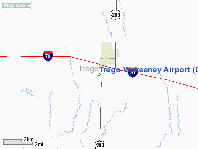
Location & QuickFacts
|
FAA Information Effective: |
2008-09-25 |
|
Airport Identifier: |
0H1 |
|
Airport Status: |
Operational |
|
Longitude/Latitude: |
099-53-34.4370W/39-00-16.0290N
-99.892899/39.004452 (Estimated) |
|
Elevation: |
2435 ft / 742.19 m (Estimated) |
|
Land: |
9 acres |
|
From nearest city: |
2 nautical miles SW of Wakeeney, KS |
|
Location: |
Trego County, KS |
|
Magnetic Variation: |
08E (1985) |
Owner & Manager
|
Ownership: |
Publicly owned |
|
Owner: |
Trego County |
|
Address: |
216 N Main
Wakeeney, KS 67672 |
|
Phone number: |
785-743-5773 |
|
Manager: |
Michael Ghumm |
|
Address: |
216 N Main
Wakeeney, KS 67672 |
|
Phone number: |
785-743-8344
FOR SVC CALL 785-769-4344 |
Airport Operations and Facilities
|
Airport Use: |
Open to public |
|
Wind indicator: |
Yes |
|
Segmented Circle: |
No |
|
Control Tower: |
No |
|
Lighting Schedule: |
DUSK-DAWN |
|
Beacon Color: |
Clear-Green (lighted land airport) |
|
Landing fee charge: |
No |
|
Sectional chart: |
Wichita |
|
Region: |
ACE - Central |
|
Boundary ARTCC: |
ZDV - Denver |
|
Tie-in FSS: |
ICT - Wichita |
|
FSS on Airport: |
No |
|
FSS Toll Free: |
1-800-WX-BRIEF |
|
NOTAMs Facility: |
ICT (NOTAM-d service avaliable) |
|
Federal Agreements: |
N |
Airport Communications
Airport Services
|
Power Plant Repair: |
MINOR |
|
Runway Information
Runway 17/35
|
Dimension: |
4000 x 50 ft / 1219.2 x 15.2 m |
|
Surface: |
ASPH, Good Condition |
|
Edge Lights: |
Low |
|
|
Runway 17
|
Runway 35
|
|
Longitude: |
099-53-37.8100W |
099-53-31.0600W |
|
Latitude: |
39-00-35.6200N |
38-59-56.4400N |
|
Elevation: |
2432.00 ft |
2424.00 ft |
|
Alignment: |
127 |
127 |
|
Traffic
Pattern: |
Right |
Left |
|
Markings: |
Basic, Good Condition |
Basic, Good Condition |
|
Obstruction: |
46 ft pole, 1035.0 ft from runway, 150 ft left of centerline, 18:1 slope
to clear |
, 50:1 slope to clear
HAS +15' ROAD AT RWY END. |
|
Radio Navigation Aids
|
ID |
Type |
Name |
Ch |
Freq |
Var |
Dist |
|
OEL |
NDB |
Oakley |
|
380.00 |
08E |
43.5 nm |
|
HLC |
VORTAC |
Hill City |
084X |
113.70 |
08E |
21.8 nm |
|
HYS |
VORTAC |
Hays |
041X |
110.40 |
10E |
30.3 nm |
Remarks
-
PRVDD EACH
APCH IS MAINT FOR MIN 20:1 GLIDE SLOPE & TRSNL SFC MAINT FOR 7:1 SLOPE.
Based Aircraft
|
Aircraft
based on field: |
9 |
|
Single Engine
Airplanes: |
9 |
Operational Statistics
Time Period: 2005-10-01 - 2006-09-30
|
Aircraft
Operations: |
39/Week |
|
Air Taxi: |
5.0% |
|
General
Aviation Local: |
50.0% |
|
General
Aviation Itinerant: |
45.0% |
Trego Wakeeney Airport
Address:
Trego County, KS
Tel:
785-743-5773,
785-743-8344
Images
and information placed above are from
http://www.airport-data.com/airport/0H1/
We
thank them for the data!
|
General Info |
| Country |
United
States |
| State |
KANSAS
|
| FAA ID |
0H1
|
| Latitude |
39-00-16.029N |
|
Longitude |
099-53-34.437W |
|
Elevation |
2435
feet |
| Near
City |
WAKEENEY
|
We don't guarantee the information is fresh and accurate. The data may
be wrong or outdated.
For more up-to-date information please refer to other sources.
|
|


