 |
|
|
Location &
QuickFacts
|
FAA
Information Effective: |
2008-09-25 |
|
Airport
Identifier: |
8KS9 |
|
Airport
Status: |
Operational |
|
Longitude/Latitude: |
095-25-30.9200W/38-26-40.0600N
-95.425256/38.444461 (Estimated) |
|
Elevation: |
1050 ft / 320.04 m (Estimated) |
|
Land: |
0 acres |
|
From
nearest city: |
5 nautical miles NW of Williamsburg, KS |
|
Location: |
Franklin County, KS |
|
Magnetic Variation: |
05E (1995) |
Owner & Manager
|
Ownership: |
Privately owned |
|
Owner: |
Henry Snodgrass |
|
Address: |
952 Douglas Rd
Williamsburg, KS |
|
Phone number: |
785-418-7158 |
|
Manager: |
Henry Snodgrass |
|
Address: |
952 Douglas Rd
Williamsburg, KS 66095 |
|
Phone number: |
785-418-7158 |
Airport
Operations and Facilities
|
Airport
Use: |
Private |
|
Segmented Circle: |
No |
|
Control
Tower: |
No |
|
Sectional chart: |
Kansas City |
|
Region: |
ACE - Central |
|
Boundary
ARTCC: |
ZKC - Kansas City |
|
Tie-in
FSS: |
ICT - Wichita |
|
FSS on
Airport: |
No |
|
FSS Toll
Free: |
1-800-WX-BRIEF |
|
Runway Information
Runway 18/36
|
Dimension: |
2500 x 50 ft / 762.0 x 15.2 m |
|
Surface: |
TURF, |
|
|
Runway 18
|
Runway 36
|
|
Traffic
Pattern: |
Left |
Left |
|
Displaced
threshold: |
0.00 ft |
300.00 ft |
|
Obstruction: |
5 ft fence |
35 ft pline, 100.0 ft from runway |
|
Radio Navigation Aids
|
ID |
Type |
Name |
Ch |
Freq |
Var |
Dist |
|
UKL |
NDB |
Boyd |
|
245.00 |
05E |
16.5 nm |
|
MSB |
NDB |
Monarch |
|
410.00 |
04E |
39.3 nm |
|
TO |
NDB |
Biloy |
|
521.00 |
05E |
42.4 nm |
|
FSK |
NDB |
Fort Scott |
|
379.00 |
05E |
49.9 nm |
|
FOE |
TACAN |
Forbes |
053X |
|
05E |
32.2 nm |
|
OJC |
VOR/DME |
Johnson County |
077X |
113.00 |
06E |
40.1 nm |
|
CNU |
VOR/DME |
Chanute |
029X |
109.20 |
05E |
49.8 nm |
|
EMP |
VORTAC |
Emporia |
075X |
112.80 |
08E |
34.8 nm |
|
TOP |
VORTAC |
Topeka |
125X |
117.80 |
05E |
42.0 nm |
|
BUM |
VORTAC |
Butler |
106X |
115.90 |
07E |
45.4 nm |
|
FOE |
VOT |
Forbes |
|
111.00 |
|
32.5 nm |
Remarks
-
OWNER DESIRES
ARPT NOT BE CHARTED.
-
PRVDD MAINTAIN
20:1 APCH SLOPE & 7:1 TRANSITIONAL SFC.
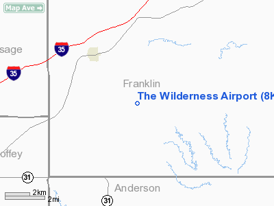
The Wilderness Airport
Address:
Franklin County, KS
Tel:
785-418-7158
Images
and information placed above are from
http://www.airport-data.com/airport/8KS9/
We
thank them for the data!
|
General Info |
| Country |
United
States |
| State |
KANSAS
|
| FAA ID |
8KS9
|
| Latitude |
38-26-40.060N |
|
Longitude |
095-25-30.920W |
|
Elevation |
1050
feet |
| Near
City |
WILLIAMSBURG |
We don't guarantee the information is fresh and accurate. The data may
be wrong or outdated.
For more up-to-date information please refer to other sources.
|
|


