 |
|
|
Location &
QuickFacts
|
FAA
Information Effective: |
2008-09-25 |
|
Airport
Identifier: |
SN92 |
|
Airport
Status: |
Operational |
|
Longitude/Latitude: |
096-42-01.0280W/39-19-59.9880N
-96.700286/39.333330 (Estimated) |
|
Elevation: |
1300 ft / 396.24 m (Estimated) |
|
Land: |
0 acres |
|
From
nearest city: |
10 nautical miles NW of Manhattan, KS |
|
Location: |
Riley County, KS |
|
Magnetic Variation: |
06E (1985) |
Owner & Manager
|
Ownership: |
Privately owned |
|
Owner: |
Dr. Jerry Gillispie |
|
Address: |
Rt 4 Box 220p
Manhattan, KS 66502 |
|
Phone
number: |
913-485-2253 |
|
Manager: |
Jerry Gillespie |
|
Address: |
Rt 4 Box 220p
Manhattan, KS 66502 |
|
Phone number: |
913-485-2253 |
Airport Operations and Facilities
|
Airport Use: |
Private |
|
Wind indicator: |
Yes |
|
Segmented Circle: |
No |
|
Control Tower: |
No |
|
Landing fee charge: |
No |
|
Sectional chart: |
Kansas City |
|
Region: |
ACE - Central |
|
Boundary ARTCC: |
ZKC - Kansas City |
|
Tie-in FSS: |
ICT - Wichita |
|
FSS on Airport: |
No |
|
FSS Toll Free: |
1-800-WX-BRIEF |
Airport Services
|
Airframe
Repair: |
NONE |
|
Power
Plant Repair: |
NONE |
|
Runway Information
Runway N/S
|
Dimension: |
2100 x 60 ft / 640.1 x 18.3 m |
|
Surface: |
TURF, |
|
|
Runway N
|
Runway S
|
|
Traffic
Pattern: |
Left |
Left |
|
Radio Navigation Aids
|
ID |
Type |
Name |
Ch |
Freq |
Var |
Dist |
|
MQD |
NDB |
Mc Dowell Creek |
|
391.00 |
06E |
13.4 nm |
|
CVY |
NDB |
Cavalry |
|
314.00 |
06E |
19.0 nm |
|
CYW |
NDB |
Clay Center |
|
362.00 |
07E |
21.6 nm |
|
DBX |
NDB |
Morrison |
|
212.00 |
06E |
30.2 nm |
|
MYZ |
NDB |
Marysville |
|
341.00 |
06E |
31.4 nm |
|
HRU |
NDB |
Herington |
|
407.00 |
06E |
38.8 nm |
|
CNK |
NDB |
Concordia |
|
335.00 |
06E |
46.1 nm |
|
TO |
NDB |
Biloy |
|
521.00 |
05E |
48.9 nm |
|
FRI |
VOR |
Fort Riley |
|
109.40 |
06E |
23.1 nm |
|
MHK |
VOR/DME |
Manhattan |
039X |
110.20 |
06E |
11.4 nm |
|
SLN |
VORTAC |
Salina |
118X |
117.10 |
07E |
49.5 nm |
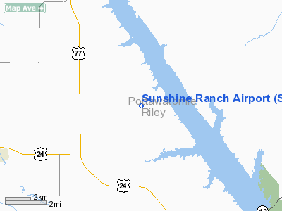
Sunshine Ranch Airport
Address:
Riley County, KS
Tel:
913-485-2253
Images
and information placed above are from
http://www.airport-data.com/airport/SN92/
We
thank them for the data!
|
General Info |
| Country |
United
States |
| State |
KANSAS
|
| FAA ID |
SN92
|
| Latitude |
39-19-59.988N |
|
Longitude |
096-42-01.028W |
|
Elevation |
1300
feet |
| Near
City |
MANHATTAN |
We don't guarantee the information is fresh and accurate. The data may
be wrong or outdated.
For more up-to-date information please refer to other sources.
|
|


