 |
|
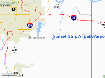
Sunset Strip Airpark Airport |
|
Location &
QuickFacts
|
FAA
Information Effective: |
2008-09-25 |
|
Airport
Identifier: |
90KS |
|
Airport
Status: |
Operational |
|
Longitude/Latitude: |
095-35-41.9200W/38-58-57.0000N
-95.594978/38.982500 (Estimated) |
|
Elevation: |
1075 ft / 327.66 m (Estimated) |
|
Land: |
46 acres |
|
From
nearest city: |
6 nautical miles SE of Topeka, KS |
|
Location: |
Shawnee County, KS |
|
Magnetic Variation: |
04E (2000) |
Owner & Manager
|
Ownership: |
Privately owned |
|
Owner: |
Sunset Strip Homeowners |
|
Address: |
4624 Se Paulen Road
Berryton, KS 66409 |
|
Phone
number: |
785-379-9229 |
|
Manager: |
Greg Hunsicker
E-MAIL - GREG@FURNACESAFETYCONSULTANTS.COM |
|
Address: |
4624 Se Paulen Rd
Berryton, KS 66409 |
|
Phone number: |
785-379-9229 |
Airport Operations and Facilities
|
Airport
Use: |
Private |
|
Wind
indicator: |
Yes |
|
Segmented Circle: |
No |
|
Control
Tower: |
No |
|
Sectional chart: |
Kansas City |
|
Region: |
ACE - Central |
|
Boundary
ARTCC: |
ZKC - Kansas City |
|
Tie-in
FSS: |
ICT - Wichita |
|
FSS Toll
Free: |
1-800-WX-BRIEF |
|
Runway Information
Runway 18/36
|
Dimension: |
2600 x 100 ft / 792.5 x 30.5 m |
|
Surface: |
TURF, |
|
|
Runway 18
|
Runway 36
|
|
Traffic
Pattern: |
Left |
Left |
|
Obstruction: |
|
25 ft trees, 20.0 ft from runway |
|
Radio Navigation Aids
|
ID |
Type |
Name |
Ch |
Freq |
Var |
Dist |
|
TO |
NDB |
Biloy |
|
521.00 |
05E |
9.3 nm |
|
UKL |
NDB |
Boyd |
|
245.00 |
05E |
41.5 nm |
|
DO |
NDB |
Dotte |
|
359.00 |
05E |
41.9 nm |
|
GQ |
NDB |
Norge |
|
517.00 |
05E |
44.1 nm |
|
GKB |
NDB |
Norge |
|
517.00 |
05E |
44.1 nm |
|
MQD |
NDB |
Mc Dowell Creek |
|
391.00 |
06E |
49.0 nm |
|
FOE |
TACAN |
Forbes |
053X |
|
05E |
3.7 nm |
|
OJC |
VOR/DME |
Johnson County |
077X |
113.00 |
06E |
41.0 nm |
|
RIS |
VOR/DME |
Riverside |
051X |
111.40 |
05E |
47.3 nm |
|
TOP |
VORTAC |
Topeka |
125X |
117.80 |
05E |
9.5 nm |
|
MCI |
VORTAC |
Kansas City |
079Y |
113.25 |
05E |
43.9 nm |
|
EMP |
VORTAC |
Emporia |
075X |
112.80 |
08E |
48.8 nm |
|
FOE |
VOT |
Forbes |
|
111.00 |
|
3.8 nm |
|
MKC |
VOT |
Kansas City Downtown |
|
108.60 |
|
47.3 nm |
Remarks
-
PRVDD CLEAR 20:1
APCH; CLEAR 7:1 TRANSITONAL SFC; REMOVE THE 25 FT TREES AT SOUTH END;
ESTABLISH RIGHT TRAFFIC RY 36 TO AVOID TRAFFIC WITH FORBES FIELD.
Based Aircraft
|
Aircraft based
on field: |
3 |
|
Single Engine
Airplanes: |
3 |
Sunset Strip Airpark Airport
Address:
Shawnee County, KS
Tel:
785-379-9229
Images
and information placed above are from
http://www.airport-data.com/airport/90KS/
We
thank them for the data!
|
General Info |
| Country |
United
States |
| State |
KANSAS
|
| FAA ID |
90KS
|
| Latitude |
38-58-57.000N |
|
Longitude |
095-35-41.920W |
|
Elevation |
1076
feet |
| Near
City |
TOPEKA
|
We don't guarantee the information is fresh and accurate. The data may
be wrong or outdated.
For more up-to-date information please refer to other sources.
|
|


