 |
|
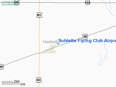
Sublette Flying Club Airport |
|
|
|
Location &
QuickFacts
|
FAA
Information Effective: |
2008-09-25 |
|
Airport
Identifier: |
19S |
|
Airport
Status: |
Operational |
|
Longitude/Latitude: |
100-49-46.5840W/37-29-29.0880N
-100.829607/37.491413 (Estimated) |
|
Elevation: |
2907 ft / 886.05 m (Estimated) |
|
Land: |
18 acres |
|
From
nearest city: |
1 nautical miles NE of Sublette, KS |
|
Location: |
Haskell County, KS |
|
Magnetic Variation: |
09E (1985) |
Owner & Manager
|
Ownership: |
Publicly owned |
|
Owner: |
City Of Sublette |
|
Address: |
City Hall, 103 Cody P.o. Box 934
Sublette, KS 67877 |
|
Phone
number: |
620-675-2326 |
|
Manager: |
Brad Menzie |
|
Address: |
City Hall, 103 Cody P.o. Box 934
Sublette, KS 67877 |
|
Phone number: |
620-675-2691 |
Airport Operations and Facilities
|
Airport
Use: |
Open to public |
|
Wind
indicator: |
Yes |
|
Segmented Circle: |
No |
|
Control
Tower: |
No |
|
Lighting
Schedule: |
DUSK-DAWN |
|
Landing
fee charge: |
No |
|
Sectional chart: |
Wichita |
|
Region: |
ACE - Central |
|
Boundary
ARTCC: |
ZKC - Kansas City |
|
Tie-in
FSS: |
ICT - Wichita |
|
FSS on
Airport: |
No |
|
FSS Toll
Free: |
1-800-WX-BRIEF |
|
NOTAMs
Facility: |
ICT (NOTAM-d service avaliable) |
Airport Communications
|
CTAF: |
122.900 |
|
Unicom: |
122.800 |
Airport Services
|
Airframe
Repair: |
NONE |
|
Power
Plant Repair: |
NONE |
|
Bottled
Oxygen: |
NONE |
|
Bulk
Oxygen: |
NONE |
|
Runway Information
Runway 08/26
|
Dimension: |
2300 x 100 ft / 701.0 x 30.5 m |
|
Surface: |
TURF, Fair Condition |
|
|
Runway 08
|
Runway 26
|
|
Traffic
Pattern: |
Left |
Left |
|
Runway End
Identifier: |
No |
No |
|
Centerline
Lights: |
No |
No |
|
Touchdown
Lights: |
No |
No |
|
Obstruction: |
, 165.0 ft from runway
RY 17/35 AT 35 FT FM END. |
10 ft tower, 130.0 ft from runway |
|
Runway 17/35
|
Dimension: |
4500 x 60 ft / 1371.6 x 18.3 m |
|
Surface: |
ASPH, Good Condition |
|
Edge Lights: |
Low |
|
|
Runway 17
|
Runway 35
|
|
Longitude: |
100-50-03.4100W |
100-50-03.4100W |
|
Latitude: |
37-30-11.5200N |
37-29-27.0200N |
|
Traffic
Pattern: |
Left |
Left |
|
Markings: |
Basic, Fair Condition |
Basic, Fair Condition
NSTD THLD BAR (TOO NARROW). |
|
Runway End
Identifier: |
No |
No |
|
Centerline
Lights: |
No |
No |
|
Touchdown
Lights: |
No |
No |
|
Obstruction: |
, 250.0 ft from runway
ROAD AT 250 FT FROM THLD. |
15 ft fence, 200.0 ft from runway, 50:1 slope to clear
ROAD AT 100' FROM THR. |
|
Radio Navigation Aids
|
ID |
Type |
Name |
Ch |
Freq |
Var |
Dist |
|
GC |
NDB |
Pieve |
|
347.00 |
09E |
20.9 nm |
|
MEJ |
NDB |
Meade |
|
389.00 |
09E |
25.7 nm |
|
ULS |
NDB |
Ulysses |
|
395.00 |
09E |
26.4 nm |
|
HQG |
NDB |
Hugoton |
|
365.00 |
09E |
32.7 nm |
|
JHN |
NDB |
Bear Creek |
|
341.00 |
10E |
44.0 nm |
|
GCK |
VORTAC |
Garden City |
080X |
113.30 |
11E |
26.2 nm |
|
LBL |
VORTAC |
Liberal |
070X |
112.30 |
11E |
27.7 nm |
|
DDC |
VORTAC |
Dodge City |
019X |
108.20 |
08E |
44.8 nm |
Remarks
-
LGTD 150' GRAIN
ELEVATOR SOUTH OF RWY 08/26.
-
BE ALERT FOR 2
DRAINAGE PIPES CROSSING TWY TO RY 35.
Based Aircraft
|
Aircraft based
on field: |
3 |
|
Single Engine
Airplanes: |
3 |
Operational Statistics
Time Period: 2005-06-17 - 2006-06-16
|
Aircraft
Operations: |
12/Week |
|
General
Aviation Local: |
50.0% |
|
General
Aviation Itinerant: |
50.0% |
Sublette Flying Club Airport
Address:
Haskell County, KS
Tel:
620-675-2326,
620-675-2691
Images
and information placed above are from
http://www.airport-data.com/airport/19S/
We
thank them for the data!
|
General Info |
| Country |
United
States |
| State |
KANSAS
|
| FAA ID |
19S
|
| Latitude |
37.491414
37° 29' 29.09" N |
|
Longitude |
-100.829606
100° 49' 46.58" W |
|
Elevation |
2907
feet
886 meters |
| Magnetic
Variation |
007° E
(01/06) |
|
Operating Agency |
PRIVATE
|
We don't guarantee the information is fresh and accurate. The data may
be wrong or outdated.
For more up-to-date information please refer to other sources.
|
|


