 |
|
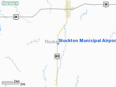
Stockton Municipal Airport |
|
|
|
Location &
QuickFacts
|
FAA
Information Effective: |
2008-09-25 |
|
Airport
Identifier: |
0S2 |
|
Airport
Status: |
Operational |
|
Longitude/Latitude: |
099-17-42.3540W/39-22-38.0350N
-99.295098/39.377232 (Estimated) |
|
Elevation: |
1973 ft / 601.37 m (Surveyed) |
|
Land: |
116 acres |
|
From
nearest city: |
3 nautical miles SW of Stockton, KS |
|
Location: |
Rooks County, KS |
|
Magnetic Variation: |
08E (1985) |
Owner & Manager
|
Ownership: |
Publicly owned |
|
Owner: |
City Of Stockton |
|
Address: |
115 S Walnut
Stockton, KS 67669 |
|
Phone number: |
785-425-6703 |
|
Manager: |
Connie Conyac |
|
Address: |
115 S Walnut
Stockton, KS 67669 |
|
Phone number: |
785-425-6703 |
Airport
Operations and Facilities
|
Airport
Use: |
Open to public |
|
Wind
indicator: |
Yes |
|
Segmented Circle: |
No |
|
Control
Tower: |
No |
|
Lighting
Schedule: |
DUSK-DAWN
FOR MIRL RY 17/35 KEY 122.9 5 TIMES. |
|
Beacon
Color: |
Clear-Green (lighted land airport) |
|
Landing
fee charge: |
No |
|
Sectional chart: |
Wichita |
|
Region: |
ACE - Central |
|
Boundary
ARTCC: |
ZDV - Denver |
|
Tie-in
FSS: |
ICT - Wichita |
|
FSS on
Airport: |
No |
|
FSS Toll
Free: |
1-800-WX-BRIEF |
|
NOTAMs
Facility: |
ICT (NOTAM-d service avaliable) |
|
Federal Agreements: |
1 |
Airport Communications
Airport Services
|
Airframe
Repair: |
NONE |
|
Power
Plant Repair: |
NONE |
|
Bottled
Oxygen: |
NONE |
|
Bulk
Oxygen: |
NONE |
|
Runway Information
Runway 17/35
|
Dimension: |
3500 x 240 ft / 1066.8 x 73.2 m |
|
Surface: |
TURF, Good Condition |
|
Edge Lights: |
Medium
NSTD LIRL; LGTS PLACED BESIDE BARRELS. |
|
|
Runway 17
|
Runway 35
|
|
Traffic
Pattern: |
Left |
Left |
|
Obstruction: |
23 ft pline, 896.0 ft from runway, 214 ft right of
centerline, 38:1 slope to clear |
24 ft pole, 580.0 ft from runway, 24:1 slope to clear |
|
Radio Navigation Aids
|
ID |
Type |
Name |
Ch |
Freq |
Var |
Dist |
|
PHG |
NDB |
Phillipsburg |
|
368.00 |
08E |
19.8 nm |
|
NRN |
NDB |
Norton |
|
230.00 |
08E |
39.8 nm |
|
HYS |
VORTAC |
Hays |
041X |
110.40 |
10E |
31.8 nm |
|
HLC |
VORTAC |
Hill City |
084X |
113.70 |
08E |
43.9 nm |
Based Aircraft
|
Aircraft based
on field: |
3 |
|
Single Engine
Airplanes: |
3 |
Operational Statistics
Time Period: 2005-12-02 - 2006-12-01
|
Aircraft
Operations: |
13/Week |
|
General
Aviation Local: |
61.5% |
|
General
Aviation Itinerant: |
38.5% |
Stockton Municipal Airport
Address:
Rooks County, KS
Tel:
785-425-6703
Images
and information placed above are from
http://www.airport-data.com/airport/0S2/
We
thank them for the data!
|
General Info |
| Country |
United
States |
| State |
KANSAS
|
| FAA ID |
0S2
|
| Latitude |
39-22-38.035N |
|
Longitude |
099-17-42.354W |
|
Elevation |
1973
feet |
| Near
City |
STOCKTON
|
We don't guarantee the information is fresh and accurate. The data may
be wrong or outdated.
For more up-to-date information please refer to other sources.
|
|


