 |
|
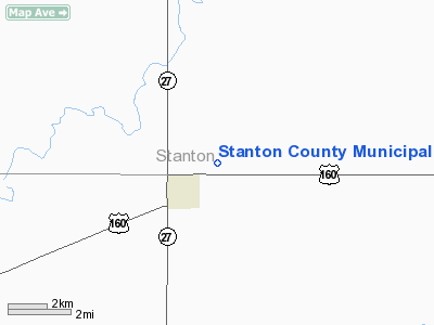
Stanton County Municipal Airport |
|
|
|
Location &
QuickFacts
|
FAA
Information Effective: |
2008-09-25 |
|
Airport
Identifier: |
2K3 |
|
Airport
Status: |
Operational |
|
Longitude/Latitude: |
101-43-58.1160W/37-34-57.7600N
-101.732810/37.582711 (Estimated) |
|
Elevation: |
3324 ft / 1013.16 m (Estimated) |
|
Land: |
115 acres |
|
From
nearest city: |
2 nautical miles NE of Johnson, KS |
|
Location: |
Stanton County, KS |
|
Magnetic Variation: |
10E (1980) |
Owner & Manager
|
Ownership: |
Publicly owned |
|
Owner: |
Stanton County |
|
Address: |
201 N Main St
Johnson, KS 67855 |
|
Phone
number: |
620-492-2140 |
|
Manager: |
Luke T Gerard |
|
Address: |
Box 759, 105 N. Airport Road
Johnson, KS 67855 |
|
Phone number: |
620-492-2414 |
Airport Operations and Facilities
|
Airport
Use: |
Open to public |
|
Wind
indicator: |
Yes |
|
Segmented Circle: |
No |
|
Control
Tower: |
No |
|
Lighting
Schedule: |
DUSK-DAWN
MIRL RY 17/35 PRESET ON LOW INTST DUSK-2300; TO INCR INTST AND ACTVT
AFT 2300 - CTAF. |
|
Beacon
Color: |
Clear-Green (lighted land airport) |
|
Landing
fee charge: |
No |
|
Sectional chart: |
Wichita |
|
Region: |
ACE - Central |
|
Boundary
ARTCC: |
ZKC - Kansas City |
|
Tie-in
FSS: |
ICT - Wichita |
|
FSS on
Airport: |
No |
|
FSS Toll
Free: |
1-800-WX-BRIEF |
|
NOTAMs
Facility: |
ICT (NOTAM-d service avaliable) |
|
Federal Agreements: |
NGY |
Airport Communications
|
CTAF: |
122.800 |
|
Unicom: |
122.800 |
Airport Services
|
Fuel
available: |
100LLA |
|
Airframe
Repair: |
MAJOR |
|
Power
Plant Repair: |
MAJOR |
|
Bottled
Oxygen: |
NONE |
|
Bulk
Oxygen: |
HIGH |
|
Runway Information
Runway 08/26
|
Dimension: |
2140 x 60 ft / 652.3 x 18.3 m |
|
Surface: |
ASPH, Fair Condition
SURFACE CRACKING WITH SMALL WEEDS GROWING IN CRACKS. |
|
Weight Limit: |
Single wheel: 3000 lbs. |
|
|
Runway 08
|
Runway 26
|
|
Longitude: |
101-44-03.7100W |
101-43-37.1300W |
|
Latitude: |
37-34-47.0700N |
37-34-46.9500N |
|
Elevation: |
3324.00 ft |
3319.00 ft |
|
Alignment: |
90 |
127 |
|
Traffic
Pattern: |
Left |
Left |
|
Markings: |
Basic, Poor Condition
MARKINGS ARE FADED. |
Basic, Poor Condition
MARKINGS ARE FADED. |
|
Obstruction: |
, 50:1 slope to clear
+15 ROAD AT APCH END RY 08. |
7 ft road, 270.0 ft from runway, 10:1 slope to clear |
|
Runway 17/35
|
Dimension: |
4100 x 60 ft / 1249.7 x 18.3 m |
|
Surface: |
CONC, Good Condition
SURFACE CRACKING WITH SMALL WEEDS GROWING IN CRACKS. |
|
Weight Limit: |
Single wheel: 3000 lbs. |
|
Edge Lights: |
Medium |
|
|
Runway 17
|
Runway 35
|
|
Longitude: |
101-44-02.0940W |
101-44-01.5390W |
|
Latitude: |
37-35-24.2590N |
37-34-43.7250N |
|
Elevation: |
3319.00 ft |
3324.00 ft |
|
Alignment: |
127 |
0 |
|
Traffic
Pattern: |
Left |
Left |
|
Markings: |
Non-precision instrument, Fair Condition
MARKINGS ARE FADED. |
Non-precision instrument, Fair Condition
MARKINGS ARE FADED. |
|
Crossing
Height: |
27.00 ft |
29.00 ft |
|
VASI: |
2-box on left side |
2-box on left side |
|
Visual
Glide Angle: |
3.00° |
2.50° |
|
Runway End
Identifier: |
No |
No |
|
Obstruction: |
15 ft road, 620.0 ft from runway, 28:1 slope to clear |
17 ft road, 500.0 ft from runway, 17:1 slope to clear |
|
Radio Navigation Aids
|
ID |
Type |
Name |
Ch |
Freq |
Var |
Dist |
|
JHN |
NDB |
Bear Creek |
|
341.00 |
10E |
3.2 nm |
|
ULS |
NDB |
Ulysses |
|
395.00 |
09E |
17.4 nm |
|
HQG |
NDB |
Hugoton |
|
365.00 |
09E |
30.5 nm |
|
EHA |
NDB |
Elkhart |
|
377.00 |
10E |
35.7 nm |
|
LBL |
VORTAC |
Liberal |
070X |
112.30 |
11E |
48.7 nm |
Remarks
-
PUB TELEPHONE AVBL 24 HRS
620-492-2414.
-
TWY ADJ TO RY
17/35 UNMARKED.
Based Aircraft
|
Aircraft based
on field: |
35 |
|
Single Engine
Airplanes: |
30 |
|
Multi Engine
Airplanes: |
3 |
|
Jet Engine
Airplanes: |
2 |
Operational Statistics
Time Period: 2006-08-24 - 2007-08-23
|
Aircraft
Operations: |
64/Day |
|
Air Taxi: |
0.4% |
|
General
Aviation Local: |
61.9% |
|
General
Aviation Itinerant: |
37.7% |
Stanton County Municipal Airport
Address:
Stanton County, KS
Tel:
620-492-2140,
620-492-2414
Images
and information placed above are from
http://www.airport-data.com/airport/2K3/
We
thank them for the data!
|
General Info |
| Country |
United
States |
| State |
KANSAS
|
| FAA ID |
2K3
|
| Latitude |
37-34-57.760N |
|
Longitude |
101-43-58.116W |
|
Elevation |
3324
feet |
| Near
City |
JOHNSON
|
We don't guarantee the information is fresh and accurate. The data may
be wrong or outdated.
For more up-to-date information please refer to other sources.
|
|


