 |
|
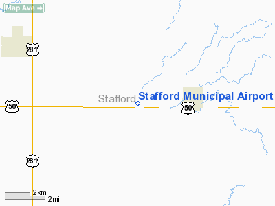
Stafford Municipal Airport |
|
|
|
Location &
QuickFacts
|
FAA
Information Effective: |
2008-09-25 |
|
Airport
Identifier: |
3TA |
|
Airport
Status: |
Operational |
|
Longitude/Latitude: |
098-39-01.3030W/37-57-30.0540N
-98.650362/37.958348 (Estimated) |
|
Elevation: |
1886 ft / 574.85 m (Surveyed) |
|
Land: |
80 acres |
|
From
nearest city: |
3 nautical miles W of Stafford, KS |
|
Location: |
Stafford County, KS |
|
Magnetic Variation: |
08E (1985) |
Owner & Manager
|
Ownership: |
Publicly owned |
|
Owner: |
City Of Stafford |
|
Address: |
112 W. Broadway
Stafford, KS 67578 |
|
Phone number: |
620-234-5561 |
|
Manager: |
Jerry Mcmillian |
|
Address: |
112 W. Broadway
Stafford, KS 67578 |
|
Phone number: |
620-234-5561 |
Airport
Operations and Facilities
|
Airport
Use: |
Open to public |
|
Wind
indicator: |
Yes |
|
Segmented Circle: |
No |
|
Control
Tower: |
No |
|
Lighting
Schedule: |
DUSK-DAWN |
|
Beacon
Color: |
Clear-Green (lighted land airport) |
|
Landing
fee charge: |
No |
|
Sectional chart: |
Wichita |
|
Region: |
ACE - Central |
|
Boundary
ARTCC: |
ZKC - Kansas City |
|
Tie-in
FSS: |
ICT - Wichita |
|
FSS on
Airport: |
No |
|
FSS Toll
Free: |
1-800-WX-BRIEF |
|
NOTAMs
Facility: |
ICT (NOTAM-d service avaliable) |
Airport Communications
Airport Services
|
Airframe
Repair: |
NONE |
|
Power
Plant Repair: |
NONE |
|
Bottled
Oxygen: |
NONE |
|
Bulk
Oxygen: |
NONE |
|
Runway Information
Runway 03/21
|
Dimension: |
1580 x 260 ft / 481.6 x 79.2 m |
|
Surface: |
TURF, Good Condition
FIRST 700 FT OF RY 31 WET & SOFT AFTER RAIN.
FIRST 1200 FT OF RY 35 SOFT & WET AFTER RAIN. |
|
|
Runway 03
|
Runway 21
|
|
Longitude: |
098-39-01.8900W |
098-38-47.3200W |
|
Latitude: |
37-57-32.7300N |
37-57-43.2700N |
|
Traffic
Pattern: |
Left |
Left |
|
Obstruction: |
, 50:1 slope to clear |
15 ft road, 200.0 ft from runway, 13:1 slope to clear |
|
Runway 13/31
|
Dimension: |
1900 x 80 ft / 579.1 x 24.4 m |
|
Surface: |
TURF, Good Condition
FIRST 700 FT OF RY 31 WET & SOFT AFTER RAIN.
FIRST 1200 FT OF RY 35 SOFT & WET AFTER RAIN. |
|
|
Runway 13
|
Runway 31
|
|
Traffic
Pattern: |
Left |
Left |
|
Obstruction: |
3 ft fence |
19 ft road, 580.0 ft from runway, 30:1 slope to clear |
|
Runway 17/35
|
Dimension: |
2560 x 100 ft / 780.3 x 30.5 m |
|
Surface: |
TURF, Good Condition
FIRST 700 FT OF RY 31 WET & SOFT AFTER RAIN.
FIRST 1200 FT OF RY 35 SOFT & WET AFTER RAIN. |
|
Edge Lights: |
Low |
|
|
Runway 17
|
Runway 35
|
|
Longitude: |
098-38-48.0500W |
098-38-48.0600W |
|
Latitude: |
37-57-44.1200N |
37-57-18.8100N |
|
Traffic
Pattern: |
Left |
Left |
|
Obstruction: |
15 ft road, 30.0 ft from runway, 2:1 slope to clear |
19 ft road, 60.0 ft from runway, 3:1 slope to clear |
|
Radio Navigation Aids
|
ID |
Type |
Name |
Ch |
Freq |
Var |
Dist |
|
PTT |
NDB |
Pratt |
|
356.00 |
07E |
14.8 nm |
|
LQR |
NDB |
Larned |
|
296.00 |
08E |
25.4 nm |
|
HIL |
NDB |
Hilyn |
|
338.00 |
08E |
26.9 nm |
|
LYO |
NDB |
Lyons |
|
386.00 |
06E |
30.8 nm |
|
HUT |
VOR/DME |
Hutchinson |
115X |
116.80 |
09E |
34.0 nm |
Remarks
Based Aircraft
|
Aircraft based
on field: |
5 |
|
Single Engine
Airplanes: |
5 |
Operational Statistics
Time Period: 2007-07-24 - 2008-07-22
|
Aircraft
Operations: |
31/Week |
|
General
Aviation Local: |
75.0% |
|
General
Aviation Itinerant: |
25.0% |
Stafford Municipal Airport
Address:
Stafford County, KS
Tel:
620-234-5561
Images
and information placed above are from
http://www.airport-data.com/airport/3TA/
We
thank them for the data!
|
General Info |
| Country |
United
States |
| State |
KANSAS
|
| FAA ID |
3TA
|
| Latitude |
37-57-30.054N |
|
Longitude |
098-39-01.303W |
|
Elevation |
1886
feet |
| Near
City |
STAFFORD
|
We don't guarantee the information is fresh and accurate. The data may
be wrong or outdated.
For more up-to-date information please refer to other sources.
|
|


