 |
|
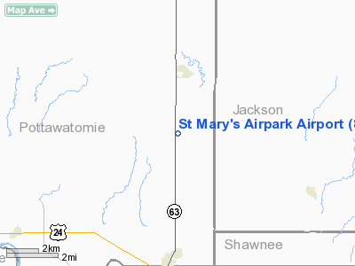
St Mary's Airpark Airport |
|
Location &
QuickFacts
|
FAA
Information Effective: |
2008-09-25 |
|
Airport
Identifier: |
8K4 |
|
Airport
Status: |
Operational |
|
Longitude/Latitude: |
096-03-41.0000W/39-16-21.0000N
-96.061389/39.272500 (Estimated) |
|
Elevation: |
1220 ft / 371.86 m (Estimated) |
|
Land: |
0 acres |
|
From
nearest city: |
4 nautical miles N of St. Mary's, KS |
|
Location: |
Pottawatomie County, KS |
|
Magnetic Variation: |
() |
Owner & Manager
|
Ownership: |
Privately owned |
|
Owner: |
St Mary's Airpark |
|
Address: |
632 W. Bertrand
St Mary's, KS 66536 |
|
Phone
number: |
785-437-2025 |
|
Manager: |
Greg Plfum |
|
Address: |
P.o. Box G
St Mary's, KS 66536 |
|
Phone number: |
785-437-2025 |
Airport Operations and Facilities
|
Airport
Use: |
Open to public |
|
Wind
indicator: |
Yes |
|
Control
Tower: |
No |
|
Sectional chart: |
Kansas City |
|
Region: |
ACE - Central |
|
Boundary
ARTCC: |
ZKC - Kansas City |
|
Tie-in
FSS: |
ICT - Wichita |
|
FSS Toll
Free: |
1-800-WX-BRIEF |
|
NOTAMs
Facility: |
ICT (NOTAM-d service avaliable) |
Airport Communications
|
Runway Information
Runway 18/36
|
Dimension: |
2514 x 60 ft / 766.3 x 18.3 m |
|
Surface: |
TURF-GRVL, Fair Condition
UNEVEN SFC; LINE OF SIGHT OBSTRUCTED BETWEEN RY ENDS. |
|
|
Runway 18
|
Runway 36
|
|
Traffic
Pattern: |
Left |
Right |
|
Obstruction: |
22 ft , 299.0 ft from runway, 75 ft right of centerline,
13:1 slope to clear |
30 ft , 1080.0 ft from runway, 104 ft right of centerline,
36:1 slope to clear |
|
Radio Navigation Aids
|
ID |
Type |
Name |
Ch |
Freq |
Var |
Dist |
|
TO |
NDB |
Biloy |
|
521.00 |
05E |
19.7 nm |
|
MQD |
NDB |
Mc Dowell Creek |
|
391.00 |
06E |
28.1 nm |
|
CVY |
NDB |
Cavalry |
|
314.00 |
06E |
37.2 nm |
|
MYZ |
NDB |
Marysville |
|
341.00 |
06E |
43.8 nm |
|
HRU |
NDB |
Herington |
|
407.00 |
06E |
49.4 nm |
|
FOE |
TACAN |
Forbes |
053X |
|
05E |
27.0 nm |
|
FRI |
VOR |
Fort Riley |
|
109.40 |
06E |
41.5 nm |
|
MHK |
VOR/DME |
Manhattan |
039X |
110.20 |
06E |
29.3 nm |
|
RBA |
VOR/DME |
Robinson |
019X |
108.20 |
04E |
45.6 nm |
|
TOP |
VORTAC |
Topeka |
125X |
117.80 |
05E |
25.2 nm |
|
FOE |
VOT |
Forbes |
|
111.00 |
|
26.7 nm |
Remarks
-
ALL TRAFFIC
REMAIN EAST OF RY.
-
440 FT TWR, 3 NM
SOUTH & 680 FT SMOKE STACKS 3.2 NM WNW OF ARPT.
-
168 FT TWR 1.2 NM
SSW OF RY 36.
-
PRVDD ALL TFC PAT
FLOWN ON THE EAST SIDE OF THE RY; MAINTAIN CLEAR 20:1 APCHS; MAINTAIN CLEAR
7:1 TRANSITIONAL SFC; WRITTEN AGREEMENT WITH JMJ LANDING ARPT.
Based Aircraft
|
Aircraft based
on field: |
1 |
|
Single Engine
Airplanes: |
1 |
Operational Statistics
Time Period: 2006-03-01 - 2007-02-28
|
Aircraft
Operations: |
11/Week |
|
General
Aviation Local: |
18.2% |
|
General
Aviation Itinerant: |
36.4% |
|
Military: |
45.5% |
St Mary's Airpark Airport
Address:
Pottawatomie County, KS
Tel:
785-437-2025
Images
and information placed above are from
http://www.airport-data.com/airport/8K4/
We
thank them for the data!
We don't guarantee the information is fresh and accurate. The data may
be wrong or outdated.
For more up-to-date information please refer to other sources.
|
|


