 |
|
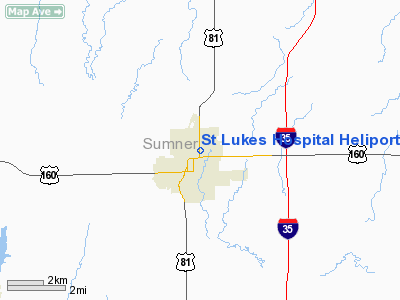
St Lukes Hospital Heliport |
|
|
|
Location &
QuickFacts
|
FAA
Information Effective: |
2008-09-25 |
|
Airport
Identifier: |
26KS |
|
Airport
Status: |
Operational |
|
Longitude/Latitude: |
097-23-37.1640W/37-16-42.0790N
-97.393657/37.278355 (Estimated) |
|
Elevation: |
1236 ft / 376.73 m (Estimated) |
|
Land: |
0 acres
4000 SQ FT. |
|
From
nearest city: |
0 nautical miles N of Wellington, KS |
|
Location: |
Sumner County, KS |
|
Magnetic Variation: |
07E (1985) |
Owner & Manager
|
Ownership: |
Publicly owned |
|
Owner: |
St. Lukes Hospital
AND CITY OF WELLINGTON |
|
Address: |
1323 North A
Wellington, KS 67152 |
|
Phone number: |
316-326-7451 |
|
Manager: |
Robert H. Bean |
|
Address: |
1323 North A
Wellington, KS 67152 |
|
Phone number: |
316-326-7451 |
Airport
Operations and Facilities
|
Airport
Use: |
Private
MEDICAL. |
|
Wind
indicator: |
Yes |
|
Segmented Circle: |
No |
|
Control
Tower: |
No |
|
Lighting
Schedule: |
PHONE REQ
FOR ROTG BCN CALL 316-326-7451. |
|
Landing
fee charge: |
No |
|
Sectional chart: |
Wichita |
|
Region: |
ACE - Central |
|
Boundary
ARTCC: |
ZKC - Kansas City |
|
Tie-in
FSS: |
ICT - Wichita |
|
FSS on
Airport: |
No |
|
FSS Toll
Free: |
1-800-WX-BRIEF |
|
Runway Information
Helipad H1
|
Dimension: |
20 x 16 ft / 6.1 x 4.9 m |
|
Surface: |
CONC-GRVL, |
|
|
Runway H1
|
Runway
|
|
Traffic
Pattern: |
Left |
Left |
|
Obstruction: |
25 ft pline, 175.0 ft from runway |
|
|
Radio Navigation Aids
|
ID |
Type |
Name |
Ch |
Freq |
Var |
Dist |
|
EGT |
NDB |
Wellington |
|
414.00 |
07E |
2.7 nm |
|
IC |
NDB |
Piche |
|
332.00 |
07E |
18.3 nm |
|
PN |
NDB |
Ponca |
|
515.00 |
05E |
30.7 nm |
|
EQA |
NDB |
El Dorado |
|
383.00 |
05E |
40.8 nm |
|
EWK |
NDB |
Newton |
|
281.00 |
06E |
47.6 nm |
|
IAB |
TACAN |
Mc Connell |
112X |
|
07E |
21.5 nm |
|
ICT |
VORTAC |
Wichita |
085X |
113.80 |
07E |
29.5 nm |
|
PER |
VORTAC |
Pioneer |
079X |
113.20 |
06E |
33.9 nm |
|
ANY |
VORTAC |
Anthony |
076X |
112.90 |
07E |
37.9 nm |
|
ICT |
VOT |
Wichita |
|
114.00 |
|
21.6 nm |
Remarks
-
OWNER DESIRES
ARPT NOT BE CHARTED.
-
CONDL-PROVIDED
APPROACH/DEPARTURE PATHS ARE MAINTAINED FOR A MINIMUM 8:1 GLIDE SLOPE AND THE
TRANSITIONAL SURFACE BE MAINTAINED FOR A MINIMUM 2:1 SLOPE.
St Lukes Hospital Heliport
Address:
Sumner County, KS
Tel:
316-326-7451
Images
and information placed above are from
http://www.airport-data.com/airport/26KS/
We
thank them for the data!
|
General Info |
| Country |
United
States |
| State |
KANSAS
|
| FAA ID |
26KS
|
| Latitude |
37-16-42.079N |
|
Longitude |
097-23-37.164W |
|
Elevation |
1236
feet |
| Near
City |
WELLINGTON |
We don't guarantee the information is fresh and accurate. The data may
be wrong or outdated.
For more up-to-date information please refer to other sources.
|
|


