 |
|
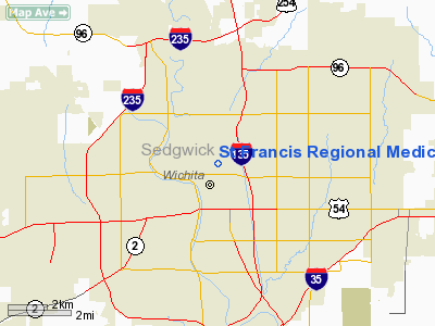
St Francis Regional Medical Center Heliport |
|
|
|
Location &
QuickFacts
|
FAA
Information Effective: |
2008-09-25 |
|
Airport
Identifier: |
22KS |
|
Airport
Status: |
Operational |
|
Longitude/Latitude: |
097-19-58.1610W/37-42-00.0490N
-97.332823/37.700014 (Estimated) |
|
Elevation: |
1382 ft / 421.23 m (Estimated) |
|
Land: |
0 acres |
|
From
nearest city: |
0 nautical miles N of Wichita, KS |
|
Location: |
Sedgwick County, KS |
|
Magnetic Variation: |
07E (1985) |
Owner & Manager
|
Ownership: |
Privately owned |
|
Owner: |
St. Francis Regional Med. Ctr |
|
Address: |
929 N. St. Francis
Wichita, KS 67214 |
|
Phone
number: |
316-268-5000 |
|
Manager: |
W. Smyth, Dir., Bldg Svs |
|
Address: |
929 N. St. Francis
Wichita, KS 67214 |
|
Phone number: |
316-268-5110 |
Airport Operations and Facilities
|
Airport
Use: |
Private
MEDICAL. |
|
Wind
indicator: |
Yes |
|
Segmented Circle: |
Yes |
|
Control
Tower: |
No |
|
Lighting
Schedule: |
PHONE REQ
FOR PERIMETER LGTS CALL 316-268-5092. |
|
Landing
fee charge: |
No |
|
Sectional chart: |
Wichita |
|
Region: |
ACE - Central |
|
Boundary
ARTCC: |
ZKC - Kansas City |
|
Tie-in
FSS: |
ICT - Wichita |
|
FSS on
Airport: |
No |
|
FSS Toll
Free: |
1-800-WX-BRIEF |
|
Runway Information
Helipad H1
|
Dimension: |
83 x 83 ft / 25.3 x 25.3 m |
|
Surface: |
CONC,
ROOFTOP. |
|
|
Runway H1
|
Runway
|
|
Traffic
Pattern: |
Left |
Left |
|
Markings: |
Basic, Good Condition |
, |
|
Radio Navigation Aids
|
ID |
Type |
Name |
Ch |
Freq |
Var |
Dist |
|
IC |
NDB |
Piche |
|
332.00 |
07E |
9.4 nm |
|
EWK |
NDB |
Newton |
|
281.00 |
06E |
22.1 nm |
|
EGT |
NDB |
Wellington |
|
414.00 |
07E |
22.8 nm |
|
EQA |
NDB |
El Dorado |
|
383.00 |
05E |
25.0 nm |
|
MPR |
NDB |
Mc Pherson |
|
227.00 |
06E |
42.4 nm |
|
IAB |
TACAN |
Mc Connell |
112X |
|
07E |
5.6 nm |
|
HUT |
VOR/DME |
Hutchinson |
115X |
116.80 |
09E |
33.7 nm |
|
ICT |
VORTAC |
Wichita |
085X |
113.80 |
07E |
12.2 nm |
|
ICT |
VOT |
Wichita |
|
114.00 |
|
6.1 nm |
Remarks
-
PROVIDED
APPROACH/DEPARTURE PATHS ARE MAINTAINED FOR A MINIMUM 8:1 GLIDE SLOPE &
TRANSITIONAL SURFACE BE MAINTAINED FOR A MINIMUM 2:1 SLOPE.
St Francis Regional Medical Center
Heliport
Address:
Sedgwick County, KS
Tel:
316-268-5000,
316-268-5110
Images
and information placed above are from
http://www.airport-data.com/airport/22KS/
We
thank them for the data!
|
General Info |
| Country |
United
States |
| State |
KANSAS
|
| FAA ID |
22KS
|
| Latitude |
37-42-00.049N |
|
Longitude |
097-19-58.161W |
|
Elevation |
1382
feet |
| Near
City |
WICHITA
|
We don't guarantee the information is fresh and accurate. The data may
be wrong or outdated.
For more up-to-date information please refer to other sources.
|
|


