 |
|
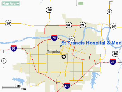
St Francis Hospital And Medical Center Heliport |
|
|
|
Location &
QuickFacts
|
FAA
Information Effective: |
2008-09-25 |
|
Airport
Identifier: |
21KS |
|
Airport
Status: |
Operational |
|
Longitude/Latitude: |
095-41-45.9350W/39-03-25.0000N
-95.696093/39.056944 (Estimated) |
|
Elevation: |
1114 ft / 339.55 m (Estimated) |
|
Land: |
0 acres |
|
From
nearest city: |
0 nautical miles N of Topeka, KS |
|
Location: |
Shawnee County, KS |
|
Magnetic Variation: |
06E (1985) |
Owner & Manager
|
Ownership: |
Privately owned |
|
Owner: |
St. Francis Hospital
SCL HEALTH SERVICES CORP. |
|
Address: |
1700 W. 7 Th Street
Topeka, KS 66606 |
|
Phone
number: |
913-295-8000 |
|
Manager: |
Sister Loretta M. Colewell |
|
Address: |
1700 W. 7 Th Street
Topeka, KS 66606 |
|
Phone number: |
913-295-8989 |
Airport Operations and Facilities
|
Airport
Use: |
Private
MEDICAL. |
|
Wind
indicator: |
Yes |
|
Segmented Circle: |
No |
|
Control
Tower: |
No |
|
Lighting
Schedule: |
DUSK-DAWN |
|
Landing
fee charge: |
No |
|
Sectional chart: |
Kansas City |
|
Region: |
ACE - Central |
|
Boundary
ARTCC: |
ZKC - Kansas City |
|
Tie-in
FSS: |
ICT - Wichita |
|
FSS on
Airport: |
No |
|
FSS Toll
Free: |
1-800-WX-BRIEF |
|
Runway Information
Helipad H1
|
Dimension: |
60 x 60 ft / 18.3 x 18.3 m |
|
Surface: |
CONC,
ROOFTOP. |
|
|
Runway H1
|
Runway
|
|
Traffic
Pattern: |
Left |
Left |
|
Radio Navigation Aids
|
ID |
Type |
Name |
Ch |
Freq |
Var |
Dist |
|
TO |
NDB |
Biloy |
|
521.00 |
05E |
3.8 nm |
|
MQD |
NDB |
Mc Dowell Creek |
|
391.00 |
06E |
43.7 nm |
|
DO |
NDB |
Dotte |
|
359.00 |
05E |
45.2 nm |
|
UKL |
NDB |
Boyd |
|
245.00 |
05E |
45.5 nm |
|
GKB |
NDB |
Norge |
|
517.00 |
05E |
48.6 nm |
|
GQ |
NDB |
Norge |
|
517.00 |
05E |
48.6 nm |
|
FOE |
TACAN |
Forbes |
053X |
|
05E |
6.8 nm |
|
MHK |
VOR/DME |
Manhattan |
039X |
110.20 |
06E |
45.7 nm |
|
OJC |
VOR/DME |
Johnson County |
077X |
113.00 |
06E |
46.7 nm |
|
RBA |
VOR/DME |
Robinson |
019X |
108.20 |
04E |
49.4 nm |
|
TOP |
VORTAC |
Topeka |
125X |
117.80 |
05E |
8.4 nm |
|
MCI |
VORTAC |
Kansas City |
079Y |
113.25 |
05E |
46.8 nm |
|
FOE |
VOT |
Forbes |
|
111.00 |
|
6.5 nm |
Remarks
-
PROVIDED
APPROACH/DEPARTURE PATHS ARE MAINTAINED FOR A MINIMUM 8:1 GLIDE SLOPE & THE
TRANSITIONAL SURFACE BE MAINTAINED FOR A MINIMUM 2:1 SLOPE.
St Francis Hospital And Medical Center
Heliport
Address:
Shawnee County, KS
Tel:
913-295-8000,
913-295-8989
Images
and information placed above are from
http://www.airport-data.com/airport/21KS/
We
thank them for the data!
|
General Info |
| Country |
United
States |
| State |
KANSAS
|
| FAA ID |
21KS
|
| Latitude |
39-03-25.000N |
|
Longitude |
095-41-45.935W |
|
Elevation |
1114
feet |
| Near
City |
TOPEKA
|
We don't guarantee the information is fresh and accurate. The data may
be wrong or outdated.
For more up-to-date information please refer to other sources.
|
|


