 |
|
|
Location &
QuickFacts
|
FAA
Information Effective: |
2008-09-25 |
|
Airport
Identifier: |
SN75 |
|
Airport
Status: |
Operational |
|
Longitude/Latitude: |
095-20-00.9190W/39-52-00.0000N
-95.333589/39.866667 (Estimated) |
|
Elevation: |
1070 ft / 326.14 m (Estimated) |
|
Land: |
0 acres |
|
From
nearest city: |
3 nautical miles W of Highland, KS |
|
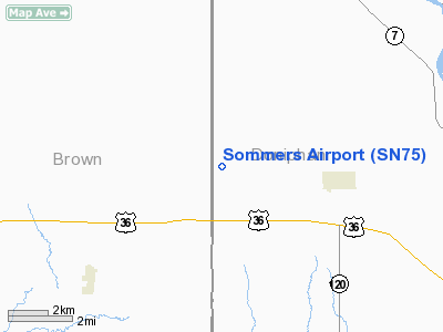
Location: |
Brown County, KS |
|
Magnetic Variation: |
05E (1985) |
Owner & Manager
|
Ownership: |
Privately owned |
|
Owner: |
Harold D Sommers |
|
Address: |
201 Miami St
Hiawatha, KS 66434 |
|
Phone number: |
785-742-2610 |
|
Manager: |
Bradley Sommers |
|
Address: |
2491 Willow Rd
Robinson, KS 66532 |
|
Phone number: |
785-544-6608 |
Airport Operations and Facilities
|
Airport Use: |
Private |
|
Wind indicator: |
No |
|
Segmented Circle: |
No |
|
Control Tower: |
No |
|
Landing fee charge: |
No |
|
Sectional chart: |
Kansas City |
|
Region: |
ACE - Central |
|
Boundary ARTCC: |
ZKC - Kansas City |
|
Tie-in FSS: |
ICT - Wichita |
|
FSS on Airport: |
No |
|
FSS Toll Free: |
1-800-WX-BRIEF |
Airport Services
|
Airframe
Repair: |
NONE |
|
Power
Plant Repair: |
NONE |
|
Runway Information
Runway 16/34
|
Dimension: |
1900 x 60 ft / 579.1 x 18.3 m |
|
Surface: |
TURF, |
|
|
Runway 16
|
Runway 34
|
|
Traffic
Pattern: |
Left |
Left |
|
Radio Navigation Aids
|
ID |
Type |
Name |
Ch |
Freq |
Var |
Dist |
|
FNB |
NDB |
Brenner |
|
404.00 |
05E |
17.2 nm |
|
AZN |
NDB |
Amazon |
|
233.00 |
06E |
19.7 nm |
|
EVU |
NDB |
Emville |
|
317.00 |
05E |
34.8 nm |
|
AYB |
NDB |
Auburn |
|
430.00 |
05E |
40.5 nm |
|
DO |
NDB |
Dotte |
|
359.00 |
05E |
47.3 nm |
|
TO |
NDB |
Biloy |
|
521.00 |
05E |
47.8 nm |
|
EZZ |
NDB |
Cameron |
|
394.00 |
03E |
49.7 nm |
|
RBA |
VOR/DME |
Robinson |
019X |
108.20 |
04E |
4.2 nm |
|
STJ |
VORTAC |
St Joseph |
102X |
115.50 |
08E |
19.7 nm |
|
MCI |
VORTAC |
Kansas City |
079Y |
113.25 |
05E |
44.6 nm |
|
PWE |
VORTAC |
Pawnee City |
071X |
112.40 |
05E |
44.9 nm |
|
TOP |
VORTAC |
Topeka |
125X |
117.80 |
05E |
45.0 nm |
Based Aircraft
|
Aircraft based
on field: |
1 |
|
Single Engine
Airplanes: |
1 |
Sommers Airport
Address:
Brown County, KS
Tel:
785-742-2610, 785-544-6608
Images
and information placed above are from
http://www.airport-data.com/airport/SN75/
We
thank them for the data!
|
General Info |
| Country |
United
States |
| State |
KANSAS
|
| FAA ID |
SN75
|
| Latitude |
39-52-00.000N |
|
Longitude |
095-20-00.919W |
|
Elevation |
1070
feet |
| Near
City |
HIGHLAND
|
We don't guarantee the information is fresh and accurate. The data may
be wrong or outdated.
For more up-to-date information please refer to other sources.
|
|


