 |
|
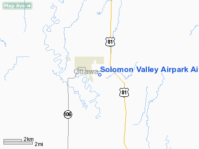
Solomon Valley Airpark Airport |
|
Location &
QuickFacts
|
FAA
Information Effective: |
2008-09-25 |
|
Airport
Identifier: |
SN09 |
|
Airport
Status: |
Operational |
|
Longitude/Latitude: |
097-40-59.1270W/39-06-50.0000N
-97.683091/39.113889 (Estimated) |
|
Elevation: |
1205 ft / 367.28 m (Estimated) |
|
Land: |
6 acres |
|
From
nearest city: |
1 nautical miles SE of Minneapolis, KS |
|
Location: |
Ottawa County, KS |
|
Magnetic Variation: |
07E (1985) |
Owner & Manager
|
Ownership: |
Privately owned |
|
Owner: |
Donald D. Lott
OWNER LIVES ADJ TO ARPT. |
|
Address: |
Rr 2
Minneapolis, KS 67467 |
|
Phone number: |
913-392-2228 |
|
Manager: |
Donald D. Lott |
|
Address: |
Rr 2
Minneapolis, KS 67467 |
|
Phone number: |
913-392-2228 |
Airport Operations and Facilities
|
Airport Use: |
Private |
|
Wind indicator: |
Yes |
|
Segmented Circle: |
No |
|
Control Tower: |
No |
|
Landing fee charge: |
No |
|
Sectional chart: |
Wichita |
|
Region: |
ACE - Central |
|
Boundary ARTCC: |
ZKC - Kansas City |
|
Tie-in FSS: |
ICT - Wichita |
|
FSS on Airport: |
No |
|
FSS Toll Free: |
1-800-WX-BRIEF |
Airport Services
|
Airframe
Repair: |
NONE |
|
Power
Plant Repair: |
NONE |
|
Runway Information
Runway 17/35
|
Dimension: |
2590 x 90 ft / 789.4 x 27.4 m |
|
Surface: |
TURF, |
|
|
Runway 17
|
Runway 35
|
|
Traffic
Pattern: |
Left |
Left |
|
Obstruction: |
15 ft road, 30.0 ft from runway, 2:1 slope to clear |
5 ft fence, 27.0 ft from runway, 5:1 slope to clear |
|
Radio Navigation Aids
|
ID |
Type |
Name |
Ch |
Freq |
Var |
Dist |
|
CNK |
NDB |
Concordia |
|
335.00 |
06E |
26.5 nm |
|
CYW |
NDB |
Clay Center |
|
362.00 |
07E |
29.1 nm |
|
CVY |
NDB |
Cavalry |
|
314.00 |
06E |
41.8 nm |
|
RPB |
NDB |
Republican |
|
414.00 |
07E |
42.1 nm |
|
MPR |
NDB |
Mc Pherson |
|
227.00 |
06E |
46.0 nm |
|
HRU |
NDB |
Herington |
|
407.00 |
06E |
48.0 nm |
|
DBX |
NDB |
Morrison |
|
212.00 |
06E |
49.0 nm |
|
MQD |
NDB |
Mc Dowell Creek |
|
391.00 |
06E |
49.1 nm |
|
FRI |
VOR |
Fort Riley |
|
109.40 |
06E |
39.3 nm |
|
MHK |
VOR/DME |
Manhattan |
039X |
110.20 |
06E |
47.3 nm |
|
SLN |
VORTAC |
Salina |
118X |
117.10 |
07E |
11.7 nm |
|
TKO |
VORTAC |
Mankato |
035X |
109.80 |
10E |
49.5 nm |
Remarks
-
PRVDD EACH RWY
APCH IS MAINTD FOR A MIN 20:1 GLIDE SLOPE & TRSNL SFC MAINTD FOR A 7:1 SLOPE.
Based Aircraft
|
Aircraft based
on field: |
3 |
|
Single Engine
Airplanes: |
1 |
|
Ultralights: |
2 |
Operational Statistics
Time Period: 1981-09-01 - 1982-08-31
|
Aircraft
Operations: |
3/Month |
|
General
Aviation Local: |
76.9% |
|
General
Aviation Itinerant: |
23.1% |
Solomon Valley Airpark Airport
Address:
Ottawa County, KS
Tel:
913-392-2228
Images
and information placed above are from
http://www.airport-data.com/airport/SN09/
We
thank them for the data!
|
General Info |
| Country |
United
States |
| State |
KANSAS
|
| FAA ID |
SN09
|
| Latitude |
39-06-50.000N |
|
Longitude |
097-40-59.127W |
|
Elevation |
1205
feet |
| Near
City |
MINNEAPOLIS |
We don't guarantee the information is fresh and accurate. The data may
be wrong or outdated.
For more up-to-date information please refer to other sources.
|
|


