 |
|
|
Location &
QuickFacts
|
FAA
Information Effective: |
2008-09-25 |
|
Airport
Identifier: |
0KS4 |
|
Airport
Status: |
Operational |
|
Longitude/Latitude: |
095-35-55.9310W/38-48-30.0160N
-95.598870/38.808338 (Estimated) |
|
Elevation: |
1090 ft / 332.23 m (Estimated) |
|
Land: |
0 acres |
|
From
nearest city: |
3 nautical miles NW of Overbrook, KS |
|
Location: |
Osage County, KS |
|
Magnetic Variation: |
06E (1985) |
Owner & Manager
|
Ownership: |
Privately owned |
|
Owner: |
Majorie A. Shrimplin |
|
Address: |
Rr 1, Box 161
Carbondale, KS 66414 |
|
Phone number: |
913-665-7146 |
|
Address: |
|
Airport Operations and Facilities
|
Airport Use: |
Private |
|
Wind indicator: |
No |
|
Segmented Circle: |
No |
|
Control Tower: |
No |
|
Landing fee charge: |
No |
|
Sectional chart: |
Kansas City |
|
Region: |
ACE - Central |
|
Boundary ARTCC: |
ZKC - Kansas City |
|
Tie-in FSS: |
ICT - Wichita |
|
FSS on Airport: |
No |
|
FSS Toll Free: |
1-800-WX-BRIEF |
Airport Services
|
Airframe
Repair: |
NONE |
|
Power
Plant Repair: |
NONE |
|
Runway Information
Runway 01/19
|
Dimension: |
1750 x 60 ft / 533.4 x 18.3 m |
|
Surface: |
TURF, |
|
|
Runway 01
|
Runway 19
|
|
Traffic
Pattern: |
Left |
Left |
|
Radio Navigation Aids
|
ID |
Type |
Name |
Ch |
Freq |
Var |
Dist |
|
TO |
NDB |
Biloy |
|
521.00 |
05E |
19.2 nm |
|
UKL |
NDB |
Boyd |
|
245.00 |
05E |
31.1 nm |
|
GKB |
NDB |
Norge |
|
517.00 |
05E |
46.6 nm |
|
GQ |
NDB |
Norge |
|
517.00 |
05E |
46.6 nm |
|
DO |
NDB |
Dotte |
|
359.00 |
05E |
46.8 nm |
|
FOE |
TACAN |
Forbes |
053X |
|
05E |
8.9 nm |
|
OJC |
VOR/DME |
Johnson County |
077X |
113.00 |
06E |
40.4 nm |
|
TOP |
VORTAC |
Topeka |
125X |
117.80 |
05E |
19.9 nm |
|
EMP |
VORTAC |
Emporia |
075X |
112.80 |
08E |
40.1 nm |
|
MCI |
VORTAC |
Kansas City |
079Y |
113.25 |
05E |
49.4 nm |
|
FOE |
VOT |
Forbes |
|
111.00 |
|
9.2 nm |
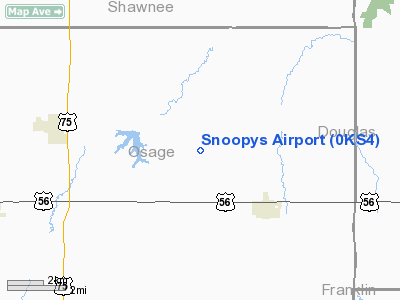
Snoopys Airport
Address:
Osage County, KS
Tel:
913-665-7146
Images
and information placed above are from
http://www.airport-data.com/airport/0KS4/
We
thank them for the data!
|
General Info |
| Country |
United
States |
| State |
KANSAS
|
| FAA ID |
0KS4
|
| Latitude |
38-48-30.016N |
|
Longitude |
095-35-55.931W |
|
Elevation |
1090
feet |
| Near
City |
OVERBROOK |
We don't guarantee the information is fresh and accurate. The data may
be wrong or outdated.
For more up-to-date information please refer to other sources.
|
|


