 |
|
|
Location &
QuickFacts
|
FAA
Information Effective: |
2008-09-25 |
|
Airport
Identifier: |
43KS |
|
Airport
Status: |
Operational |
|
Longitude/Latitude: |
096-25-03.9960W/39-06-06.9930N
-96.417777/39.101942 (Estimated) |
|
Elevation: |
1100 ft / 335.28 m (Estimated) |
|
Land: |
200 acres |
|
From
nearest city: |
9 nautical miles NW of Manhattan, KS |
|
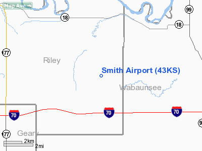
Location: |
Riley County, KS |
|
Magnetic Variation: |
06E (1985) |
Owner & Manager
|
Ownership: |
Privately owned |
|
Owner: |
Frances Smith |
|
Address: |
3999 Smith Hills Lane
Manhattan, KS 66502 |
|
Phone
number: |
785-539-4864 |
|
Manager: |
Frances Smith |
|
Address: |
3999 Smith Hills Lane
Manhattan, KS 66502 |
|
Phone number: |
785-539-4864 |
Airport Operations and Facilities
|
Airport
Use: |
Private |
|
Wind
indicator: |
Yes |
|
Segmented Circle: |
No |
|
Control
Tower: |
No |
|
Landing
fee charge: |
No |
|
Sectional chart: |
Kansas City |
|
Region: |
ACE - Central |
|
Boundary
ARTCC: |
ZKC - Kansas City |
|
Tie-in
FSS: |
ICT - Wichita |
|
FSS on
Airport: |
No |
|
FSS Toll
Free: |
1-800-WX-BRIEF |
|
Runway Information
Runway 17/35
|
Dimension: |
2800 x 50 ft / 853.4 x 15.2 m |
|
Surface: |
TURF, |
|
|
Runway 17
|
Runway 35
|
|
Traffic
Pattern: |
Left |
Left |
|
Obstruction: |
30 ft trees |
400 ft hill, 2640.0 ft from runway |
|
Radio Navigation Aids
|
ID |
Type |
Name |
Ch |
Freq |
Var |
Dist |
|
MQD |
NDB |
Mc Dowell Creek |
|
391.00 |
06E |
9.9 nm |
|
CVY |
NDB |
Cavalry |
|
314.00 |
06E |
18.2 nm |
|
HRU |
NDB |
Herington |
|
407.00 |
06E |
30.7 nm |
|
TO |
NDB |
Biloy |
|
521.00 |
05E |
34.1 nm |
|
CYW |
NDB |
Clay Center |
|
362.00 |
07E |
38.5 nm |
|
MYZ |
NDB |
Marysville |
|
341.00 |
06E |
46.2 nm |
|
DBX |
NDB |
Morrison |
|
212.00 |
06E |
49.1 nm |
|
FOE |
TACAN |
Forbes |
053X |
|
05E |
36.5 nm |
|
FRI |
VOR |
Fort Riley |
|
109.40 |
06E |
22.2 nm |
|
MHK |
VOR/DME |
Manhattan |
039X |
110.20 |
06E |
12.0 nm |
|
TOP |
VORTAC |
Topeka |
125X |
117.80 |
05E |
40.6 nm |
|
FOE |
VOT |
Forbes |
|
111.00 |
|
36.2 nm |
Remarks
-
PROVIDED
APPROACHES ARE MAINTAINED FOR A 20:1 GLIDE SLOPE AND TRANSITIONAL SFCS FOR
A7:1 SLOPE.
Based Aircraft
|
Aircraft based
on field: |
2 |
|
Single Engine
Airplanes: |
2 |
Smith Airport
Address:
Riley County, KS
Tel:
785-539-4864
Images
and information placed above are from
http://www.airport-data.com/airport/43KS/
We
thank them for the data!
|
General Info |
| Country |
United
States |
| State |
KANSAS
|
| FAA ID |
43KS
|
| Latitude |
39-06-06.993N |
|
Longitude |
096-25-03.996W |
|
Elevation |
1100
feet |
| Near
City |
MANHATTAN |
We don't guarantee the information is fresh and accurate. The data may
be wrong or outdated.
For more up-to-date information please refer to other sources.
|
|


