 |
|
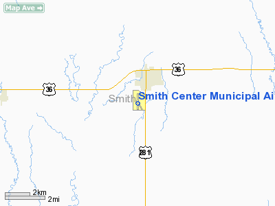
Smith Center Municipal Airport |
|
|
|
Location &
QuickFacts
|
FAA
Information Effective: |
2008-09-25 |
|
Airport
Identifier: |
K82 |
|
Airport
Status: |
Operational |
|
Longitude/Latitude: |
098-47-36.4000W/39-45-39.8000N
-98.793444/39.761056 (Estimated) |
|
Elevation: |
1799 ft / 548.34 m (Surveyed) |
|
Land: |
200 acres |
|
From
nearest city: |
1 nautical miles SW of Smith Center, KS |
|
Location: |
Smith County, KS |
|
Magnetic Variation: |
07E (2000) |
Owner & Manager
|
Ownership: |
Publicly owned |
|
Owner: |
City Of Smith Center |
|
Address: |
Smith Center
Smith Center, KS 66967 |
|
Manager: |
City Of Smith Center |
|
Address: |
119 West Court
Smith Center, KS 66967 |
|
Phone number: |
785-282-3812 |
Airport Operations and Facilities
|
Airport
Use: |
Open to public |
|
Wind
indicator: |
Yes |
|
Segmented Circle: |
No |
|
Control
Tower: |
No |
|
Lighting
Schedule: |
DUSK-DAWN |
|
Beacon
Color: |
Clear-Green (lighted land airport) |
|
Landing
fee charge: |
No |
|
Sectional chart: |
Wichita |
|
Region: |
ACE - Central |
|
Boundary
ARTCC: |
ZMP - Minneapolis |
|
Tie-in
FSS: |
ICT - Wichita |
|
FSS on
Airport: |
No |
|
FSS Toll
Free: |
1-800-WX-BRIEF |
|
NOTAMs
Facility: |
ICT (NOTAM-d service avaliable) |
|
Federal Agreements: |
N |
Airport Communications
|
CTAF: |
122.800 |
|
Unicom: |
122.800 |
Airport Services
|
Fuel
available: |
100LL
FOR FUEL CALL 785-282-6555. |
|
Bottled
Oxygen: |
NONE |
|
Bulk
Oxygen: |
NONE |
|
Runway Information
Runway 14/32
|
Dimension: |
2453 x 75 ft / 747.7 x 22.9 m |
|
Surface: |
TURF, Good Condition |
|
|
Runway 14
|
Runway 32
|
|
Longitude: |
098-47-41.7816W |
098-47-26.5823W |
|
Latitude: |
39-45-46.9255N |
39-45-25.7107N |
|
Elevation: |
1794.00 ft |
1791.00 ft |
|
Alignment: |
127 |
127 |
|
Traffic
Pattern: |
Left |
Left |
|
Obstruction: |
, 50:1 slope to clear
CROPS VARY IN HEIGHT 0-4 FT. |
18 ft road, 290.0 ft from runway, 16:1 slope to clear |
|
Decleard
distances: |
Take off run available 2453.00 ft
Take off distance available 2453.00 ft
Actual stop distance available 2453.00 ft
Landing distance available 2453.00 ft |
Take off run available 2453.00 ft
Take off distance available 2453.00 ft
Actual stop distance available 2453.00 ft
Landing distance available 2453.00 ft |
|
Runway 17/35
|
Dimension: |
3601 x 50 ft / 1097.6 x 15.2 m |
|
Surface: |
ASPH, Fair Condition |
|
Weight Limit: |
Single wheel: 4000 lbs. |
|
Edge Lights: |
Low
BANKS OF SIX THLD LIGHTS INDICATE VFR ONLY. |
|
|
Runway 17
|
Runway 35
|
|
Longitude: |
098-47-37.7773W |
098-47-38.0455W |
|
Latitude: |
39-45-59.9007N |
39-45-24.3194N |
|
Elevation: |
1797.00 ft |
1787.00 ft |
|
Alignment: |
127 |
0 |
|
Traffic
Pattern: |
Left |
Left |
|
Markings: |
Numbers only, Fair Condition
NO MKGS FOR NPI RY. |
Numbers only, Fair Condition
NO MKGS FOR NPI RY. |
|
Displaced
threshold: |
0.00 ft |
101.00 ft |
|
Obstruction: |
, 50:1 slope to clear |
15 ft road, 225.0 ft from runway, 1:1 slope to clear
APCH SLOPE 21:1 FROM DSPLCD THLD. |
|
Decleard
distances: |
Take off run available 3601.00 ft
Take off distance available 3601.00 ft
Actual stop distance available 3500.00 ft
Landing distance available 3601.00 ft |
Take off run available 3601.00 ft
Take off distance available 3601.00 ft
Actual stop distance available 3601.00 ft
Landing distance available 3500.00 ft |
|
Radio Navigation Aids
|
ID |
Type |
Name |
Ch |
Freq |
Var |
Dist |
|
PHG |
NDB |
Phillipsburg |
|
368.00 |
08E |
23.1 nm |
|
HDE |
NDB |
Holdrege |
|
396.00 |
07E |
48.4 nm |
|
TKO |
VORTAC |
Mankato |
035X |
109.80 |
10E |
24.8 nm |
Remarks
-
PUBLIC PHONE AVBL 24 HRS.
-
PRVDD THE APCH TO
EACH RWY IS MAINTD FOR A MIN 20:1 GLIDE SLOPE AND THE TRSNL SFC BE MAINTD FOR
A 7:1 SLOPE.
Based Aircraft
|
Aircraft based
on field: |
12 |
|
Single Engine
Airplanes: |
8 |
|
Multi Engine
Airplanes: |
1 |
|
Ultralights: |
3 |
Operational Statistics
Time Period: 2006-08-20 - 2007-08-19
|
Aircraft
Operations: |
78/Week |
|
General
Aviation Local: |
62.3% |
|
General
Aviation Itinerant: |
37.4% |
|
Military: |
0.3% |
Smith Center Municipal Airport
Address:
Smith County, KS
Tel:
785-282-3812
Images
and information placed above are from
http://www.airport-data.com/airport/K82/
We
thank them for the data!
|
General Info |
| Country |
United
States |
| State |
KANSAS
|
| FAA ID |
K82
|
| Latitude |
39-45-40.042N |
|
Longitude |
098-47-36.371W |
|
Elevation |
1799
feet |
| Near
City |
SMITH
CENTER |
We don't guarantee the information is fresh and accurate. The data may
be wrong or outdated.
For more up-to-date information please refer to other sources.
|
|


