 |
|
|
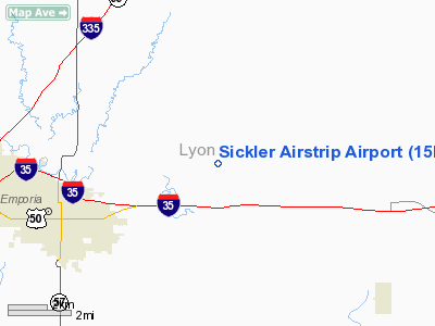
Location &
QuickFacts
|
FAA
Information Effective: |
2008-09-25 |
|
Airport
Identifier: |
15KS |
|
Airport
Status: |
Operational |
|
Longitude/Latitude: |
096-05-17.9760W/38-25-50.0490N
-96.088327/38.430569 (Estimated) |
|
Elevation: |
1200 ft / 365.76 m (Estimated) |
|
Land: |
0 acres |
|
From
nearest city: |
4 nautical miles NE of Emporia, KS |
|
Location: |
Lyon County, KS |
|
Magnetic Variation: |
06E (1985) |
Owner & Manager
|
Ownership: |
Privately owned |
|
Owner: |
Gene Sickler |
|
Address: |
1555 Rd. 190
Emporia, KS 66801 |
|
Phone number: |
620-340-0252 |
|
Manager: |
Fred Sickler |
|
Address: |
1555 Rd 190
Emporia, KS 66801 |
|
Phone number: |
620-340-0252 |
Airport
Operations and Facilities
|
Airport
Use: |
Private |
|
Wind
indicator: |
No |
|
Segmented Circle: |
No |
|
Control
Tower: |
No |
|
Landing
fee charge: |
No |
|
Sectional chart: |
Kansas City |
|
Region: |
ACE - Central |
|
Boundary
ARTCC: |
ZKC - Kansas City |
|
Tie-in
FSS: |
ICT - Wichita |
|
FSS on
Airport: |
No |
|
FSS Toll
Free: |
1-800-WX-BRIEF |
|
Runway Information
Runway 18/36
|
Dimension: |
2300 x 50 ft / 701.0 x 15.2 m |
|
Surface: |
TURF, |
|
|
Runway 18
|
Runway 36
|
|
Traffic
Pattern: |
Left |
Left |
|
Obstruction: |
, 100.0 ft from runway |
500 ft twr, 2600.0 ft from runway |
|
Radio Navigation Aids
|
ID |
Type |
Name |
Ch |
Freq |
Var |
Dist |
|
UKL |
NDB |
Boyd |
|
245.00 |
05E |
19.0 nm |
|
HRU |
NDB |
Herington |
|
407.00 |
06E |
37.4 nm |
|
TO |
NDB |
Biloy |
|
521.00 |
05E |
45.5 nm |
|
MQD |
NDB |
Mc Dowell Creek |
|
391.00 |
06E |
48.4 nm |
|
CVY |
NDB |
Cavalry |
|
314.00 |
06E |
48.8 nm |
|
MSB |
NDB |
Monarch |
|
410.00 |
04E |
49.9 nm |
|
FOE |
TACAN |
Forbes |
053X |
|
05E |
37.0 nm |
|
FRI |
VOR |
Fort Riley |
|
109.40 |
06E |
48.6 nm |
|
EMP |
VORTAC |
Emporia |
075X |
112.80 |
08E |
8.7 nm |
|
TOP |
VORTAC |
Topeka |
125X |
117.80 |
05E |
49.4 nm |
|
FOE |
VOT |
Forbes |
|
111.00 |
|
37.0 nm |
Remarks
-
PROVIDED THE
APPROACH TO EACH RWY IS MAINTAINED FOR A MINIMUM 20:1 GLIDE SLOPE AND THE
TRANSITIONAL SURFACE BE MAINTAINED FOR A 7:1 SLOPE.
Based Aircraft
|
Aircraft based
on field: |
2 |
|
Ultralights: |
2 |
Sickler Airstrip Airport
Address:
Lyon County, KS
Tel:
620-340-0252
Images
and information placed above are from
http://www.airport-data.com/airport/15KS/
We
thank them for the data!
|
General Info |
| Country |
United
States |
| State |
KANSAS
|
| FAA ID |
15KS
|
| Latitude |
38-25-50.049N |
|
Longitude |
096-05-17.976W |
|
Elevation |
1200
feet |
| Near
City |
EMPORIA
|
We don't guarantee the information is fresh and accurate. The data may
be wrong or outdated.
For more up-to-date information please refer to other sources.
|
|


