 |
|
|
Location &
QuickFacts
|
FAA
Information Effective: |
2008-09-25 |
|
Airport
Identifier: |
6KS7 |
|
Airport
Status: |
Operational |
|
Longitude/Latitude: |
098-30-37.2130W/39-59-04.0480N
-98.510337/39.984458 (Estimated) |
|
Elevation: |
1960 ft / 597.41 m (Estimated) |
|
Land: |
0 acres |
|
From
nearest city: |
10 nautical miles N of Lebanon, KS |
|
Location: |
Smith County, KS |
|
Magnetic Variation: |
08E (1985) |
Owner & Manager
|
Ownership: |
Privately owned |
|
Owner: |
George E Shute |
|
Address: |
Rr 1 Box 91
Red Cloud, NE 68970 |
|
Phone number: |
913-745-2786 |
|
Address: |
|
Airport Operations and Facilities
|
Airport
Use: |
Private |
|
Wind
indicator: |
No |
|
Segmented Circle: |
No |
|
Control
Tower: |
No |
|
Landing
fee charge: |
No |
|
Sectional chart: |
Wichita |
|
Region: |
ACE - Central |
|
Boundary
ARTCC: |
ZMP - Minneapolis |
|
Tie-in
FSS: |
ICT - Wichita |
|
FSS on
Airport: |
No |
|
FSS Toll
Free: |
1-800-WX-BRIEF |
|
Runway Information
Runway 17/35
|
Dimension: |
2000 x 50 ft / 609.6 x 15.2 m |
|
Surface: |
TURF, |
|
|
Runway 17
|
Runway 35
|
|
Traffic
Pattern: |
Left |
Left |
|
Obstruction: |
25 ft plines, 500.0 ft from runway |
25 ft trees, 300.0 ft from runway |
|
Radio Navigation Aids
|
ID |
Type |
Name |
Ch |
Freq |
Var |
Dist |
|
PHG |
NDB |
Phillipsburg |
|
368.00 |
08E |
39.6 nm |
|
RPB |
NDB |
Republican |
|
414.00 |
07E |
40.6 nm |
|
PSS |
NDB |
Prosser |
|
338.00 |
07E |
42.2 nm |
|
HJH |
NDB |
Hebron |
|
323.00 |
06E |
43.6 nm |
|
HDE |
NDB |
Holdrege |
|
396.00 |
07E |
47.2 nm |
|
CNK |
NDB |
Concordia |
|
335.00 |
06E |
47.4 nm |
|
EAR |
VOR |
Kearney |
|
111.20 |
10E |
50.0 nm |
|
HSI |
VOR/DME |
Hastings |
025X |
108.80 |
07E |
37.5 nm |
|
TKO |
VORTAC |
Mankato |
035X |
109.80 |
10E |
15.7 nm |
Remarks
-
PRVDD EACH RWY
APCH IS MAINTD FOR MIN 20:1 GLIDE SLOPE & TRSNL SFC MAINTD FOR A 7:1 SLOPE.
Based Aircraft
|
Aircraft based
on field: |
1 |
|
Single Engine
Airplanes: |
1 |
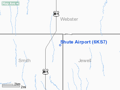
Shute Airport
Address:
Smith County, KS
Tel:
913-745-2786
Images
and information placed above are from
http://www.airport-data.com/airport/6KS7/
We
thank them for the data!
|
General Info |
| Country |
United
States |
| State |
KANSAS
|
| FAA ID |
6KS7
|
| Latitude |
39-59-04.048N |
|
Longitude |
098-30-37.213W |
|
Elevation |
1960
feet |
| Near
City |
LEBANON
|
We don't guarantee the information is fresh and accurate. The data may
be wrong or outdated.
For more up-to-date information please refer to other sources.
|
|


