 |
|
|
Location &
QuickFacts
|
FAA
Information Effective: |
2008-09-25 |
|
Airport
Identifier: |
11KS |
|
Airport
Status: |
Operational |
|
Longitude/Latitude: |
095-08-55.8910W/39-07-00.0040N
-95.148859/39.116668 (Estimated) |
|
Elevation: |
1090 ft / 332.23 m (Estimated) |
|
Land: |
60 acres |
|
From
nearest city: |
3 nautical miles W of Tonganoxie, KS |
|
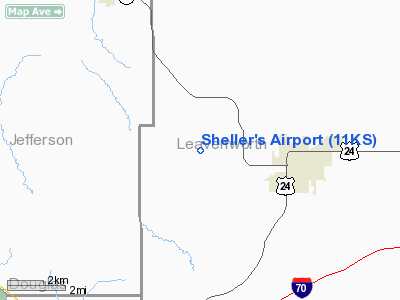
Location: |
Leavenworth County, KS |
|
Magnetic Variation: |
05E (1985) |
Owner & Manager
|
Ownership: |
Privately owned |
|
Owner: |
John R Sheller Jr |
|
Address: |
10311 West 48th Street
Shawnee, KS 66203 |
|
Phone
number: |
913-631-3019 |
|
Manager: |
John R Sheller Jr |
|
Address: |
10311 West 48th Street
Shawnee, KS 66203 |
|
Phone number: |
913-631-3019 |
Airport Operations and Facilities
|
Airport
Use: |
Private |
|
Wind
indicator: |
Yes |
|
Segmented Circle: |
No |
|
Control
Tower: |
No |
|
Landing
fee charge: |
No |
|
Sectional chart: |
Kansas City |
|
Region: |
ACE - Central |
|
Boundary
ARTCC: |
ZKC - Kansas City |
|
Tie-in
FSS: |
ICT - Wichita |
|
FSS on
Airport: |
No |
|
FSS Toll
Free: |
1-800-WX-BRIEF |
|
Runway Information
Runway 04/22
|
Dimension: |
1600 x 70 ft / 487.7 x 21.3 m |
|
Surface: |
TURF, |
|
|
Runway 04
|
Runway 22
|
|
Traffic
Pattern: |
Left |
Left |
|
Runway 18/36
|
Dimension: |
2000 x 70 ft / 609.6 x 21.3 m |
|
Surface: |
TURF, |
|
|
Runway 18
|
Runway 36
|
|
Traffic
Pattern: |
Left |
Left |
|
Displaced
threshold: |
0.00 ft |
400.00 ft |
|
Obstruction: |
, 50.0 ft from runway |
75 ft pline, 400.0 ft from runway |
|
Radio Navigation Aids
|
ID |
Type |
Name |
Ch |
Freq |
Var |
Dist |
|
DO |
NDB |
Dotte |
|
359.00 |
05E |
19.6 nm |
|
GQ |
NDB |
Norge |
|
517.00 |
05E |
23.2 nm |
|
GKB |
NDB |
Norge |
|
517.00 |
05E |
23.2 nm |
|
TO |
NDB |
Biloy |
|
521.00 |
05E |
25.1 nm |
|
LXT |
NDB |
Lesumit |
|
263.00 |
04E |
37.5 nm |
|
GPH |
NDB |
Mosby |
|
284.00 |
03E |
41.5 nm |
|
AZN |
NDB |
Amazon |
|
233.00 |
06E |
47.5 nm |
|
FOE |
TACAN |
Forbes |
053X |
|
05E |
26.0 nm |
|
OJC |
VOR/DME |
Johnson County |
077X |
113.00 |
06E |
25.4 nm |
|
RIS |
VOR/DME |
Riverside |
051X |
111.40 |
05E |
25.8 nm |
|
RBA |
VOR/DME |
Robinson |
019X |
108.20 |
04E |
45.9 nm |
|
TOP |
VORTAC |
Topeka |
125X |
117.80 |
05E |
18.7 nm |
|
MCI |
VORTAC |
Kansas City |
079Y |
113.25 |
05E |
21.7 nm |
|
ANX |
VORTAC |
Napoleon |
087X |
114.00 |
07E |
47.6 nm |
|
MKC |
VOT |
Kansas City Downtown |
|
108.60 |
|
25.7 nm |
|
FOE |
VOT |
Forbes |
|
111.00 |
|
26.1 nm |
Remarks
-
PROVIDED THAT THE
APPROACH TO EACH RWY IS MAINTAINED FOR A MINIMUM 20:1 GLIDE SLOPE AND THE
TRANSITIONAL SURFACE BE MAINTAINED FOR A 7:1 SLOPE.
Based Aircraft
|
Aircraft based
on field: |
2 |
|
Single Engine
Airplanes: |
2 |
Sheller's Airport
Address:
Leavenworth County, KS
Tel:
913-631-3019
Images
and information placed above are from
http://www.airport-data.com/airport/11KS/
We
thank them for the data!
|
General Info |
| Country |
United
States |
| State |
KANSAS
|
| FAA ID |
11KS
|
| Latitude |
39-07-00.004N |
|
Longitude |
095-08-55.891W |
|
Elevation |
1090
feet |
| Near
City |
TONGANOXIE |
We don't guarantee the information is fresh and accurate. The data may
be wrong or outdated.
For more up-to-date information please refer to other sources.
|
|


