Shawnee Mission Med Center Heliport |
|
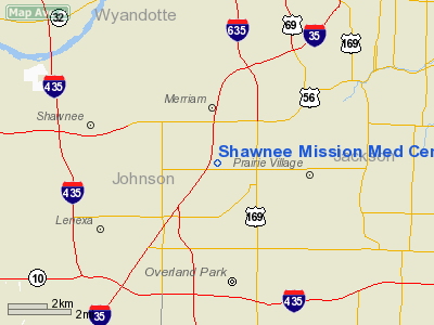
Location &
QuickFacts
|
FAA
Information Effective: |
2008-09-25 |
|
Airport
Identifier: |
9KS2 |
|
Airport
Status: |
Operational |
|
Longitude/Latitude: |
094-41-27.8500W/38-59-45.0200N
-94.691069/38.995839 (Estimated) |
|
Elevation: |
1030 ft / 313.94 m (Estimated) |
|
Land: |
0 acres |
|
From
nearest city: |
0 nautical miles N of Merriam, KS |
|
Location: |
Johnson County, KS |
|
Magnetic Variation: |
04E (1995) |
Owner & Manager
|
Ownership: |
Privately owned |
|
Owner: |
Shawnee Mission Med Center |
|
Address: |
9100 W 74 Street
Shawnee Mission, KS 66201 |
|
Phone
number: |
913-676-2400 |
|
Manager: |
Richard Reynolds |
|
Address: |
Shawnee Mission Med Center
9100 W 74 Street |
|
Phone number: |
913-676-2400 |
Airport Operations and Facilities
|
Airport
Use: |
Private
MEDICAL USE. |
|
Wind
indicator: |
Yes |
|
Segmented Circle: |
No |
|
Control
Tower: |
No |
|
Sectional chart: |
Kansas City |
|
Region: |
ACE - Central |
|
Boundary
ARTCC: |
ZKC - Kansas City |
|
Tie-in
FSS: |
COU - Columbia |
|
FSS on
Airport: |
No |
|
FSS Toll
Free: |
1-800-WX-BRIEF |
|
Runway Information
Helipad H1
|
Dimension: |
55 x 55 ft / 16.8 x 16.8 m |
|
Surface: |
CONC, |
|
|
Runway H1
|
Runway
|
|
Traffic
Pattern: |
Left |
Left |
|
Radio Navigation Aids
|
ID |
Type |
Name |
Ch |
Freq |
Var |
Dist |
|
GKB |
NDB |
Norge |
|
517.00 |
05E |
4.3 nm |
|
GQ |
NDB |
Norge |
|
517.00 |
05E |
4.3 nm |
|
DO |
NDB |
Dotte |
|
359.00 |
05E |
13.8 nm |
|
LXT |
NDB |
Lesumit |
|
263.00 |
04E |
15.1 nm |
|
GPH |
NDB |
Mosby |
|
284.00 |
03E |
27.6 nm |
|
TO |
NDB |
Biloy |
|
521.00 |
05E |
47.1 nm |
|
EZZ |
NDB |
Cameron |
|
394.00 |
03E |
48.2 nm |
|
FOE |
TACAN |
Forbes |
053X |
|
05E |
45.4 nm |
|
RIS |
VOR/DME |
Riverside |
051X |
111.40 |
05E |
8.7 nm |
|
OJC |
VOR/DME |
Johnson County |
077X |
113.00 |
06E |
9.6 nm |
|
MCI |
VORTAC |
Kansas City |
079Y |
113.25 |
05E |
17.5 nm |
|
ANX |
VORTAC |
Napoleon |
087X |
114.00 |
07E |
26.9 nm |
|
TOP |
VORTAC |
Topeka |
125X |
117.80 |
05E |
40.9 nm |
|
BUM |
VORTAC |
Butler |
106X |
115.90 |
07E |
44.5 nm |
|
MKC |
VOT |
Kansas City Downtown |
|
108.60 |
|
8.8 nm |
|
FOE |
VOT |
Forbes |
|
111.00 |
|
45.7 nm |
Remarks
-
PRVDD
INGRESS/EGRESS FM 240 CLOCKWISE TO 320; SECOND INGRESS/EGRESS POSSIBLE FM 050
CLOCKWISE TO 110 IF LIGHT STANDARD TO THE E IS REMOVED; PAINT WHITE PIPES AT
HELIPAD CORNERS RED OR ORANGE; HELIPAD ACCESS BY TWO SECURITY GUARDS.
Shawnee Mission Med Center Heliport
Address:
Johnson County, KS
Tel:
913-676-2400
Images
and information placed above are from
http://www.airport-data.com/airport/9KS2/
We
thank them for the data!
|
General Info |
| Country |
United
States |
| State |
KANSAS
|
| FAA ID |
9KS2
|
| Latitude |
38-59-45.020N |
|
Longitude |
094-41-27.850W |
|
Elevation |
1030
feet |
| Near
City |
MERRIAM
|
We don't guarantee the information is fresh and accurate. The data may
be wrong or outdated.
For more up-to-date information please refer to other sources.
|


