 |
|
Colby Municipal Airport
Shalz Field |
| IATA: CBK â ICAO: KCBK â FAA LID: CBK |
| Summary |
| Airport type |
Public |
| Owner |
City of Colby |
| Serves |
Colby, Kansas |
| Elevation AMSL |
3,187 ft / 971 m |
| Coordinates |
39°25â²39â³N 101°02â²48â³W / 39.4275°N 101.04667°W / 39.4275; -101.04667 |
| Runways |
| Direction |
Length |
Surface |
| ft |
m |
| 17/35 |
5,110 |
1,558 |
Concrete |
| 12/30 |
2,660 |
811 |
Turf |
| 4/22 |
2,600 |
792 |
Turf |
| Statistics (2007) |
| Aircraft operations |
6,506 |
| Based aircraft |
19 |
| Sources: airport web page and FAA |
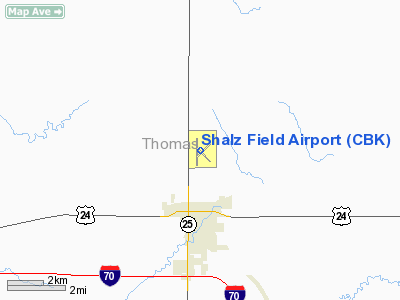
Colby Municipal Airport or Shalz Field (IATA: CBK, ICAO: KCBK, FAA LID: CBK) is a city-owned, public-use airport located on Kansas Highway 25, two miles (3 km) north of the city of Colby, in Thomas County, Kansas, United States.
The airport's page at the Kansas Department of Transportation Airport Directory lists the name as Shaltz Field, but that is an incorrect spelling as per the Federal Register dated March 8, 2004.
Facilities and aircraft
Shalz Field covers an area of 473 acres (191 ha) which contains one concrete paved runway, 17/35, measuring 5,110 x 75 ft (1,558 x 23 m). It also has two turf runways: 12/30 measuring 2,660 x 90 ft (811 x 27 m) and 4/22 measuring 2,600 x 80 ft (792 x 24 m).
For the 12-month period ending July 10, 2007, the airport had 6,506 aircraft operations, an average of 17 per day: 85% general aviation, 15% air taxi and <1% military. At that time there were 19 aircraft based at this airport: 90% single-engine, 5% multi-engine and 5% ultralight.
The above content comes from Wikipedia and is published under free licenses – click here to read more.
|
Location &
QuickFacts
|
FAA
Information Effective: |
2008-09-25 |
|
Airport
Identifier: |
CBK |
|
Airport
Status: |
Operational |
|
Longitude/Latitude: |
101-02-47.8000W/39-25-38.8000N
-101.046611/39.427444 (Estimated) |
|
Elevation: |
3187 ft / 971.40 m (Surveyed) |
|
Land: |
473 acres |
|
From
nearest city: |
2 nautical miles N of Colby, KS |
|
Location: |
Thomas County, KS |
|
Magnetic Variation: |
08E (2000) |
Owner & Manager
|
Ownership: |
Publicly owned |
|
Owner: |
City Of Colby |
|
Address: |
585 N. Franklin
Colby, KS 67701 |
|
Phone number: |
785-460-4438 |
|
Manager: |
Mark Oystmeyer |
|
Address: |
5 Arpt Plazza
Colby, KS 67701 |
|
Phone number: |
785-460-3298 |
Airport
Operations and Facilities
|
Airport
Use: |
Open to public |
|
Wind
indicator: |
Yes |
|
Segmented Circle: |
No |
|
Control
Tower: |
No |
|
Lighting
Schedule: |
DUSK-DAWN
ACTVT MIRL RY 17/35 & TWY LGTS - CTAF. |
|
Beacon
Color: |
Clear-Green (lighted land airport) |
|
Landing
fee charge: |
No |
|
Sectional chart: |
Wichita |
|
Region: |
ACE - Central |
|
Boundary
ARTCC: |
ZDV - Denver |
|
Tie-in
FSS: |
ICT - Wichita |
|
FSS on
Airport: |
No |
|
FSS Toll
Free: |
1-800-WX-BRIEF |
|
NOTAMs
Facility: |
ICT (NOTAM-d service avaliable) |
|
Federal Agreements: |
NGY |
Airport Communications
|
CTAF: |
122.800 |
|
Unicom: |
122.800 |
Airport Services
|
Fuel
available: |
100LLA1 |
|
Bottled
Oxygen: |
NONE |
|
Bulk
Oxygen: |
NONE |
|
Runway Information
Runway 04/22
|
Dimension: |
2600 x 80 ft / 792.5 x 24.4 m |
|
Surface: |
TURF, Good Condition |
|
|
Runway 04
|
Runway 22
|
|
Longitude: |
101-02-53.6896W |
101-02-30.0454W |
|
Latitude: |
39-25-30.6607N |
39-25-48.6566N |
|
Elevation: |
3162.00 ft |
3171.00 ft |
|
Alignment: |
46 |
127 |
|
Traffic
Pattern: |
Left |
Left |
|
Obstruction: |
, 50:1 slope to clear |
50 ft pline, 1850.0 ft from runway, 37:1 slope to clear |
|
Runway 12/30
|
Dimension: |
2660 x 90 ft / 810.8 x 27.4 m |
|
Surface: |
TURF, Good Condition |
|
|
Runway 12
|
Runway 30
|
|
Longitude: |
101-02-53.5891W |
101-02-29.7817W |
|
Latitude: |
39-25-41.9559N |
39-25-23.2467N |
|
Elevation: |
3170.00 ft |
3153.00 ft |
|
Alignment: |
127 |
127 |
|
Traffic
Pattern: |
Left |
Left |
|
Obstruction: |
, 50:1 slope to clear |
32 ft tree, 471.0 ft from runway, 150 ft right of
centerline, 14:1 slope to clear |
|
Runway 17/35
|
Dimension: |
5110 x 75 ft / 1557.5 x 22.9 m |
|
Surface: |
CONC, Good Condition |
|
Surface
Treatment: |
Aggregate Friction Seal Coat |
|
Weight Limit: |
Single wheel: 30000 lbs.
Dual wheel: 38000 lbs. |
|
Edge Lights: |
Medium |
|
|
Runway 17
|
Runway 35
|
|
Longitude: |
101-02-53.8476W |
101-02-54.2931W |
|
Latitude: |
39-26-06.9415N |
39-25-16.4431N |
|
Elevation: |
3187.00 ft |
3154.00 ft |
|
Alignment: |
127 |
0 |
|
Traffic
Pattern: |
Left |
Left |
|
Markings: |
Non-precision instrument, Fair Condition
RWY 17 MARKINGS FADED. |
Non-precision instrument, Fair Condition
RWY 35 MARKINGS FADED. |
|
Crossing
Height: |
25.00 ft |
48.00 ft |
|
VASI: |
2-light PAPI on left side |
2-light PAPI on left side |
|
Visual
Glide Angle: |
3.00° |
3.00° |
|
Radio Navigation Aids
|
ID |
Type |
Name |
Ch |
Freq |
Var |
Dist |
|
JDM |
NDB |
Wheatfield |
|
408.00 |
08E |
5.0 nm |
|
OEL |
NDB |
Oakley |
|
380.00 |
08E |
21.8 nm |
|
ADT |
NDB |
Atwood |
|
365.00 |
09E |
24.7 nm |
|
GL |
NDB |
Shugr |
|
414.00 |
09E |
27.0 nm |
|
OIN |
NDB |
Oberlin |
|
341.00 |
09E |
33.8 nm |
|
SYF |
NDB |
St Francis |
|
386.00 |
10E |
37.8 nm |
|
GLD |
VORTAC |
Goodland |
098X |
115.10 |
12E |
30.1 nm |
|
HLC |
VORTAC |
Hill City |
084X |
113.70 |
08E |
39.5 nm |
Based Aircraft
|
Aircraft based
on field: |
16 |
|
Single Engine
Airplanes: |
13 |
|
Multi Engine
Airplanes: |
1 |
|
Helicopters: |
1 |
|
Ultralights: |
1
ULTRALIGHT ACTIVITY ON & INVOF ARPT. |
Operational Statistics
Time Period: 2006-07-11 - 2007-07-10
|
Aircraft
Operations: |
126/Week |
|
Air Taxi: |
15.4% |
|
General
Aviation Local: |
53.8% |
|
General
Aviation Itinerant: |
30.7% |
|
Military: |
0.1% |
Shalz Field Airport
Address:
Thomas County, KS
Tel:
785-460-4438, 785-460-3298
Images
and information placed above are from
http://www.airport-data.com/airport/CBK/
We
thank them for the data!
|
General Info |
| Country |
United
States |
| State |
KANSAS
|
| FAA ID |
CBK
|
| Latitude |
39-25-39.111N |
|
Longitude |
101-02-47.659W |
|
Elevation |
3186
feet |
| Near
City |
COLBY
|
We don't guarantee the information is fresh and accurate. The data may
be wrong or outdated.
For more up-to-date information please refer to other sources.
|
|


