 |
|
|
|
|
|
|
Location &
QuickFacts
|
FAA
Information Effective: |
2008-09-25 |
|
Airport
Identifier: |
62K |
|
Airport
Status: |
Operational |
|
Longitude/Latitude: |
096-06-46.0110W/39-50-49.9950N
-96.112781/39.847221 (Estimated) |
|
Elevation: |
1270 ft / 387.10 m (Estimated) |
|
Land: |
30 acres |
|
From
nearest city: |
3 nautical miles W of Seneca, KS |
|
Location: |
Nemaha County, KS |
|
Magnetic Variation: |
06E (1985) |
Owner & Manager
|
Ownership: |
Publicly owned |
|
Owner: |
City Of Seneca |
|
Address: |
531 Main St.
Seneca, KS 66538 |
|
Phone number: |
785-336-2747 |
|
Manager: |
Brian Rusche |
|
Address: |
531 Main St.
Seneca, KS 66538 |
|
Phone number: |
785-336-3537 |
Airport
Operations and Facilities
|
Airport
Use: |
Open to public |
|
Wind
indicator: |
Yes |
|
Segmented Circle: |
No |
|
Control
Tower: |
No |
|
Lighting
Schedule: |
DUSK-DAWN |
|
Landing
fee charge: |
No |
|
Sectional chart: |
Kansas City |
|
Region: |
ACE - Central |
|
Boundary
ARTCC: |
ZKC - Kansas City |
|
Tie-in
FSS: |
ICT - Wichita |
|
FSS on
Airport: |
No |
|
FSS Toll
Free: |
1-800-WX-BRIEF |
|
NOTAMs
Facility: |
ICT (NOTAM-d service avaliable) |
Airport Communications
Airport Services
|
Airframe
Repair: |
NONE |
|
Power
Plant Repair: |
NONE |
|
Bottled
Oxygen: |
NONE |
|
Bulk
Oxygen: |
NONE |
|
Runway Information
Runway 18/36
|
Dimension: |
2400 x 100 ft / 731.5 x 30.5 m |
|
Surface: |
TURF, Good Condition
RY 18/36 ROUGH AT INTERSECTION WITH TWY. |
|
Edge Lights: |
Non-standard lighting system
NSTD LIRL; SPACING MORE THAN 200 FT APART; RY END LGTS ORANGE. |
|
|
Runway 18
|
Runway 36
|
|
Traffic
Pattern: |
Left |
Left |
|
Obstruction: |
6 ft fence, 192.0 ft from runway, 32:1 slope to clear |
36 ft trees, 1090.0 ft from runway, 95 ft left of
centerline, 30:1 slope to clear |
|
Radio Navigation Aids
|
ID |
Type |
Name |
Ch |
Freq |
Var |
Dist |
|
MYZ |
NDB |
Marysville |
|
341.00 |
06E |
24.0 nm |
|
FNB |
NDB |
Brenner |
|
404.00 |
05E |
27.9 nm |
|
AYB |
NDB |
Auburn |
|
430.00 |
05E |
38.1 nm |
|
HWB |
NDB |
Shaw |
|
263.00 |
06E |
38.8 nm |
|
DBX |
NDB |
Morrison |
|
212.00 |
06E |
43.2 nm |
|
BJU |
NDB |
Big Blue |
|
248.00 |
06E |
44.7 nm |
|
AFK |
NDB |
Nebraska City |
|
347.00 |
05E |
47.0 nm |
|
TO |
NDB |
Biloy |
|
521.00 |
05E |
47.9 nm |
|
MQD |
NDB |
Mc Dowell Creek |
|
391.00 |
06E |
50.0 nm |
|
BIE |
VOR |
Beatrice |
|
110.60 |
07E |
40.2 nm |
|
RBA |
VOR/DME |
Robinson |
019X |
108.20 |
04E |
31.8 nm |
|
MHK |
VOR/DME |
Manhattan |
039X |
110.20 |
06E |
49.4 nm |
|
PWE |
VORTAC |
Pawnee City |
071X |
112.40 |
05E |
21.7 nm |
Remarks
-
ULTRALGT ACTVTY
ON & INVOF ARPT.
Operational Statistics
Time Period: 2005-04-01 - 2006-03-31
|
Aircraft
Operations: |
25/Month |
|
General
Aviation Local: |
66.7% |
|
General
Aviation Itinerant: |
33.3% |
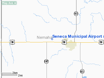
Seneca Municipal Airport
Address:
Nemaha County, KS
Tel:
785-336-2747, 785-336-3537
Images
and information placed above are from
http://www.airport-data.com/airport/62K/
We
thank them for the data!
|
General Info |
| Country |
United
States |
| State |
KANSAS
|
| FAA ID |
62K
|
| Latitude |
39-50-49.995N |
|
Longitude |
096-06-46.011W |
|
Elevation |
1270
feet |
| Near
City |
SENECA
|
We don't guarantee the information is fresh and accurate. The data may
be wrong or outdated.
For more up-to-date information please refer to other sources.
|
|


