 |
|
|
|
|
|
|
Location &
QuickFacts
|
FAA
Information Effective: |
2008-09-25 |
|
Airport
Identifier: |
61K |
|
Airport
Status: |
Operational |
|
Longitude/Latitude: |
096-11-06.9710W/37-08-54.1870N
-96.185270/37.148385 (Estimated) |
|
Elevation: |
1005 ft / 306.32 m (Estimated) |
|
Land: |
12 acres |
|
From
nearest city: |
2 nautical miles N of Sedan, KS |
|
Location: |
Chautauqua County, KS |
|
Magnetic Variation: |
06E (1985) |
Owner & Manager
|
Ownership: |
Privately owned |
|
Owner: |
City Of Sedan
LEASED TO CITY OF SEDAN. |
|
Address: |
City Hall
Sedan, KS 67361 |
|
Phone number: |
620-725-3193 |
|
Manager: |
John Miller |
|
Address: |
City Hall
Sedan, KS 67361 |
|
Phone number: |
620-725-3193
HOME NUMBER (620) 725-3429 |
Airport
Operations and Facilities
|
Airport
Use: |
Open to public |
|
Wind
indicator: |
Yes |
|
Segmented Circle: |
Yes
SEGMENTED CIRCLE NSTD. |
|
Control
Tower: |
No |
|
Lighting
Schedule: |
RDO-CTL
ACTVT LIRL RY 18/36 - CTAF. |
|
Landing
fee charge: |
No |
|
Sectional chart: |
Kansas City |
|
Region: |
ACE - Central |
|
Boundary
ARTCC: |
ZKC - Kansas City |
|
Tie-in
FSS: |
ICT - Wichita |
|
FSS on
Airport: |
No |
|
FSS Toll
Free: |
1-800-WX-BRIEF |
|
NOTAMs
Facility: |
ICT (NOTAM-d service avaliable) |
Airport Communications
Airport Services
|
Airframe
Repair: |
NONE |
|
Power
Plant Repair: |
NONE |
|
Bottled
Oxygen: |
NONE |
|
Bulk
Oxygen: |
NONE |
|
Runway Information
Runway 12/30
|
Dimension: |
1790 x 95 ft / 545.6 x 29.0 m |
|
Surface: |
TURF, Fair Condition |
|
|
Runway 12
|
Runway 30
|
|
Traffic
Pattern: |
Left |
Left |
|
Obstruction: |
4 ft fence |
10 ft tree, 0.0 ft from runway |
|
Runway 18/36
|
Dimension: |
3160 x 81 ft / 963.2 x 24.7 m |
|
Surface: |
TURF, Fair Condition |
|
Edge Lights: |
Low |
|
|
Runway 18
|
Runway 36
|
|
Longitude: |
096-11-03.9700W |
096-11-09.9500W |
|
Latitude: |
37-09-14.1800N |
37-08-43.3000N |
|
Traffic
Pattern: |
Left |
Left |
|
Obstruction: |
15 ft trees, 75.0 ft from runway, 90 ft left of
centerline, 5:1 slope to clear |
5 ft fence, 15.0 ft from runway, 3:1 slope to clear |
|
Radio Navigation Aids
|
ID |
Type |
Name |
Ch |
Freq |
Var |
Dist |
|
CFV |
NDB |
Coffeyville |
|
212.00 |
05E |
29.6 nm |
|
PPF |
NDB |
Parsons |
|
258.00 |
06E |
34.3 nm |
|
PN |
NDB |
Ponca |
|
515.00 |
05E |
48.1 nm |
|
EQA |
NDB |
El Dorado |
|
383.00 |
05E |
48.4 nm |
|
BVO |
VOR/DME |
Bartlesville |
126X |
117.90 |
08E |
20.5 nm |
|
CNU |
VOR/DME |
Chanute |
029X |
109.20 |
05E |
40.3 nm |
|
OSW |
VORTAC |
Oswego |
123X |
117.60 |
08E |
47.0 nm |
Based Aircraft
|
Aircraft based
on field: |
3 |
|
Single Engine
Airplanes: |
3 |
Operational Statistics
Time Period: 2006-08-31 - 2007-08-30
|
Aircraft
Operations: |
12/Week |
|
General
Aviation Local: |
58.3% |
|
General
Aviation Itinerant: |
41.7% |
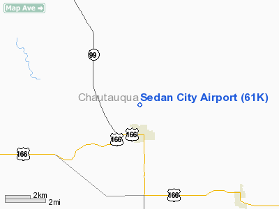
Sedan City Airport
Address:
Chautauqua County, KS
Tel:
620-725-3193
Images
and information placed above are from
http://www.airport-data.com/airport/61K/
We
thank them for the data!
|
General Info |
| Country |
United
States |
| State |
KANSAS
|
| FAA ID |
61K
|
| Latitude |
37-08-54.187N |
|
Longitude |
096-11-06.971W |
|
Elevation |
1005
feet |
| Near
City |
SEDAN
|
We don't guarantee the information is fresh and accurate. The data may
be wrong or outdated.
For more up-to-date information please refer to other sources.
|
|


