 |
|
|
Location &
QuickFacts
|
FAA
Information Effective: |
2008-09-25 |
|
Airport
Identifier: |
19KS |
|
Airport
Status: |
Operational |
|
Longitude/Latitude: |
095-27-30.9300W/37-37-12.1790N
-95.458592/37.620050 (Estimated) |
|
Elevation: |
940 ft / 286.51 m (Estimated) |
|
Land: |
20 acres |
|
From
nearest city: |
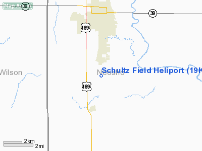
3 nautical miles S of Chanute, KS |
|
Location: |
Neosho County, KS |
|
Magnetic Variation: |
06E (1985) |
Owner & Manager
|
Ownership: |
Privately owned |
|
Owner: |
John G Schultz |
|
Address: |
Po Box 582
Chanute, KS 66720 |
|
Phone number: |
316-431-6130 |
|
Manager: |
John G Schultz |
|
Address: |
Po Box 582
Chanute, KS 66720 |
|
Phone number: |
316-431-2030 |
Airport
Operations and Facilities
|
Airport
Use: |
Private |
|
Wind
indicator: |
Yes |
|
Segmented Circle: |
Yes |
|
Control
Tower: |
No |
|
Landing
fee charge: |
No |
|
Sectional chart: |
Kansas City |
|
Region: |
ACE - Central |
|
Boundary
ARTCC: |
ZKC - Kansas City |
|
Tie-in
FSS: |
ICT - Wichita |
|
FSS on
Airport: |
No |
|
FSS Toll
Free: |
1-800-WX-BRIEF |
|
Runway Information
Helipad H1
|
Dimension: |
25 x 25 ft / 7.6 x 7.6 m |
|
Surface: |
CONC, |
|
|
Runway H1
|
Runway
|
|
Traffic
Pattern: |
Left |
Left |
|
Radio Navigation Aids
|
ID |
Type |
Name |
Ch |
Freq |
Var |
Dist |
|
MSB |
NDB |
Monarch |
|
410.00 |
04E |
10.5 nm |
|
PPF |
NDB |
Parsons |
|
258.00 |
06E |
17.1 nm |
|
CFV |
NDB |
Coffeyville |
|
212.00 |
05E |
32.1 nm |
|
FSK |
NDB |
Fort Scott |
|
379.00 |
05E |
34.6 nm |
|
PTS |
NDB |
Pittsburg |
|
365.00 |
05E |
36.5 nm |
|
UKL |
NDB |
Boyd |
|
245.00 |
05E |
42.7 nm |
|
CNU |
VOR/DME |
Chanute |
029X |
109.20 |
05E |
6.4 nm |
|
OSW |
VORTAC |
Oswego |
123X |
117.60 |
08E |
30.4 nm |
Remarks
-
PROVIDED THE
APPROACH/DEPARTURE PATHS TO LANDING ARE ARE MAINTAINED FOR A MINIMUM 8:1 GLIDE
SLOPE AND THE TRANSITIONAL SURFACE BE MAINTAINED FOR A MINIMUM 2:1 SLOPE.
Based Aircraft
|
Aircraft based
on field: |
2 |
|
Helicopters: |
1 |
|
Ultralights: |
1 |
Schultz Field Heliport
Address:
Neosho County, KS
Tel:
316-431-6130, 316-431-2030
Images
and information placed above are from
http://www.airport-data.com/airport/19KS/
We
thank them for the data!
|
General Info |
| Country |
United
States |
| State |
KANSAS
|
| FAA ID |
19KS
|
| Latitude |
37-37-12.179N |
|
Longitude |
095-27-30.930W |
|
Elevation |
940 feet
|
| Near
City |
CHANUTE
|
We don't guarantee the information is fresh and accurate. The data may
be wrong or outdated.
For more up-to-date information please refer to other sources.
|
|


