 |
|
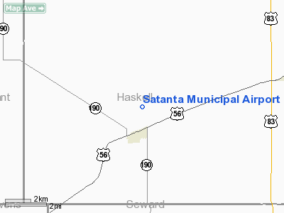
Satanta Municipal Airport |
|
|
|
Location &
QuickFacts
|
FAA
Information Effective: |
2008-09-25 |
|
Airport
Identifier: |
1K9 |
|
Airport
Status: |
Operational |
|
Longitude/Latitude: |
100-59-04.6000W/37-27-24.0000N
-100.984611/37.456667 (Estimated) |
|
Elevation: |
2976 ft / 907.08 m (Estimated) |
|
Land: |
160 acres |
|
From
nearest city: |
1 nautical miles N of Satanta, KS |
|
Location: |
Haskell County, KS |
|
Magnetic Variation: |
09E (1985) |
Owner & Manager
|
Ownership: |
Publicly owned |
|
Owner: |
Dudley Township |
|
Address: |
Rt 1 Box 121
Satanta, KS 67870 |
|
Phone number: |
620-649-2348 |
|
Manager: |
Bill Anton |
|
Address: |
Rr2, Box 76
Satanta, KS 67870 |
|
Phone number: |
620-649-2220 |
Airport
Operations and Facilities
|
Airport
Use: |
Open to public |
|
Wind
indicator: |
Yes |
|
Segmented Circle: |
No |
|
Control
Tower: |
No |
|
Lighting
Schedule: |
DUSK-DAWN
ACTVT LIRL RY 03/21 - CTAF. |
|
Beacon
Color: |
Clear-Green (lighted land airport) |
|
Landing
fee charge: |
No |
|
Sectional chart: |
Wichita |
|
Region: |
ACE - Central |
|
Boundary
ARTCC: |
ZKC - Kansas City |
|
Tie-in
FSS: |
ICT - Wichita |
|
FSS on
Airport: |
No |
|
FSS Toll
Free: |
1-800-WX-BRIEF |
|
NOTAMs
Facility: |
ICT (NOTAM-d service avaliable) |
|
Federal Agreements: |
N |
Airport Communications
|
CTAF: |
122.800 |
|
Unicom: |
122.800 |
Airport Services
|
Fuel
available: |
100LL
FOR FUEL CALL 620-649-2230. |
|
Bottled
Oxygen: |
NONE |
|
Bulk
Oxygen: |
NONE |
|
Runway Information
Runway 03/21
|
Dimension: |
3250 x 40 ft / 990.6 x 12.2 m |
|
Surface: |
ASPH, Good Condition |
|
Edge Lights: |
Low
NSTD LIRL DUE TO SPACING. |
|
|
Runway 03
|
Runway 21
|
|
Longitude: |
100-59-17.5300W |
100-58-51.7100W |
|
Latitude: |
37-27-11.6900N |
37-27-36.3700N |
|
Traffic
Pattern: |
Left |
Left |
|
Markings: |
Basic, Good Condition |
Basic, Good Condition |
|
Radio Navigation Aids
|
ID |
Type |
Name |
Ch |
Freq |
Var |
Dist |
|
ULS |
NDB |
Ulysses |
|
395.00 |
09E |
20.1 nm |
|
GC |
NDB |
Pieve |
|
347.00 |
09E |
25.6 nm |
|
HQG |
NDB |
Hugoton |
|
365.00 |
09E |
25.7 nm |
|
MEJ |
NDB |
Meade |
|
389.00 |
09E |
31.7 nm |
|
JHN |
NDB |
Bear Creek |
|
341.00 |
10E |
37.3 nm |
|
LBL |
VORTAC |
Liberal |
070X |
112.30 |
11E |
24.8 nm |
|
GCK |
VORTAC |
Garden City |
080X |
113.30 |
11E |
30.4 nm |
Remarks
-
UNLGTD 200'+ ANT
7500'+ SW OF RWY 03.
-
PAY PHONE AVBL 24 HRS.
Based Aircraft
|
Aircraft based
on field: |
6 |
|
Single Engine
Airplanes: |
6 |
Operational Statistics
Time Period: 2006-08-22 - 2007-08-21
|
Aircraft
Operations: |
58/Week |
|
General
Aviation Local: |
83.3% |
|
General
Aviation Itinerant: |
16.7% |
Satanta Municipal Airport
Address:
Haskell County, KS
Tel:
620-649-2348, 620-649-2220
Images
and information placed above are from
http://www.airport-data.com/airport/1K9/
We
thank them for the data!
|
General Info |
| Country |
United
States |
| State |
KANSAS
|
| FAA ID |
1K9
|
| Latitude |
37-27-15.088N |
|
Longitude |
100-59-31.603W |
|
Elevation |
2976
feet |
| Near
City |
SATANTA
|
We don't guarantee the information is fresh and accurate. The data may
be wrong or outdated.
For more up-to-date information please refer to other sources.
|
|


