 |
|
|
Location &
QuickFacts
|
FAA
Information Effective: |
2008-09-25 |
|
Airport
Identifier: |
85KS |
|
Airport
Status: |
Operational |
|
Longitude/Latitude: |
095-12-52.3800W/39-18-03.4800N
-95.214550/39.300967 (Estimated) |
|
Elevation: |
1070 ft / 326.14 m (Estimated) |
|
Land: |
4 acres |
|
From
nearest city: |
3 nautical miles E of Winchester, KS |
|
Location: |
Jefferson County, KS |
|
Magnetic Variation: |
() |
Owner & Manager
|
Ownership: |
Privately owned |
|
Owner: |
Mary & Dean Sanders |
|
Address: |
19105 142nd St.
Winchester, KS 66097 |
|
Manager: |
Mary & Dean Sanders |
|
Address: |
19105 142nd St.
Winchester, KS 66097 |
|
Phone number: |
913-774-7001 |
Airport
Operations and Facilities
|
Airport
Use: |
Private |
|
Segmented Circle: |
No |
|
Control
Tower: |
No |
|
Sectional chart: |
Kansas City |
|
Region: |
ACE - Central |
|
Boundary
ARTCC: |
ZKC - Kansas City |
|
Tie-in
FSS: |
ICT - Wichita |
|
FSS Toll
Free: |
1-800-WX-BRIEF |
|
Runway Information
Runway 01/19
|
Dimension: |
1250 x 60 ft / 381.0 x 18.3 m |
|
Surface: |
TURF, |
|
|
Runway 01
|
Runway 19
|
|
Traffic
Pattern: |
Left |
Left |
|
Obstruction: |
415 ft tower, 3.0 ft from runway |
|
|
Radio Navigation Aids
|
ID |
Type |
Name |
Ch |
Freq |
Var |
Dist |
|
DO |
NDB |
Dotte |
|
359.00 |
05E |
22.2 nm |
|
TO |
NDB |
Biloy |
|
521.00 |
05E |
24.5 nm |
|
GQ |
NDB |
Norge |
|
517.00 |
05E |
29.8 nm |
|
GKB |
NDB |
Norge |
|
517.00 |
05E |
29.8 nm |
|
AZN |
NDB |
Amazon |
|
233.00 |
06E |
37.8 nm |
|
GPH |
NDB |
Mosby |
|
284.00 |
03E |
42.3 nm |
|
LXT |
NDB |
Lesumit |
|
263.00 |
04E |
44.3 nm |
|
FNB |
NDB |
Brenner |
|
404.00 |
05E |
49.7 nm |
|
FOE |
TACAN |
Forbes |
053X |
|
05E |
29.8 nm |
|
RIS |
VOR/DME |
Riverside |
051X |
111.40 |
05E |
30.8 nm |
|
RBA |
VOR/DME |
Robinson |
019X |
108.20 |
04E |
34.4 nm |
|
OJC |
VOR/DME |
Johnson County |
077X |
113.00 |
06E |
35.5 nm |
|
TOP |
VORTAC |
Topeka |
125X |
117.80 |
05E |
18.4 nm |
|
MCI |
VORTAC |
Kansas City |
079Y |
113.25 |
05E |
22.2 nm |
|
STJ |
VORTAC |
St Joseph |
102X |
115.50 |
08E |
41.8 nm |
|
FOE |
VOT |
Forbes |
|
111.00 |
|
29.8 nm |
|
MKC |
VOT |
Kansas City Downtown |
|
108.60 |
|
30.6 nm |
Remarks
-
PRVDD 20:1 GLIDE
SLOPE, 20 FT (HORIZONTAL) +01 FT (VERTICAL), 4:1 SFC RECOMMENDED REMOVALTREES.
Based Aircraft
|
Aircraft based
on field: |
1 |
|
Single Engine
Airplanes: |
1 |
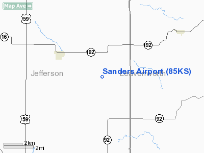
Sanders Airport
Address:
Jefferson County, KS
Tel:
913-774-7001
Images
and information placed above are from
http://www.airport-data.com/airport/85KS/
We
thank them for the data!
We don't guarantee the information is fresh and accurate. The data may
be wrong or outdated.
For more up-to-date information please refer to other sources.
|
|


