 |
|
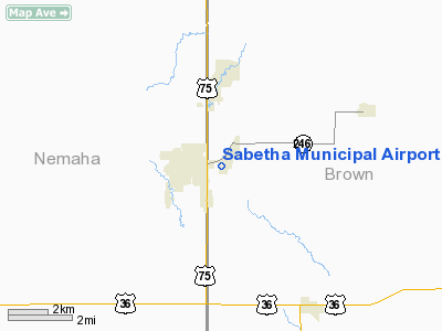
Sabetha Municipal Airport |
|
|
|
Location &
QuickFacts
|
FAA
Information Effective: |
2008-09-25 |
|
Airport
Identifier: |
K83 |
|
Airport
Status: |
Operational |
|
Longitude/Latitude: |
095-46-45.9570W/39-54-15.0000N
-95.779432/39.904167 (Estimated) |
|
Elevation: |
1330 ft / 405.38 m (Estimated) |
|
Land: |
55 acres |
|
From
nearest city: |
1 nautical miles E of Sabetha, KS |
|
Location: |
Brown County, KS |
|
Magnetic Variation: |
06E (1985) |
Owner & Manager
|
Ownership: |
Publicly owned |
|
Owner: |
City Of Sabetha |
|
Address: |
Po Box 187
Sabetha, KS 66534 |
|
Phone number: |
785-284-2158 |
|
Manager: |
Doug Allen - City Administrator |
|
Address: |
Po Box 187
Sabetha, KS 66534 |
|
Phone number: |
785-284-2158 |
Airport
Operations and Facilities
|
Airport
Use: |
Open to public |
|
Wind
indicator: |
Yes |
|
Segmented Circle: |
No |
|
Control
Tower: |
No |
|
Lighting
Schedule: |
DUSK-DAWN |
|
Beacon
Color: |
Clear-Green (lighted land airport) |
|
Landing
fee charge: |
No |
|
Sectional chart: |
Kansas City |
|
Region: |
ACE - Central |
|
Boundary
ARTCC: |
ZKC - Kansas City |
|
Tie-in
FSS: |
ICT - Wichita |
|
FSS on
Airport: |
No |
|
FSS Toll
Free: |
1-800-WX-BRIEF |
|
NOTAMs
Facility: |
ICT (NOTAM-d service avaliable) |
|
Federal Agreements: |
N1 |
Airport Communications
Airport Services
|
Fuel
available: |
100LL
< 785-284-2158 CALL FUEL> |
|
Bottled
Oxygen: |
NONE |
|
Bulk
Oxygen: |
NONE |
|
Runway Information
Runway 01/19
|
Dimension: |
3100 x 40 ft / 944.9 x 12.2 m
USBL WIDTH LIMITED TO 70 FT DSTC BTWN EXPOSED CULVERT ENDS AT MIDFIELD.
CULVERT ENDS MKD WITH YELLOW & BLACK POSTS. |
|
Surface: |
ASPH, Good Condition
SFC ROUGH ABV BURIED DRAIN PIPE AT MIDFIELD. |
|
Weight Limit: |
Single wheel: 6000 lbs. |
|
Edge Lights: |
Low
RY 01/19 END LGTS 2 FT FM THLD. |
|
|
Runway 01
|
Runway 19
|
|
Longitude: |
095-46-42.7600W |
095-46-28.1300W |
|
Latitude: |
39-54-04.8700N |
39-54-33.3700N |
|
Traffic
Pattern: |
Left |
Left |
|
Markings: |
Basic, Fair Condition |
Basic, Fair Condition |
|
Obstruction: |
25 ft pole, 750.0 ft from runway, 170 ft left of
centerline, 22:1 slope to clear |
, 50:1 slope to clear |
|
Runway 12/30
|
Dimension: |
1440 x 70 ft / 438.9 x 21.3 m
USBL WIDTH LIMITED TO 70 FT DSTC BTWN EXPOSED CULVERT ENDS AT MIDFIELD.
CULVERT ENDS MKD WITH YELLOW & BLACK POSTS. |
|
Surface: |
TURF, Fair Condition
SFC ROUGH ABV BURIED DRAIN PIPE AT MIDFIELD. |
|
|
Runway 12
|
Runway 30
|
|
Traffic
Pattern: |
Left |
Left |
|
Obstruction: |
40 ft bldg, 867.0 ft from runway, 145 ft left of
centerline, 21:1 slope to clear |
17 ft pline, 470.0 ft from runway, 27:1 slope to clear |
|
Radio Navigation Aids
|
ID |
Type |
Name |
Ch |
Freq |
Var |
Dist |
|
FNB |
NDB |
Brenner |
|
404.00 |
05E |
13.6 nm |
|
AYB |
NDB |
Auburn |
|
430.00 |
05E |
32.0 nm |
|
MYZ |
NDB |
Marysville |
|
341.00 |
06E |
39.5 nm |
|
AZN |
NDB |
Amazon |
|
233.00 |
06E |
40.2 nm |
|
AFK |
NDB |
Nebraska City |
|
347.00 |
05E |
42.3 nm |
|
TO |
NDB |
Biloy |
|
521.00 |
05E |
47.3 nm |
|
EVU |
NDB |
Emville |
|
317.00 |
05E |
47.8 nm |
|
HWB |
NDB |
Shaw |
|
263.00 |
06E |
49.9 nm |
|
RBA |
VOR/DME |
Robinson |
019X |
108.20 |
04E |
16.7 nm |
|
PWE |
VORTAC |
Pawnee City |
071X |
112.40 |
05E |
26.5 nm |
|
STJ |
VORTAC |
St Joseph |
102X |
115.50 |
08E |
39.5 nm |
|
TOP |
VORTAC |
Topeka |
125X |
117.80 |
05E |
47.3 nm |
Based Aircraft
|
Aircraft based
on field: |
6 |
|
Single Engine
Airplanes: |
4 |
|
Multi Engine
Airplanes: |
2 |
Operational Statistics
Time Period: 2007-05-02 - 2008-04-30
|
Aircraft
Operations: |
82/Week |
|
General
Aviation Local: |
62.4% |
|
General
Aviation Itinerant: |
37.6% |
Sabetha Municipal Airport
Address:
Brown County, KS
Tel:
785-284-2158
Images
and information placed above are from
http://www.airport-data.com/airport/K83/
We
thank them for the data!
|
General Info |
| Country |
United
States |
| State |
KANSAS
|
| FAA ID |
K83
|
| Latitude |
39-54-15.000N |
|
Longitude |
095-46-45.957W |
|
Elevation |
1330
feet |
| Near
City |
SABETHA
|
We don't guarantee the information is fresh and accurate. The data may
be wrong or outdated.
For more up-to-date information please refer to other sources.
|
|


