 |
|
|
Location & QuickFacts
|
FAA Information Effective: |
2008-09-25 |
|
Airport Identifier: |
2KS1 |
|
Airport Status: |
Operational |
|
Longitude/Latitude: |
095-15-03.9100W/39-46-27.9940N
-95.251086/39.774443 (Estimated) |
|
Elevation: |
950 ft / 289.56 m (Estimated) |
|
Land: |
0 acres |
|
From nearest city: |
1 nautical miles N of Severance, KS |
|
Location: |
Doniphan County, KS |
|
Magnetic Variation: |
05E (1985) |
Owner & Manager
|
Ownership: |
Privately owned |
|
Owner: |
Leonard Rush |
|
Address: |
Severance, KS 66081 |
|
Phone number: |
913-359-6746 |
|
Address: |
|
Airport Operations and
Facilities
|
Airport Use: |
Private |
|
Segmented Circle: |
No |
|
Control Tower: |
No |
|
Sectional chart: |
Kansas City |
|
Region: |
ACE - Central |
|
Boundary ARTCC: |
ZKC - Kansas City |
|
Tie-in FSS: |
ICT - Wichita |
|
FSS on Airport: |
No |
|
FSS Toll Free: |
1-800-WX-BRIEF |
Airport Services
|
Airframe Repair: |
NONE |
|
Power Plant Repair: |
NONE |
|
Runway Information
Runway E/W
|
Dimension: |
2500 x 50 ft / 762.0 x 15.2 m |
|
Surface: |
TURF, |
|
|
Runway E
|
Runway W
|
|
Traffic
Pattern: |
Left |
Left |
|
Runway N/S
|
Dimension: |
1250 x 40 ft / 381.0 x 12.2 m |
|
Surface: |
TURF, |
|
|
Runway N
|
Runway S
|
|
Traffic
Pattern: |
Left |
Left |
|
Radio Navigation Aids
|
ID |
Type |
Name |
Ch |
Freq |
Var |
Dist |
|
AZN |
NDB |
Amazon |
|
233.00 |
06E |
17.1 nm |
|
FNB |
NDB |
Brenner |
|
404.00 |
05E |
23.9 nm |
|
EVU |
NDB |
Emville |
|
317.00 |
05E |
37.8 nm |
|
DO |
NDB |
Dotte |
|
359.00 |
05E |
40.6 nm |
|
TO |
NDB |
Biloy |
|
521.00 |
05E |
44.2 nm |
|
EZZ |
NDB |
Cameron |
|
394.00 |
03E |
45.3 nm |
|
AYB |
NDB |
Auburn |
|
430.00 |
05E |
47.2 nm |
|
RBA |
VOR/DME |
Robinson |
019X |
108.20 |
04E |
9.2 nm |
|
RIS |
VOR/DME |
Riverside |
051X |
111.40 |
05E |
49.7 nm |
|
STJ |
VORTAC |
St Joseph |
102X |
115.50 |
08E |
18.7 nm |
|
MCI |
VORTAC |
Kansas City |
079Y |
113.25 |
05E |
37.8 nm |
|
TOP |
VORTAC |
Topeka |
125X |
117.80 |
05E |
40.7 nm |
|
MKC |
VOT |
Kansas City Downtown |
|
108.60 |
|
49.5 nm |
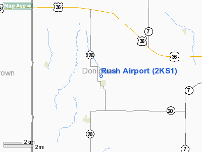
Rush Airport
Address:
Doniphan County, KS
Tel:
913-359-6746
Images
and information placed above are from
http://www.airport-data.com/airport/2KS1/
We
thank them for the data!
| General Info
|
| Country |
United States
|
| State |
KANSAS
|
| FAA ID |
2KS1
|
| Latitude |
39-46-27.994N
|
| Longitude |
095-15-03.910W
|
| Elevation |
950 feet
|
| Near City |
SEVERANCE
|
We don't guarantee the information is fresh and accurate. The data may
be wrong or outdated.
For more up-to-date information please refer to other sources.
|
|


