 |
|
|
Location &
QuickFacts
|
FAA
Information Effective: |
2008-09-25 |
|
Airport
Identifier: |
9KS5 |
|
Airport
Status: |
Operational |
|
Longitude/Latitude: |
098-06-01.1940W/38-34-40.0320N
-98.100332/38.577787 (Estimated) |
|
Elevation: |
1675 ft / 510.54 m (Estimated) |
|
Land: |
0 acres |
|
From
nearest city: |
7 nautical miles NE of Geneseo, KS |
|
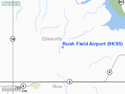
Location: |
Ellsworth County, KS |
|
Magnetic Variation: |
07E (1985) |
Owner & Manager
|
Ownership: |
Privately owned |
|
Owner: |
Kermit Rush |
|
Address: |
Geneseo, KS 67444 |
|
Phone number: |
316-824-6382 |
|
Manager: |
Kermit Rush |
|
Address: |
Geneseo, KS 67444 |
|
Phone number: |
316-824-6382 |
Airport
Operations and Facilities
|
Airport
Use: |
Private |
|
Wind
indicator: |
No |
|
Segmented Circle: |
No |
|
Control
Tower: |
No |
|
Landing
fee charge: |
No |
|
Sectional chart: |
Wichita |
|
Region: |
ACE - Central |
|
Boundary
ARTCC: |
ZKC - Kansas City |
|
Tie-in
FSS: |
ICT - Wichita |
|
FSS on
Airport: |
No |
|
FSS Toll
Free: |
1-800-WX-BRIEF |
|
Runway Information
Runway 17/35
|
Dimension: |
2200 x 70 ft / 670.6 x 21.3 m |
|
Surface: |
TURF, |
|
|
Runway 17
|
Runway 35
|
|
Traffic
Pattern: |
Left |
Left |
|
Radio Navigation Aids
|
ID |
Type |
Name |
Ch |
Freq |
Var |
Dist |
|
LYO |
NDB |
Lyons |
|
386.00 |
06E |
15.1 nm |
|
MPR |
NDB |
Mc Pherson |
|
227.00 |
06E |
23.8 nm |
|
HIL |
NDB |
Hilyn |
|
338.00 |
08E |
40.0 nm |
|
EWK |
NDB |
Newton |
|
281.00 |
06E |
49.7 nm |
|
HUT |
VOR/DME |
Hutchinson |
115X |
116.80 |
09E |
35.8 nm |
|
SLN |
VORTAC |
Salina |
118X |
117.10 |
07E |
30.7 nm |
Remarks
-
PROVIDED THE APCH
TO EACH RWY IS MAINTAINED FOR A MIN 20:1 GLIDE SLOPE AND THE TRANSITIONAL
SURFACE BE MAINTAINED FOR A 7:1 SLOPE.
Based Aircraft
|
Aircraft based
on field: |
1 |
|
Single Engine
Airplanes: |
1 |
Rush Field Airport
Address:
Ellsworth County, KS
Tel:
316-824-6382
Images
and information placed above are from
http://www.airport-data.com/airport/9KS5/
We
thank them for the data!
|
General Info |
| Country |
United
States |
| State |
KANSAS
|
| FAA ID |
9KS5
|
| Latitude |
38-34-40.032N |
|
Longitude |
098-06-01.194W |
|
Elevation |
1675
feet |
| Near
City |
GENESEO
|
We don't guarantee the information is fresh and accurate. The data may
be wrong or outdated.
For more up-to-date information please refer to other sources.
|
|


