 |
|
|
|
|
|
|
Location &
QuickFacts
|
FAA
Information Effective: |
2008-09-25 |
|
Airport
Identifier: |
K94 |
|
Airport
Status: |
Operational |
|
Longitude/Latitude: |
099-17-23.4000W/38-32-48.4000N
-99.289833/38.546778 (Estimated) |
|
Elevation: |
2070 ft / 630.94 m (Surveyed) |
|
Land: |
97 acres |
|
From
nearest city: |
1 nautical miles NE of La Crosse, KS |
|
Location: |
Rush County, KS |
|
Magnetic Variation: |
08E (1985) |
Owner & Manager
|
Ownership: |
Publicly owned |
|
Owner: |
City Of La Crosse-rush Co |
|
Address: |
1119 Main
La Crosse, KS 67548 |
|
Phone
number: |
785-222-2511 |
|
Manager: |
Jeff Vap
AIRPORT COMMITTEE CHAIRMAN. |
|
Address: |
P.o. Box 459
La Crosse, KS 67548 |
|
Phone number: |
785-222-2430 |
Airport Operations and Facilities
|
Airport
Use: |
Open to public |
|
Wind
indicator: |
Yes |
|
Segmented Circle: |
Yes |
|
Control
Tower: |
No |
|
Lighting
Schedule: |
RDO-CTL
FOR RWY LGTS KEY 122.7 5 TIMES IN 5 SEC. |
|
Landing
fee charge: |
No |
|
Sectional chart: |
Wichita |
|
Region: |
ACE - Central |
|
Boundary
ARTCC: |
ZKC - Kansas City |
|
Tie-in
FSS: |
ICT - Wichita |
|
FSS on
Airport: |
No |
|
FSS Toll
Free: |
1-800-WX-BRIEF |
|
NOTAMs
Facility: |
ICT (NOTAM-d service avaliable) |
|
Federal Agreements: |
GY |
Airport Communications
Airport Services
|
Airframe
Repair: |
NONE |
|
Power
Plant Repair: |
NONE |
|
Bottled
Oxygen: |
NONE |
|
Bulk
Oxygen: |
NONE |
|
Runway Information
Runway 17/35
|
Dimension: |
3200 x 50 ft / 975.4 x 15.2 m |
|
Surface: |
ASPH, Good Condition |
|
Weight Limit: |
Single wheel: 12000 lbs.
Dual wheel: 16000 lbs. |
|
Edge Lights: |
Medium |
|
|
Runway 17
|
Runway 35
|
|
Longitude: |
099-17-23.7900W |
099-17-23.0900W |
|
Latitude: |
38-33-04.2500N |
38-32-32.6200N |
|
Traffic
Pattern: |
Left |
Left |
|
Markings: |
Basic, Good Condition |
Basic, Good Condition |
|
Obstruction: |
21 ft road, 650.0 ft from runway, 21:1 slope to clear |
50 ft bldg, 1500.0 ft from runway, 200 ft left of
centerline, 26:1 slope to clear |
|
Radio Navigation Aids
|
ID |
Type |
Name |
Ch |
Freq |
Var |
Dist |
|
HIL |
NDB |
Hilyn |
|
338.00 |
08E |
21.4 nm |
|
LQR |
NDB |
Larned |
|
296.00 |
08E |
22.7 nm |
|
HYS |
VORTAC |
Hays |
041X |
110.40 |
10E |
18.1 nm |
Remarks
-
FOR EMERGENCY
CONTACT SHERIFFS OFFICE 785-222-2578
Based Aircraft
|
Aircraft based
on field: |
4 |
|
Single Engine
Airplanes: |
4 |
Operational Statistics
Time Period: 2007-08-08 - 2008-08-06
|
Aircraft
Operations: |
64/Week |
|
General
Aviation Local: |
90.9% |
|
General
Aviation Itinerant: |
9.1% |
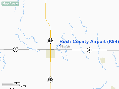
Rush County Airport
Address:
Rush County, KS
Tel:
785-222-2511,
785-222-2430
Images
and information placed above are from
http://www.airport-data.com/airport/K94/
We
thank them for the data!
|
General Info |
| Country |
United
States |
| State |
KANSAS
|
| FAA ID |
K94
|
| Latitude |
38-32-54.047N |
|
Longitude |
099-17-19.372W |
|
Elevation |
2070
feet |
| Near
City |
LA
CROSSE |
We don't guarantee the information is fresh and accurate. The data may
be wrong or outdated.
For more up-to-date information please refer to other sources.
|
|


