 |
|
|
Location &
QuickFacts
|
FAA
Information Effective: |
2008-09-25 |
|
Airport
Identifier: |
SN34 |
|
Airport
Status: |
Operational |
|
Longitude/Latitude: |
097-29-31.1690W/37-34-30.0580N
-97.491991/37.575016 (Estimated) |
|
Elevation: |
1300 ft / 396.24 m (Estimated) |
|
Land: |
0 acres |
|
From
nearest city: |
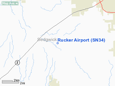
4 nautical miles N of Clearwater, KS |
|
Location: |
Sedgwick County, KS |
|
Magnetic Variation: |
07E (1985) |
Owner & Manager
|
Ownership: |
Privately owned |
|
Owner: |
Ira M. Rucker |
|
Address: |
6437 South 149 Th Ave
Omaha, NE 68137-3932 |
|
Address: |
|
Airport Operations and Facilities
|
Airport
Use: |
Private |
|
Wind
indicator: |
No |
|
Segmented Circle: |
No |
|
Control
Tower: |
No |
|
Landing
fee charge: |
No |
|
Sectional chart: |
Wichita |
|
Region: |
ACE - Central |
|
Boundary
ARTCC: |
ZKC - Kansas City |
|
Tie-in
FSS: |
ICT - Wichita |
|
FSS on
Airport: |
No |
|
FSS Toll
Free: |
1-800-WX-BRIEF |
|
Runway
Information
Runway N/S
|
Dimension: |
2600 x 100 ft / 792.5 x 30.5 m |
|
Surface: |
TURF, |
|
|
Runway N
|
Runway S
|
|
Traffic
Pattern: |
Left |
Left |
|
Radio Navigation Aids
|
ID |
Type |
Name |
Ch |
Freq |
Var |
Dist |
|
IC |
NDB |
Piche |
|
332.00 |
07E |
1.7 nm |
|
EGT |
NDB |
Wellington |
|
414.00 |
07E |
15.9 nm |
|
EWK |
NDB |
Newton |
|
281.00 |
06E |
31.2 nm |
|
EQA |
NDB |
El Dorado |
|
383.00 |
05E |
34.4 nm |
|
MPR |
NDB |
Mc Pherson |
|
227.00 |
06E |
47.4 nm |
|
PN |
NDB |
Ponca |
|
515.00 |
05E |
48.8 nm |
|
IAB |
TACAN |
Mc Connell |
112X |
|
07E |
11.0 nm |
|
HUT |
VOR/DME |
Hutchinson |
115X |
116.80 |
09E |
32.9 nm |
|
ICT |
VORTAC |
Wichita |
085X |
113.80 |
07E |
11.1 nm |
|
ANY |
VORTAC |
Anthony |
076X |
112.90 |
07E |
40.9 nm |
|
ICT |
VOT |
Wichita |
|
114.00 |
|
4.6 nm |
Remarks
-
LANDING ONLY BY
PRIOR PERMISSION, CALL 316-545-7622.
Based Aircraft
|
Aircraft based
on field: |
4 |
|
Single Engine
Airplanes: |
4 |
Rucker Airport
Address:
Sedgwick County, KS
Tel:
Images
and information placed above are from
http://www.airport-data.com/airport/SN34/
We
thank them for the data!
|
General Info |
| Country |
United
States |
| State |
KANSAS
|
| FAA ID |
SN34
|
| Latitude |
37-34-30.058N |
|
Longitude |
097-29-31.169W |
|
Elevation |
1300
feet |
| Near
City |
CLEARWATER |
We don't guarantee the information is fresh and accurate. The data may
be wrong or outdated.
For more up-to-date information please refer to other sources.
|
|


