 |
|
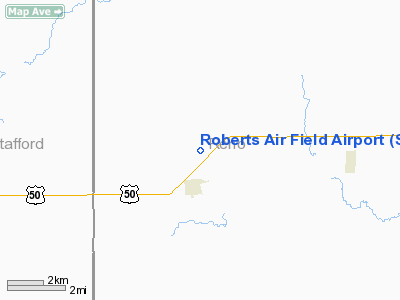
Roberts Air Field Airport |
|
|
|
Location &
QuickFacts
|
FAA
Information Effective: |
2008-09-25 |
|
Airport
Identifier: |
SN95 |
|
Airport
Status: |
Operational |
|
Longitude/Latitude: |
098-24-15.2610W/37-58-39.0510N
-98.404239/37.977514 (Estimated) |
|
Elevation: |
1765 ft / 537.97 m (Estimated) |
|
Land: |
110 acres |
|
From
nearest city: |
2 nautical miles NE of Sylvia, KS |
|
Location: |
Reno County, KS |
|
Magnetic Variation: |
07E (1985) |
Owner & Manager
|
Ownership: |
Privately owned |
|
Owner: |
L. J. Roberts, Jr. |
|
Address: |
Rt 1
Sylvia, KS 67581 |
|
Phone number: |
316-486-3445 |
|
Manager: |
L.s. Roberts Jr. |
|
Address: |
Rt 1
Sylvia, KS 67581 |
|
Phone number: |
316-486-3445 |
Airport
Operations and Facilities
|
Airport
Use: |
Private |
|
Wind
indicator: |
Yes |
|
Segmented Circle: |
No |
|
Control
Tower: |
No |
|
Lighting
Schedule: |
RDO-CTL
FOR ROTG BCN & LIRL RY 17/35 KEY 122.7 5 TIMES. |
|
Beacon
Color: |
Clear-Green (lighted land airport) |
|
Landing fee charge: |
No |
|
Sectional chart: |
Wichita |
|
Region: |
ACE - Central |
|
Boundary ARTCC: |
ZKC - Kansas City |
|
Tie-in FSS: |
ICT - Wichita |
|
FSS on Airport: |
No |
|
FSS Toll Free: |
1-800-WX-BRIEF |
Airport
Communications
Airport Services
|
Airframe
Repair: |
MINOR |
|
Power
Plant Repair: |
MINOR |
|
Runway Information
Runway 13/31
|
Dimension: |
3150 x 95 ft / 960.1 x 29.0 m |
|
Surface: |
TURF, Fair Condition
CENTER 32 FT. CONC FOR ENTIRE LGTH. |
|
|
Runway 13
|
Runway 31
|
|
Traffic
Pattern: |
Left |
Left |
|
Obstruction: |
5 ft fence, 40.0 ft from runway, 8:1 slope to clear |
19 ft road, 120.0 ft from runway, 6:1 slope to clear |
|
Runway 17/35
|
Dimension: |
2250 x 90 ft / 685.8 x 27.4 m |
|
Surface: |
CONC-TURF, Good Condition
CENTER 32 FT. CONC FOR ENTIRE LGTH. |
|
Edge Lights: |
Low |
|
|
Runway 17
|
Runway 35
|
|
Traffic
Pattern: |
Left |
Left |
|
Markings: |
Numbers only, Good Condition |
Numbers only, Good Condition |
|
Obstruction: |
35 ft trees, 1300.0 ft from runway, 31:1 slope to clear
+4' FENCE AT 22 FT. |
35 ft trees, 1300.0 ft from runway, 50 ft left of
centerline, 31:1 slope to clear
+19' ROAD AT 165 FT. |
|
Radio Navigation Aids
|
ID |
Type |
Name |
Ch |
Freq |
Var |
Dist |
|
PTT |
NDB |
Pratt |
|
356.00 |
07E |
22.3 nm |
|
LYO |
NDB |
Lyons |
|
386.00 |
06E |
23.7 nm |
|
HIL |
NDB |
Hilyn |
|
338.00 |
08E |
32.9 nm |
|
LQR |
NDB |
Larned |
|
296.00 |
08E |
35.1 nm |
|
MPR |
NDB |
Mc Pherson |
|
227.00 |
06E |
40.6 nm |
|
HUT |
VOR/DME |
Hutchinson |
115X |
116.80 |
09E |
22.3 nm |
|
ICT |
VORTAC |
Wichita |
085X |
113.80 |
07E |
41.4 nm |
Remarks
-
PROVIDED A CLEAR
APPROACH TO EACH RWY IS MAINTAINED FOR A MINIMUM 20:1 GLIDE SLOPE AND THE
TRANSITIONAL SURFACE BE MAINTAINED FOR A 7:1 SLOPE.
Roberts Air Field Airport
Address:
Reno County, KS
Tel:
316-486-3445
Images
and information placed above are from
http://www.airport-data.com/airport/SN95/
We
thank them for the data!
|
General Info |
| Country |
United
States |
| State |
KANSAS
|
| FAA ID |
SN95
|
| Latitude |
37-58-39.051N |
|
Longitude |
098-24-15.261W |
|
Elevation |
1765
feet |
| Near
City |
SYLVIA
|
We don't guarantee the information is fresh and accurate. The data may
be wrong or outdated.
For more up-to-date information please refer to other sources.
|
|


