 |
|
|
|
|
|
|
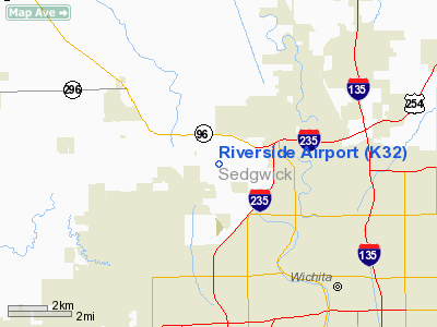
Location & QuickFacts
|
FAA Information Effective: |
2008-09-25 |
|
Airport Identifier: |
K32 |
|
Airport Status: |
Operational |
|
Longitude/Latitude: |
097-24-21.7000W/37-44-46.3000N
-97.406028/37.746194 (Estimated) |
|
Elevation: |
1335 ft / 406.91 m (Estimated) |
|
Land: |
220 acres |
|
From nearest city: |
5 nautical miles NW of Wichita, KS |
|
Location: |
Sedgwick County, KS |
|
Magnetic Variation: |
07E (1985) |
Owner & Manager
|
Ownership: |
Privately owned |
|
Owner: |
Sanders Inc |
|
Address: |
3414 N. Hoover Rd
Wichita, KS 67205 |
|
Phone
number: |
316-942-6198 |
|
Manager: |
Thomas G. Sanders |
|
Address: |
3414 N. Hoover Rd
Wichita, KS 67205 |
|
Phone number: |
316-942-6198 |
Airport Operations and Facilities
|
Airport
Use: |
Open to public |
|
Wind
indicator: |
Yes |
|
Segmented Circle: |
No |
|
Control
Tower: |
No |
|
Lighting
Schedule: |
DUSK-DAWN |
|
Beacon
Color: |
Clear-Green (lighted land airport) |
|
Landing
fee charge: |
No |
|
Sectional chart: |
Wichita |
|
Region: |
ACE - Central |
|
Boundary
ARTCC: |
ZKC - Kansas City |
|
Tie-in
FSS: |
ICT - Wichita |
|
FSS on
Airport: |
No |
|
FSS Toll
Free: |
1-800-WX-BRIEF |
|
NOTAMs
Facility: |
ICT (NOTAM-d service avaliable) |
Airport Communications
|
CTAF: |
122.800 |
|
Unicom: |
122.800 |
Airport Services
|
Fuel
available: |
100LL |
|
Airframe
Repair: |
MAJOR |
|
Power
Plant Repair: |
MAJOR |
|
Bottled
Oxygen: |
NONE |
|
Bulk
Oxygen: |
NONE |
|
Runway Information
Runway 16/34
|
Dimension: |
3200 x 40 ft / 975.4 x 12.2 m |
|
Surface: |
ASPH, Good Condition |
|
Weight Limit: |
Single wheel: 2000 lbs. |
|
Edge Lights: |
Low
NSTD THLD LGTS RY 34 CONSIST OF ONE RED/GREEN LIGHT ON EACH SIDE OF RY. |
|
|
Runway 16
|
Runway 34
|
|
Longitude: |
097-24-25.6300W |
097-24-17.7500W |
|
Latitude: |
37-45-01.7800N |
37-44-30.7600N |
|
Traffic
Pattern: |
Left |
Right |
|
Markings: |
Basic, Good Condition |
Basic, Good Condition |
|
Obstruction: |
45 ft pline, 710.0 ft from runway, 11:1 slope to clear |
40 ft tree, 1500.0 ft from runway, 200 ft left of
centerline, 32:1 slope to clear |
|
Radio Navigation Aids
|
ID |
Type |
Name |
Ch |
Freq |
Var |
Dist |
|
IC |
NDB |
Piche |
|
332.00 |
07E |
10.4 nm |
|
EWK |
NDB |
Newton |
|
281.00 |
06E |
20.1 nm |
|
EGT |
NDB |
Wellington |
|
414.00 |
07E |
25.4 nm |
|
EQA |
NDB |
El Dorado |
|
383.00 |
05E |
28.1 nm |
|
MPR |
NDB |
Mc Pherson |
|
227.00 |
06E |
38.6 nm |
|
IAB |
TACAN |
Mc Connell |
112X |
|
07E |
9.9 nm |
|
HUT |
VOR/DME |
Hutchinson |
115X |
116.80 |
09E |
29.2 nm |
|
ICT |
VORTAC |
Wichita |
085X |
113.80 |
07E |
8.5 nm |
|
ICT |
VOT |
Wichita |
|
114.00 |
|
6.7 nm |
Remarks
-
RGT TFC RWY 34
MAINT SEGMENTED CIRCLE; NONSTD TFC PAT PUBLISHED IN AIM; VFR OPNS ONLY WITH
STRICT OBSERVANCE OF WICHITA MUNI ARPT VFR WEATHER MINIMUMS; APCHS MAINTD FOR
20:1 GLIDE SLOPE; AND TRSNL SFC MAINTD FOR 7:1 SLOPE.
Based Aircraft
|
Aircraft based
on field: |
32 |
|
Single Engine
Airplanes: |
31 |
|
Multi Engine
Airplanes: |
1 |
Operational Statistics
Time Period: 2007-05-01 - 2008-04-29
|
Aircraft
Operations: |
270/Week |
|
General
Aviation Local: |
71.4% |
|
General
Aviation Itinerant: |
28.6% |
Riverside Airport
Address:
Sedgwick County, KS
Tel:
316-942-6198
Images
and information placed above are from
http://www.airport-data.com/airport/K32/
We
thank them for the data!
|
General Info |
| Country |
United
States |
| State |
KANSAS
|
| FAA ID |
K32
|
| Latitude |
37.748067
37° 44' 53.04" N |
|
Longitude |
-97.406711
097° 24' 24.16" W |
|
Elevation |
1335
feet
407 meters |
| Magnetic
Variation |
005° E
(01/06) |
|
Operating Agency |
PRIVATE
|
We don't guarantee the information is fresh and accurate. The data may
be wrong or outdated.
For more up-to-date information please refer to other sources.
|
|


