 |
|
|
Location &
QuickFacts
|
FAA
Information Effective: |
2008-09-25 |
|
Airport
Identifier: |
1KS2 |
|
Airport
Status: |
Operational |
|
Longitude/Latitude: |
095-04-17.7600W/39-18-50.4800N
-95.071600/39.314022 (Estimated) |
|
Elevation: |
1133 ft / 345.34 m (Estimated) |
|
Land: |
40 acres |
|
From
nearest city: |
3 nautical miles SE of Easton, KS |
|
Location: |
Leavenworth County, KS |
|
Magnetic Variation: |
05E (1995) |
Owner & Manager
|
Ownership: |
Privately owned |
|
Owner: |
Myron E. Gadow |
|
Address: |
10314 Grant Lane
Overland Park, KS 66212 |
|
Phone number: |
913-888-3994 |
|
Address: |
|
Airport Operations and Facilities
|
Airport
Use: |
Private |
|
Wind
indicator: |
Yes |
|
Segmented Circle: |
Yes |
|
Control
Tower: |
No |
|
Sectional chart: |
Kansas City |
|
Region: |
ACE - Central |
|
Boundary
ARTCC: |
ZKC - Kansas City |
|
Tie-in
FSS: |
ICT - Wichita |
|
FSS Toll
Free: |
1-800-WX-BRIEF |
|
Runway Information
Runway 18/36
|
Dimension: |
1500 x 75 ft / 457.2 x 22.9 m |
|
Surface: |
TURF, |
|
|
Runway 18
|
Runway 36
|
|
Traffic
Pattern: |
Right |
Left |
|
Obstruction: |
25 ft trees, 400.0 ft from runway |
25 ft trees, 400.0 ft from runway |
|
Radio Navigation Aids
|
ID |
Type |
Name |
Ch |
Freq |
Var |
Dist |
|
DO |
NDB |
Dotte |
|
359.00 |
05E |
16.0 nm |
|
GQ |
NDB |
Norge |
|
517.00 |
05E |
24.6 nm |
|
GKB |
NDB |
Norge |
|
517.00 |
05E |
24.6 nm |
|
TO |
NDB |
Biloy |
|
521.00 |
05E |
30.9 nm |
|
AZN |
NDB |
Amazon |
|
233.00 |
06E |
35.1 nm |
|
GPH |
NDB |
Mosby |
|
284.00 |
03E |
35.6 nm |
|
LXT |
NDB |
Lesumit |
|
263.00 |
04E |
38.9 nm |
|
EZZ |
NDB |
Cameron |
|
394.00 |
03E |
44.7 nm |
|
FOE |
TACAN |
Forbes |
053X |
|
05E |
35.2 nm |
|
RIS |
VOR/DME |
Riverside |
051X |
111.40 |
05E |
25.0 nm |
|
OJC |
VOR/DME |
Johnson County |
077X |
113.00 |
06E |
32.5 nm |
|
RBA |
VOR/DME |
Robinson |
019X |
108.20 |
04E |
36.1 nm |
|
MCI |
VORTAC |
Kansas City |
079Y |
113.25 |
05E |
15.7 nm |
|
TOP |
VORTAC |
Topeka |
125X |
117.80 |
05E |
24.6 nm |
|
STJ |
VORTAC |
St Joseph |
102X |
115.50 |
08E |
39.4 nm |
|
ANX |
VORTAC |
Napoleon |
087X |
114.00 |
07E |
45.8 nm |
|
MKC |
VOT |
Kansas City Downtown |
|
108.60 |
|
24.9 nm |
|
FOE |
VOT |
Forbes |
|
111.00 |
|
35.3 nm |
Remarks
-
TFC PATTERN WEST
OF ARPT TO AVOID 290 FT MICROWAVE TOWER LCTD 3/4 MILE SE OF FIELD.
-
PRVDD CLEAR 20:1
APCH; CLEAR 7:1 TRANSITIONAL SFC; MUST KEEP TFC PAT WEST OF ARPT TO AVOID 290
FT AGL MICROWAVE TOWER; MUST COMPLY WITH CLASS B TERMINAL AIRSPACE PROCEDURES.
Based Aircraft
|
Aircraft based
on field: |
1 |
|
Single Engine
Airplanes: |
1 |
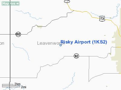
Risky Airport
Address:
Leavenworth County, KS
Tel:
913-888-3994
Images
and information placed above are from
http://www.airport-data.com/airport/1KS2/
We
thank them for the data!
|
General Info |
| Country |
United
States |
| State |
KANSAS
|
| FAA ID |
1KS2
|
| Latitude |
39-18-50.480N |
|
Longitude |
095-04-17.760W |
|
Elevation |
1133
feet |
| Near
City |
EASTON
|
We don't guarantee the information is fresh and accurate. The data may
be wrong or outdated.
For more up-to-date information please refer to other sources.
|
|


