 |
|
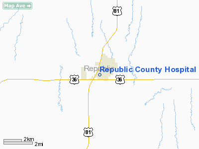
Republic County Hospital Heliport |
|
Location &
QuickFacts
|
FAA
Information Effective: |
2008-09-25 |
|
Airport
Identifier: |
6KS0 |
|
Airport
Status: |
Operational |
|
Longitude/Latitude: |
097-38-14.1490W/39-49-04.0200N
-97.637264/39.817783 (Estimated) |
|
Elevation: |
1470 ft / 448.06 m (Estimated) |
|
Land: |
0 acres |
|
From
nearest city: |
0 nautical miles SW of Belleville, KS |
|
Location: |
Republic County, KS |
|
Magnetic Variation: |
06E (1995) |
Owner & Manager
|
Ownership: |
Privately owned |
|
Owner: |
Republic County Hospital |
|
Address: |
C/o Blaine K. Miller, Ceo, 2420 G Street
Belleville, KS 66935-2400 |
|
Phone number: |
785-527-2254 |
|
Manager: |
Tom Moravek |
|
Address: |
2420 G St
Belleville, KS 66935-2400 |
|
Phone number: |
785-527-2254 |
Airport
Operations and Facilities
|
Airport
Use: |
Private
MEDICAL USE. |
|
Segmented Circle: |
No |
|
Control
Tower: |
No |
|
Lighting
Schedule: |
DUSK-DAWN |
|
Sectional chart: |
Wichita |
|
Region: |
ACE - Central |
|
Boundary
ARTCC: |
ZMP - Minneapolis |
|
Tie-in
FSS: |
ICT - Wichita |
|
FSS on
Airport: |
No |
|
FSS Toll
Free: |
1-800-WX-BRIEF |
|
Runway Information
Helipad H1
|
Dimension: |
40 x 40 ft / 12.2 x 12.2 m |
|
Surface: |
CONC, |
|
|
Runway H1
|
Runway
|
|
Traffic
Pattern: |
Left |
Left |
|
Radio Navigation Aids
|
ID |
Type |
Name |
Ch |
Freq |
Var |
Dist |
|
RPB |
NDB |
Republican |
|
414.00 |
07E |
1.0 nm |
|
CNK |
NDB |
Concordia |
|
335.00 |
06E |
15.9 nm |
|
HJH |
NDB |
Hebron |
|
323.00 |
06E |
20.1 nm |
|
DBX |
NDB |
Morrison |
|
212.00 |
06E |
27.7 nm |
|
FBY |
NDB |
Fairbury |
|
293.00 |
06E |
30.6 nm |
|
CYW |
NDB |
Clay Center |
|
362.00 |
07E |
34.3 nm |
|
MYZ |
NDB |
Marysville |
|
341.00 |
06E |
46.4 nm |
|
FMZ |
NDB |
Beklof |
|
392.00 |
07E |
46.5 nm |
|
HWB |
NDB |
Shaw |
|
263.00 |
06E |
48.6 nm |
|
BIE |
VOR |
Beatrice |
|
110.60 |
07E |
49.9 nm |
|
TKO |
VORTAC |
Mankato |
035X |
109.80 |
10E |
28.8 nm |
Remarks
-
OWNER DESIRES
ARPT NOT BE CHARTED.
-
PRVDD A CLEAT 8:1
APCH/DEP SLOPE; CLEAR 2:1 TRANSITIONAL SFC; MK PLINES WITH ORANGE BALLS & FIRE
DEPT CTL HELIPAD ACCESS.
Republic County Hospital Heliport
Address:
Republic County, KS
Tel:
785-527-2254
Images
and information placed above are from
http://www.airport-data.com/airport/6KS0/
We
thank them for the data!
|
General Info |
| Country |
United
States |
| State |
KANSAS
|
| FAA ID |
6KS0
|
| Latitude |
39-49-04.020N |
|
Longitude |
097-38-14.149W |
|
Elevation |
1470
feet |
| Near
City |
BELLEVILLE |
We don't guarantee the information is fresh and accurate. The data may
be wrong or outdated.
For more up-to-date information please refer to other sources.
|
|


